Category:Satellite pictures of Lake Malawi
Media in category "Satellite pictures of Lake Malawi"
The following 19 files are in this category, out of 19 total.
-
 Biomass Burning, Southern Africa.JPG 4,256 × 2,832; 4.84 MB
-
 FlankMalawi.png 5,135 × 3,719; 2.33 MB
-
 ISS-60 Progress MS-11 shortly before undocking, crop.jpg 2,516 × 1,523; 571 KB
-
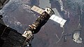 ISS-60 Progress MS-11 shortly before undocking.jpg 4,928 × 2,768; 1.85 MB
-
 ISS063-E-95854 - View of Earth.jpg 5,568 × 3,712; 3.73 MB
-
 ISS063-E-95855 - View of Earth.jpg 5,568 × 3,712; 3.74 MB
-
 ISS063-E-95856 - View of Earth.jpg 5,568 × 3,712; 3.76 MB
-
 ISS063-E-95857 - View of Earth.jpg 5,568 × 3,712; 3.77 MB
-
 Lake Malawai (MODIS 2019-11-01).jpg 4,198 × 3,327; 3.9 MB
-
 Lake Malawi 34.60837E 11.93308S.jpg 1,280 × 958; 151 KB
-
 Lake Malawi park.jpg 301 × 158; 8 KB
-
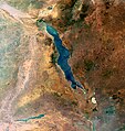
 Lake Malawi seen from orbit.jpg 2,778 × 3,628; 3.24 MB
-
 Lake Malawi, Great Rift Valley ESA205475.tiff 3,293 × 3,482; 39.15 MB
-
 Lake Malawi, Great Rift Valley.jpg 3,293 × 3,482; 12.78 MB
-
 Lake Nyasa from Orbit , Dec 1993.jpg 5,304 × 5,258; 9.72 MB
-
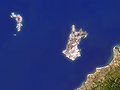 Likoma (satellite).jpg 800 × 600; 172 KB
-
 Likoma sentinel2 (airport).jpg 524 × 1,135; 84 KB
-
 Likoma sentinel2.jpg 3,847 × 5,025; 1.44 MB
-
 NOAA-20 Sees ‘Popcorn’ Cumulus Clouds Around Lake Malawi (NESDIS 2019-10-23).jpg 1,920 × 1,080; 2.04 MB


.jpg)


.jpg)
.jpg)

.jpg)