Category:Satellite pictures of North Macedonia
Media in category "Satellite pictures of North Macedonia"
The following 63 files are in this category, out of 63 total.
-
 Balkan Fires, Earth from Aqua (EOS PM-1) (2007-07-25).jpg 4,800 × 6,200; 4.33 MB
-
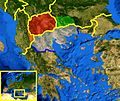 Europe Balkans Macedonia geo.jpg 726 × 609; 146 KB
-
 ISS006-E-30222 - View of Albania.jpg 3,032 × 2,064; 1.19 MB
-
 ISS018-E-10032 - View of North Macedonia.jpg 3,072 × 2,040; 417 KB
-
 ISS018-E-10494 - View of North Macedonia.jpg 3,072 × 2,040; 582 KB
-
 ISS018-E-10495 - View of North Macedonia.jpg 3,072 × 2,040; 610 KB
-
 ISS027-E-8037 - View of North Macedonia.jpg 4,288 × 2,929; 1.63 MB
-
 ISS028-E-8609 - View of North Macedonia.jpg 4,256 × 2,832; 1.66 MB
-
 ISS061-E-13485 - View of Earth.jpg 5,568 × 3,712; 3.55 MB
-
 ISS061-E-13487 - View of Earth.jpg 5,568 × 3,712; 3.51 MB
-
 ISS061-E-14315 - View of Albania.jpg 3,712 × 5,568; 2.58 MB
-
 ISS061-E-14316 - View of Albania.jpg 3,712 × 5,568; 2.55 MB
-
 ISS061-E-64669 - View of North Macedonia.jpg 5,568 × 3,712; 2.54 MB
-
 Macedonia.JPG 554 × 407; 40 KB
-
 Mediterranean heatwave ESA23380840.jpeg 1,920 × 1,920; 2.38 MB
-
 MIHPM(Gradsko).png 413 × 331; 486 KB
-
 MIHPM(Jegunovce).png 413 × 331; 486 KB
-
 MIHPM(Kratovo).png 413 × 331; 484 KB
-
 MIHPM(Kriva Palanka).png 413 × 331; 484 KB
-
 MIHPM(MG).png 413 × 331; 580 KB
-
 MIHPM(Radovish).png 413 × 331; 556 KB
-
 MIHPM(Skopje).png 413 × 331; 469 KB
-
 MIHPM(SkopjeG).png 413 × 331; 470 KB
-
 MK Berovo.png 413 × 331; 483 KB
-
 MK Bitola.png 413 × 331; 501 KB
-
 MK Bogdanci.PNG 413 × 331; 229 KB
-
 MK Debar.PNG 413 × 331; 229 KB
-
 MK Delcevo.png 413 × 331; 485 KB
-
 MK Demir Hisar.PNG 413 × 331; 229 KB
-
 MK Demir Kapija.PNG 413 × 331; 229 KB
-
 MK Gevgelija.PNG 413 × 331; 229 KB
-
 MK Gostivar.PNG 413 × 331; 229 KB
-
 MK Kavadarci.png 413 × 331; 484 KB
-
 MK Kicevo.PNG 413 × 331; 229 KB
-
 MK Kocani.png 413 × 331; 484 KB
-
 MK Kratovo.PNG 413 × 331; 206 KB
-
 MK Kriva Palanka.PNG 413 × 331; 229 KB
-
 MK Krusevo.PNG 413 × 331; 229 KB
-
 MK Kumanovo.png 413 × 331; 484 KB
-
 MK Makedonska Kamenica.PNG 413 × 331; 229 KB
-
 MK Makedonski brod.png 413 × 331; 484 KB
-
 MK Negotino.png 413 × 331; 486 KB
-
 MK Ohrid.png 413 × 331; 484 KB
-
 MK Pehcevo.PNG 413 × 331; 229 KB
-
 MK Prilep.png 413 × 331; 484 KB
-
 MK Probistip.png 413 × 331; 485 KB
-
 MK Radovis.PNG 413 × 331; 229 KB
-
 MK Resen.PNG 413 × 331; 229 KB
-
 MK Skopje.PNG 413 × 331; 229 KB
-
 MK Star Dojran (Dojran).PNG 413 × 331; 229 KB
-
 MK Stip.png 413 × 331; 483 KB
-
 MK Struga.PNG 413 × 331; 229 KB
-
 MK Strumica.PNG 413 × 331; 229 KB
-
 MK Sveti Nikole.png 413 × 331; 484 KB
-
 MK Tetovo.png 413 × 331; 471 KB
-
 MK Valandovo.PNG 413 × 331; 229 KB
-
 MK Veles.png 413 × 331; 471 KB
-
 MK Vinica.png 413 × 331; 486 KB
-
 Ohrid prespa nasa.jpg 1,024 × 768; 476 KB
-
 Ohridsko i Prespansko od NASA.JPG 4,088 × 4,096; 5.58 MB
-
 Satellite image of Macedonia in December 2002.jpg 878 × 706; 173 KB
-
 Skopje SPOT 1114.jpg 500 × 500; 123 KB
-
 Streževo-NASA.png 546 × 438; 300 KB
_(2007-07-25).jpg)


.png)
.png)
.png)
.png)
.png)
.png)
.png)
.png)


.PNG)


