Category:Satellite pictures of Spitsbergen
Media in category "Satellite pictures of Spitsbergen"
The following 16 files are in this category, out of 16 total.
-
 Heatwave in Longyearbyen, Svalbard Archipelago.jpg 3,508 × 2,540; 3.73 MB
-
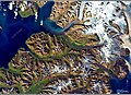
 Longyearbyen & Spitsbergen Island, Svalbard Archipelago (34620031686).jpg 12,956 × 12,828; 34.49 MB
-
 Longyearbyen NASA.jpg 1,596 × 1,509; 493 KB
-
 Longyearbyen S2A 1282 crop 10 (36873222635).jpg 2,048 × 1,540; 1.61 MB
-
 Longyearbyen S2A 432 1282mix crop 10 (36733265881).jpg 2,048 × 1,540; 1.67 MB
-
 Longyearbyen S2A 432 crop 10 (36873238365).jpg 2,048 × 1,540; 1.74 MB
-
 Longyearbyen, Norway.jpg 2,048 × 1,280; 626 KB
-
 Microfibre pollution in the Arctic (Copernicus).jpg 4,420 × 2,540; 3.03 MB
-
 Ny-Ålesund- A scientific outpost on the frontlines of Arctic climate change.jpg 4,410 × 2,540; 1.74 MB
-
 Spitsbergen Norway's largest island.jpg 3,539 × 3,540; 8.43 MB
-
 Svalbard en Norvège vu par le satellite Sentinel 2.jpg 5,000 × 5,000; 23.96 MB
-
 Svalbard oli 2020236 detail.jpg 720 × 480; 219 KB
-
 The absence of sea ice north of Svalbard in November 2021 (Copernicus).jpg 3,820 × 4,267; 5.29 MB
-
 Unusually low sea ice extent at the Svalbard archipelago, Norway.jpg 4,000 × 2,540; 4.33 MB
-
 Using Satellites to Study Svalbard’s Growing Season.jpeg 3,000 × 3,000; 9.13 MB
-
 Wilhelmøya Landsat8.jpg 1,127 × 998; 462 KB

.jpg)

.jpg)
.jpg)
.jpg)

.jpg)


.jpg)


