Category:Satellite pictures of Zeeland
Provinces of the Netherlands: Drenthe · Flevoland · Friesland · Gelderland · Groningen · North Holland · Zeeland
Media in category "Satellite pictures of Zeeland"
The following 15 files are in this category, out of 15 total.
-
 Escaut SPOT 1295.jpg 500 × 500; 116 KB
-
 ISS031-E-77619 - View of Earth.jpg 4,288 × 2,848; 1.6 MB
-
 Middelburg 3.61786E 51.50083N.jpg 1,280 × 958; 146 KB
-
 Middelburg 3.61E 51.50N.jpg 1,150 × 917; 261 KB
-
 Middelburg blanketed in snow, Netherlands.jpg 9,930 × 7,071; 14.33 MB
-
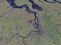
 Rotterdam 432 751 pan pub2 (27071814446).jpg 2,048 × 1,565; 2.69 MB
-
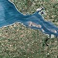
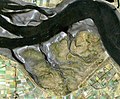 Saeftingen.jpg 741 × 609; 123 KB
-
 Schelde 4.25121E 51.26519N.jpg 1,280 × 958; 177 KB
-
 Vlissingen, Netherlands.jpg 2,048 × 1,280; 629 KB
-
 Zeeland 4.03783E 51.67521N bewerkt.jpg 1,280 × 958; 294 KB
-
 Zeeland 4.03783E 51.67521N.jpg 1,280 × 958; 213 KB
-
 Zeeland NASA.jpg 3,600 × 3,600; 3.16 MB
-
 Zeeland van boven.jpg 5,444 × 3,649; 7.49 MB
-
 Zeeland, Netherlands ESA22256852.jpeg 10,344 × 10,344; 21.75 MB
-
 Zeeland, Netherlands ESA22256852.tiff 10,344 × 10,344; 306.16 MB


.jpg)


