Category:Satellite pictures of airports in Canada
Subcategories
This category has only the following subcategory.
Media in category "Satellite pictures of airports in Canada"
The following 14 files are in this category, out of 14 total.
-
 Aeroporto Internacional de Montreal updated.JPG 800 × 539; 164 KB
-
 Aeroporto Internacional de Montreal.JPG 800 × 539; 134 KB
-
 Bell Island Airport (CCV4).jpg 934 × 803; 465 KB
-
 Buttonville.PNG 773 × 462; 820 KB
-
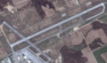
 CFB Cold Lake (YCOD).jpg 919 × 773; 515 KB
-
 CFB Greenwood (CYZX).jpg 896 × 712; 490 KB
-
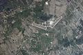
 Gander International Airport (satellite view).jpg 806 × 605; 76 KB
-
 Goose Bay WorldWind.png 959 × 687; 815 KB
-
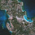
 Mirabel-Montreal.jpg 3,056 × 2,032; 1.59 MB
-
 Mirabelarptnasa.jpg 622 × 318; 253 KB
-
 Postville Airport.jpg 1,040 × 697; 161 KB
-
 Saglek airport.jpg 898 × 719; 80 KB
-
 Waterloo International Airport.PNG 1,287 × 760; 1.83 MB
-
 셍쟝공항 (1475).jpeg 3,034 × 3,034; 4.08 MB


.jpg)

.jpg)
.jpg)
.jpg)


.jpeg)