Category:Satellite pictures of islands of Canada
Countries of North America: Canada · Mexico · United States of America‡
‡: partly located in North America
‡: partly located in North America
Subcategories
This category has the following 4 subcategories, out of 4 total.
A
N
P
S
Media in category "Satellite pictures of islands of Canada"
The following 17 files are in this category, out of 17 total.
-
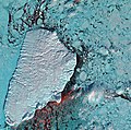 Akpatok Island (4404819892).jpg 7,282 × 7,242; 18.08 MB
-
 Bell Island Airport (CCV4).jpg 934 × 803; 465 KB
-
 BelleIsle Canada ISS012-E-15918.jpg 540 × 540; 93 KB
-
 Chantry Island Landsat.png 722 × 562; 605 KB
-
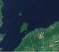
 Howe island.jpg 296 × 161; 11 KB
-
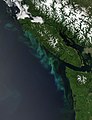 Phytoplankton Bloom off Vancouver Island, British Columbia.jpg 2,000 × 2,600; 775 KB
-
 PNW-straits.jpg 336 × 396; 128 KB
-
 Reindeer Island ESA388436.jpg 3,000 × 2,329; 6.51 MB
-
 Reindeer Island ESA388436.tiff 6,590 × 5,115; 192.9 MB
-
 Snake and Fox Island Lake Simcoe.png 714 × 633; 629 KB
-
 The Big Muddy, Western Edition (6987590721).jpg 5,559 × 3,706; 5.91 MB
-
 Vancouver Island NASA.png 792 × 424; 485 KB
-
 VancouverIsland.A2003154.1930.250m cutcontr VIRanges wo numbers.jpg 800 × 655; 415 KB
-
 VancouverIsland.A2003154.1930.250m cutcontr VIRanges800 wnumbers.jpg 800 × 655; 422 KB
-
 Weston Island Canada.png 788 × 664; 439 KB
-
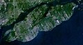
 Wfm cape breton island pseudocolour.jpg 1,280 × 948; 130 KB
-
 Wfm vancouver island.jpg 1,280 × 948; 317 KB
.jpg)
.jpg)


.jpg)


