Category:Satellite pictures of the Prince Edward Islands
Media in category "Satellite pictures of the Prince Edward Islands"
The following 17 files are in this category, out of 17 total.
-
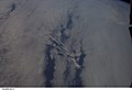
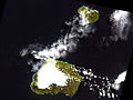
 Cloud Patterns Over the Prince Edward Islands.jpg 2,400 × 3,200; 954 KB
-
 ISS006-E-40208 - View of the Prince Edward Islands.jpg 3,032 × 2,064; 742 KB
-
 ISS006-E-40209 - View of the Prince Edward Islands.jpg 3,032 × 2,064; 743 KB
-
 ISS006-E-40210 - View of the Prince Edward Islands.jpg 3,032 × 2,064; 835 KB
-
 ISS006-E-40211 - View of the Prince Edward Islands.jpg 3,032 × 2,064; 838 KB
-
 ISS006-E-40212 - View of the Prince Edward Islands.jpg 3,032 × 2,064; 803 KB
-
 ISS006-E-40213 - View of the Prince Edward Islands.jpg 3,032 × 2,064; 828 KB
-
 ISS006-E-40214 - View of the Prince Edward Islands.jpg 3,032 × 2,064; 828 KB
-
 ISS006-E-40215 - View of the Prince Edward Islands.jpg 3,032 × 2,064; 905 KB
-
 ISS026-E-9452 - View of South Africa.jpg 4,288 × 2,929; 819 KB
-
 ISS028-E-31932 - View of Earth.jpg 4,288 × 2,848; 1.08 MB
-
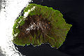 Marion Island ASTER.jpg 1,200 × 795; 261 KB
-
 Marion Island, South Africa, EO-1 ALI satellite image, 5 May 2009.jpg 3,058 × 2,222; 1.85 MB
-
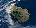
 Prince Edward Island ASTER.jpg 1,100 × 660; 188 KB
-
 Prince Edward Island, South Africa, EO-1 ALI satellite image, 5 May 2009.jpg 1,455 × 1,137; 429 KB
-
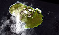
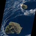
 Prince Edward Islands ASTER.jpg 1,200 × 903; 277 KB
-
 Prince Edward Islands, EO-1 ALI satellite image, 5 May 2009.jpg 5,000 × 5,000; 5.18 MB


