Category:Satellite pictures of the Saint Lawrence River
Media in category "Satellite pictures of the Saint Lawrence River"
The following 19 files are in this category, out of 19 total.
-
 2182v1 20180122-StLawrenceB.png 1,920 × 965; 1.41 MB
-
 Ice on the St Lawrence River, Canada.jpg 2,400 × 1,800; 3.98 MB
-
 ISS-27 HTV-2 Canadarm2 and Dextre.jpg 4,288 × 2,848; 1.26 MB
-
 ISS-36 Plankton bloom and Lake Ontario.jpg 2,832 × 4,256; 1.65 MB
-
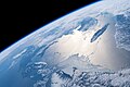 ISS-59 Canada, Gulf of St. Lawrence.jpg 5,568 × 3,712; 2.56 MB
-
 ISS-59 Canada, Saint Lawrence River and Gulf of St. Lawrence.jpg 5,568 × 3,712; 3.17 MB
-
 ISS-59 St. Lawrence River and the Manicouagan Crater, Canada.jpg 5,568 × 3,712; 4.66 MB
-
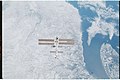
 ISS016-E-5595 - View of the Province of Quebec.jpg 3,032 × 2,008; 1.38 MB
-
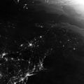
 Montreal at Night - NASA Earth Observatory.jpg 720 × 480; 191 KB
-
 Montreal, Canada - Flickr - NASA Goddard Photo and Video.jpg 1,440 × 960; 605 KB
-
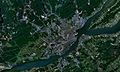 Quebec city-satellite image.jpg 1,920 × 1,154; 375 KB
-
 Quebec province ESA231785.jpg 1,909 × 1,936; 1.58 MB
-
 Quebec province ESA231785.tiff 1,909 × 1,936; 10.98 MB
-
 QuebecSatelliteNASA.jpg 800 × 481; 183 KB
-
 Saint Lawrence River and New England at night in summer 2013.jpg 2,000 × 2,000; 626 KB
-
 Saint Lawrence River SPOT 1298.jpg 500 × 500; 114 KB
-
 St Lawrence River, New Brunswick, Canada (MODIS 2017-04-28).jpg 2,729 × 2,161; 1.04 MB
-
-


.jpg)

