Category:Satellite pictures of the West Coast Region
Media in category "Satellite pictures of the West Coast Region"
The following 18 files are in this category, out of 18 total.
-
 Alpine Fault SRTM (vertical).jpg 1,746 × 5,342; 4.16 MB
-
 Alpine Fault SRTM.jpg 5,342 × 1,746; 4.16 MB
-
 Aoraki-Mount Cook and coast from Okarito to Haast, New Zealand (ISS030-E-7704.jpg 4,288 × 2,848; 1.43 MB
-
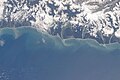
 Cook and Karangarua River mouths, New Zealand, looking southeast (ISS016-E-24567).jpg 3,032 × 2,008; 1,008 KB
-
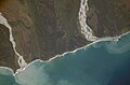
 Cook River mouth, New Zealand, looking southeast (ISS016-E-24564).jpg 3,032 × 2,008; 1,015 KB
-
 Cook River mouth, New Zealand, looking southeast (ISS016-E-24565).jpg 3,032 × 2,008; 866 KB
-
 Haast River mouth and Jackson Bay, New Zealand, looking southeast (ISS030-E-7703).jpg 4,288 × 2,848; 1.35 MB
-
 ISS-46 New Zealand, Canterbury Region and Christchurch.jpg 4,928 × 3,280; 1.71 MB
-
 Kahurangi Point, New Zealand, looking northwest (ISS016-E-12366).jpg 3,032 × 2,008; 1.09 MB
-
 Karamea Bight and Karamea River Mouth, New Zealand (ISS016-E-12377).jpg 3,032 × 2,008; 1.16 MB
-
 Lake Pukaki - STS088-721-15.JPG 4,099 × 4,096; 1.88 MB
-
 Mtcook.nz.750pix.jpg 6,108 × 5,637; 4.66 MB
-
 Murchison and Whataroa Rivers, New Zealand (ISS015-E-10544).jpg 3,032 × 2,008; 1.5 MB
-
 NASA-SLakes.png 289 × 263; 57 KB
-
 Okarito Lagoon, New Zealand, looking southeast (ISS030-E-7705).jpg 4,288 × 2,848; 1.24 MB
-

-
 Southern Alps from Lake Wakatipu to Lake Tekapo, New Zealand (ISS017-E-10675).jpg 3,072 × 2,040; 1.04 MB
-
 Westport and Buller River, New Zealand, looking southwest (ISS015-E-36395).jpg 3,032 × 2,008; 1.11 MB

.jpg)
.jpg)
.jpg)
.jpg)

.jpg)
.jpg)


.jpg)

.jpg)
.jpg)
.jpg)
.jpg)
.jpg)