Category:Saunders Island, Greenland
island in North Star Bay, Greenland  | |||||
| Upload media | |||||
| Instance of | |||||
|---|---|---|---|---|---|
| Location |
| ||||
| Located in or next to body of water | |||||
| Width |
| ||||
| Length |
| ||||
| Population |
| ||||
| Area |
| ||||
| Elevation above sea level |
| ||||
 | |||||
Media in category "Saunders Island, Greenland"
The following 6 files are in this category, out of 6 total.
-
 Aerial Picture Of Thule Air Base.jpg 800 × 571; 91 KB
-
 Aerial view of Thule AFB, Greenland.jpg 1,384 × 728; 93 KB
-
 Bear of the Lady Franklin Bay Expedition.jpg 800 × 554; 143 KB
-
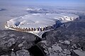 IceBridge Survey Flight Over Saunders Island and Wolstenholme Fjord.jpg 2,400 × 1,590; 3.2 MB
-
 SaundersIsland pho 2013102 lrg.jpg 2,210 × 1,473; 454 KB
-
 Thule air base above.jpeg 1,384 × 728; 227 KB


