Category:Schadow1 Expeditions
Schadow1 Expeditions is a travel and mapping advocacy resource for the Philippines owned by Ervin Malicdem. Media materials in this category are originals donated by Schadow1 Expeditions through its numerous mapping expeditions in the Philippines.
For more information about the materials, licensing, attribution, and the source - refer to Schadow1 Expeditions Mapping Advocacy and Travel Resource for the Philippines
Media in category "Schadow1 Expeditions"
The following 100 files are in this category, out of 100 total.
-
 Andres Bonifacio Mount Nagpatong Park.jpg 1,920 × 1,372; 881 KB
-
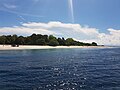
 Andulinang Island.jpg 4,032 × 3,024; 3.06 MB
-
 Anino River.jpg 4,000 × 3,000; 2.66 MB
-
 Apo Island of the Apo Reef.jpg 1,920 × 1,371; 328 KB
-
 Apo Menor Island of the Apo Reef.jpg 1,920 × 1,372; 245 KB
-
 At-Pulag-Summit.jpg 3,944 × 2,817; 3.18 MB
-
 Aurora Aragon Quezon Historical Marker.jpg 1,547 × 2,063; 2.01 MB
-
 Bagwis Cliff of Malepunyo Range.jpg 1,920 × 1,440; 666 KB
-
 Balabac Strait Sunset.jpg 4,032 × 3,024; 1.86 MB
-
-
 Baler Historical Marker.jpg 996 × 1,471; 342 KB
-
 Bamboo Organ of Las Piñas.jpg 4,032 × 3,024; 3 MB
-
 Barangay Panungyanan.jpg 4,819 × 3,739; 10.63 MB
-
 Barangay Talon Las Pinas City Aerial Photo.jpg 1,920 × 1,440; 797 KB
-
 Battle of Alapan Historical Marker at Imus Heritage Park.jpg 3,043 × 3,864; 1.53 MB
-
 Battle of Alapan Historical Marker in Alapan Elementary School.jpg 639 × 888; 159 KB
-
 Battle of Imus Historical Marker.jpg 1,488 × 1,934; 582 KB
-
 Benlen Sandbar of Balabac.jpg 4,032 × 3,024; 3.16 MB
-
 Bud Bongao Relief Map.jpg 605 × 605; 55 KB
-
 Bud Bongao.jpg 4,000 × 3,000; 2.17 MB
-
 Bundok Nagpatong Historical Marker (cropped).jpg 653 × 1,075; 473 KB
-
 Bundok Nagpatong Historical Marker.jpg 1,072 × 1,430; 851 KB
-
 Callao Cave.jpg 4,000 × 3,000; 3.95 MB
-
 Camella Homes 1 and 2 Las Pinas Drone 2022.jpg 4,000 × 3,000; 3.18 MB
-
 Camella Homes Tierra Nevada General Trias Cavite Aerial Photo.jpg 798 × 425; 121 KB
-
 Cape Engano Lighthouse Facade.jpg 3,000 × 4,000; 2.68 MB
-
 Cape Engano Lighthouse Historical Marker (cropped).jpg 1,588 × 1,870; 885 KB
-
 Cape Engano Lighthouse Historical Marker.jpg 4,000 × 3,000; 3.91 MB
-
 Cape Santiago Lighthouse Facade.jpg 4,000 × 3,000; 2.54 MB
-
 Cape Santiago Lighthouse Historical Marker.jpg 4,000 × 3,000; 2.67 MB
-
 Cape Santiago Lighthouse.jpg 2,304 × 1,296; 2.26 MB
-
 Cavite Relief Map.png 1,920 × 1,920; 4.01 MB
-
 CaviteX.jpg 1,920 × 1,082; 357 KB
-
 Cuenca Ancestral House Historical Marker.jpg 2,047 × 2,728; 1.61 MB
-
 Cuenca Ancestral House.jpg 4,032 × 3,024; 2.47 MB
-

-
 Docking at Mardanas Island.jpg 4,032 × 3,024; 3.88 MB
-
 Drone panguan mapping.jpg 824 × 589; 108 KB
-
 Dwarf Cloud Rat of Mt. Pulag.jpg 1,920 × 1,288; 658 KB
-
 Emilio Aguinaldo marker at Site of Tejeros Convention.jpg 1,155 × 2,048; 968 KB
-
 Fault Plane of WVFS at Barangay Mabuhay Carmona (cropped).jpg 2,545 × 1,693; 519 KB
-
 Fault Plane of WVFS at Barangay Mabuhay Carmona.jpg 4,912 × 3,264; 2.8 MB
-
 Flagpole PanguanIsland.jpg 4,032 × 3,024; 5.36 MB
-
 Fort Drum and Mariveles Range.jpg 3,996 × 2,247; 2.19 MB
-
 Fort Pilar Entrance.jpg 4,032 × 3,024; 3.88 MB
-
 Fort Pilar Historical Marker (cropped).jpg 1,857 × 2,768; 1.03 MB
-
 Fort Pilar Historical Marker.jpg 2,696 × 2,816; 1.21 MB
-
 Gahak-Alapan Rd Under Construction.jpg 1,920 × 1,082; 450 KB
-
 Giant Napoleon Wrasse in Shark Point Dive Site, Apo Reef, Philippines.jpg 1,920 × 1,371; 715 KB
-
 Hibok Hibok Volcano Crater.jpg 1,920 × 1,440; 947 KB
-
 Hibok-hibok Volcano Remote Monitoring Station.jpg 1,024 × 738; 362 KB
-
 Hibok-Hibok Volcano Summit.jpg 2,816 × 820; 750 KB
-
 Imus Cavite Aerial Photograph.jpg 1,920 × 1,440; 449 KB
-
 Imus Heritage Park.jpg 1,920 × 1,440; 375 KB
-
 Kanaway Golden Beach at Jomalig Island.jpg 1,920 × 1,285; 314 KB
-
 Las Pinas Church during Simbang Gabi.jpg 4,032 × 3,024; 2.52 MB
-
 Leonardo Trail at Palaui Island.jpg 1,920 × 1,440; 862 KB
-
 Makati Central Business District Aerial Photo.jpg 1,920 × 1,440; 714 KB
-
 Malepunyo Range Relief Map.png 1,920 × 1,920; 3.66 MB
-
 Manila Village historical marker.jpg 3,074 × 3,324; 1.41 MB
-
 Marawi-structures-stats.jpg 899 × 899; 164 KB
-
 Mataas na Gulod - Palay Palay Protected Landscape Relief Map.jpg 2,679 × 1,714; 1.43 MB
-
 Mount Dos Picos.jpg 4,000 × 3,000; 1.93 MB
-
 Mount Kalanggaman.jpg 4,000 × 3,000; 2.26 MB
-
 Mount Marami Boulders and Mataas na Gulod.jpg 4,000 × 3,000; 2.29 MB
-
 Mount Pico De Loro from Mataas na Gulod.jpg 4,000 × 3,000; 2.67 MB
-
 Mount Pico De Loro.jpg 1,719 × 1,228; 306 KB
-
 Mount San Cristobal.jpg 1,920 × 1,280; 660 KB
-
 Mt. Marami and Mataas na Gulod.jpg 1,920 × 1,290; 333 KB
-
 Mt. Pico De Loro Monolith.jpg 1,741 × 1,243; 376 KB
-
 Openstreetmap Philippines GPS Map by Schadow1 Expeditions.jpg 516 × 691; 114 KB
-
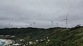 Pagudpud Wind Farm.jpg 3,840 × 2,160; 1.56 MB
-
 Panampangan Island.jpg 3,973 × 2,980; 1.33 MB
-
 Panguan Island.jpg 4,032 × 3,024; 4.54 MB
-
 PH Navy SWAG Inflatable Fast Craft.jpg 4,032 × 3,024; 3.64 MB
-
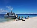 Philippine Navy MPAC Mk2 Panguan.jpg 4,032 × 3,024; 1.62 MB
-
 Pulag Banner.jpg 2,889 × 413; 473 KB
-
 Raising Hands at Hibok-Hibok Volcano Summit.jpg 1,920 × 1,080; 648 KB
-

-
-
 Road to Kanaway Beach of Jomalig Island.jpg 1,920 × 1,372; 822 KB
-
 San Francisco Parish Naga City.jpg 1,920 × 1,082; 448 KB
-
 Sariaya Church Historical Marker.jpg 2,992 × 2,730; 804 KB
-
 Schadow1 SOTMAsia2016.jpg 3,684 × 2,070; 2.48 MB
-
 Selfie with Wikipedia.jpg 1,024 × 1,024; 143 KB
-
 Seven Lakes of San Pablo.jpg 1,920 × 1,280; 199 KB
-
 Silyang Bato of Mt. Marami.jpg 1,920 × 1,308; 253 KB
-
 Sitangkai from Tumindao Channel.jpg 4,032 × 3,024; 3.48 MB
-
 SM Mall of Asia Complex, Pasay City Aerial Photo.jpg 1,920 × 1,440; 405 KB
-
-
 Surigao City Hall and Flagpole.jpg 4,000 × 3,000; 1.7 MB
-
 Taal Volcano Remote Monitoring Station.jpg 1,920 × 1,082; 498 KB
-
 TawiTawiPH mappingexpedition.jpg 2,592 × 1,944; 1.83 MB
-
 Tayabas Historical Marker.jpg 2,388 × 3,340; 1.05 MB
-
 Tejeros Convention House.jpg 1,920 × 1,080; 429 KB
-
 Tejeros Convention Marker.jpg 1,427 × 1,155; 298 KB
-
 Unang Pagtataas ng Watawat ng Pilipinas sa Mindanao Marker.jpg 2,532 × 3,652; 919 KB
-
 West Valley Fault in Pasig.png 1,303 × 891; 2.41 MB
-
 Zapote Battlefield Historical Marker.jpg 1,536 × 2,048; 957 KB
-
 Zapote Battlefield Monument.jpg 1,536 × 2,048; 490 KB


.jpg)


.jpg)


.jpg)


.jpg)


.jpg)


.jpg)


.jpg)


