Category:Schappe de Saint-Rambert
| Object location | | View all coordinates using: OpenStreetMap |
|---|
| Upload media | |||||
| Pronunciation audio | |||||
|---|---|---|---|---|---|
| Instance of | |||||
| Location | Saint-Rambert-en-Bugey, Ain, Auvergne-Rhône-Alpes, Metropolitan France, France | ||||
 | |||||
Subcategories
This category has the following 3 subcategories, out of 3 total.
C
F
S
Media in category "Schappe de Saint-Rambert"
The following 32 files are in this category, out of 32 total.
-
 1974+champi.JPG 640 × 891; 127 KB
-
 20170218 Saint Rambert.jpg 4,228 × 2,816; 1.67 MB
-
 Action Schappe.JPG 911 × 728; 223 KB
-
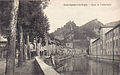
 Carte postale ancienne - quais et usine à Saint-Rambert-en-Bugey.jpg 1,024 × 656; 137 KB
-
 Entréede Saint-Rambert-en Bugey (2).jpg 840 × 525; 143 KB
-
 Greve1979.JPG 3,360 × 5,184; 2.13 MB
-
 HorlogeSchappe 01.jpg 3,155 × 4,411; 3.27 MB
-
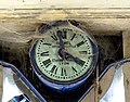 HorlogeSchappe 02.jpg 4,412 × 3,448; 5.48 MB
-
 Quai Charles-Béraudier07.jpg 4,896 × 3,672; 4.95 MB
-
 Saint-Rambert-en-Bugey, Albarine.jpg 3,456 × 2,304; 1.99 MB
-
 Schappe années 80.JPG 1,912 × 2,660; 2.32 MB
-
 Schappe de Saint-Rambert (1).jpg 2,304 × 3,456; 2.18 MB
-
 Schappe de Saint-Rambert (2).jpg 3,456 × 2,304; 1.99 MB
-
 Schappe de Saint-Rambert 002.JPG 3,072 × 2,304; 2.93 MB
-
 Schappe de Saint-Rambert 003.JPG 3,072 × 2,304; 3.02 MB
-
 Schappe de Saint-Rambert 01.JPG 2,129 × 2,580; 4.18 MB
-
 Schappe de Saint-Rambert 02.JPG 1,024 × 735; 438 KB
-
 Schappe de Saint-Rambert 03.JPG 3,072 × 2,304; 3.24 MB
-
 Schappe de Saint-Rambert 06.JPG 2,304 × 3,072; 2.94 MB
-
 Schappe de Saint-Rambert 07.JPG 3,072 × 2,304; 2.84 MB
-
 Schappe de Saint-Rambert 08.JPG 2,922 × 2,192; 2.49 MB
-
 Schappe de Saint-Rambert 09.JPG 2,304 × 3,072; 2.78 MB
-
 Schappe de Saint-Rambert 10.JPG 2,304 × 3,072; 2.94 MB
-
 Schappe de Saint-Rambert 11.JPG 3,072 × 2,304; 3 MB
-
 Schappe de Saint-Rambert 12.JPG 3,072 × 2,304; 2.81 MB
-
 Schappe de Saint-Rambert 13.JPG 3,072 × 2,304; 3.19 MB
-
 Schappe de Saint-Rambert 14.JPG 3,072 × 2,304; 2.88 MB
-
 Schappe de Saint-Rambert 15.JPG 2,304 × 3,072; 2.19 MB
-
 Schappe de Saint-Rambert 16.JPG 2,863 × 2,147; 2.69 MB
-
 Schappe de Saint-Rambert 17.jpg 975 × 610; 209 KB
-
 Schappe de Saint-Rambert 18.jpg 995 × 644; 216 KB
-
 Vue de la Schappe 2017.JPG 2,111 × 2,250; 5.38 MB


.jpg)


.jpg)
.jpg)


