Category:Scheenesluis (Nijetrijne)
| Object location | | View all coordinates using: OpenStreetMap |
|---|
 | |||||
| Upload media | |||||
| Instance of | |||||
|---|---|---|---|---|---|
| Location | Nijetrijne, Weststellingwerf, Friesland, Netherlands | ||||
| Heritage designation |
| ||||
 | |||||
Nederlands: Scheenesluis
|
This is a category about rijksmonument number 508666
|
| Address |
|
Media in category "Scheenesluis (Nijetrijne)"
The following 6 files are in this category, out of 6 total.
-
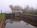
 Overzicht Scheenesluis - Nijetrijne - 20334650 - RCE.jpg 1,190 × 1,200; 272 KB
-
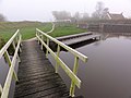
 Overzicht sluis met houten draaibrug - Nijetrijne - 20345927 - RCE.jpg 1,174 × 1,200; 276 KB
-
 Rottige Meente 01.JPG 1,024 × 768; 145 KB
-
 Scheenesluis1.jpg 3,587 × 2,690; 502 KB
-
 Scheenesluis2.jpg 3,648 × 2,736; 522 KB
-
 Scheenesluis3.jpg 3,648 × 2,736; 593 KB


