Category:Schnurrenloch
| Object location | | View all coordinates using: OpenStreetMap |
|---|
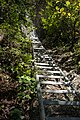
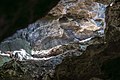
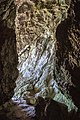
archaeological site in Oberwil in the Simmental in the canton of Bern, Switzerland  | |||||
| Upload media | |||||
| Instance of | |||||
|---|---|---|---|---|---|
| Part of | |||||
| Location | Oberwil im Simmental, Frutigen-Niedersimmental administrative district, Oberland administrative region, Bern, Switzerland | ||||
| Street address |
| ||||
| Heritage designation | |||||
 | |||||
Media in category "Schnurrenloch"
The following 8 files are in this category, out of 8 total.
-
 Oberwil i.S. Schnurrenloch 01.jpg 3,000 × 2,000; 6.65 MB
-
 Oberwil i.S. Schnurrenloch 02.jpg 2,000 × 3,000; 5.98 MB
-
 Oberwil i.S. Schnurrenloch 03.jpg 3,000 × 2,000; 4.26 MB
-
 Oberwil i.S. Schnurrenloch 04.jpg 2,000 × 3,000; 6.61 MB
-
 Oberwil i.S. Schnurrenloch 05.jpg 3,000 × 2,000; 5.91 MB
-
 Oberwil i.S. Schnurrenloch 06.jpg 2,250 × 3,000; 5.78 MB
-
 Oberwil i.S. Schnurrenloch 07.jpg 2,250 × 3,000; 4.71 MB
-
 Oberwil i.S. Schnurrenloch 08.jpg 3,000 × 2,250; 4.94 MB


