Category:School of Illiat
| Object location | | View all coordinates using: OpenStreetMap |
|---|
 | |||||
| Upload media | |||||
| Instance of | |||||
|---|---|---|---|---|---|
| Industry |
| ||||
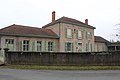
| Location | Illiat, Ain, Auvergne-Rhône-Alpes, Metropolitan France, France | ||||
| Street address |
| ||||
| Owned by | |||||
| Inception |
| ||||
 | |||||
Media in category "School of Illiat"
The following 12 files are in this category, out of 12 total.
-
 École Illiat 1.jpg 5,184 × 3,456; 7.74 MB
-
 École Illiat 10.jpg 5,184 × 3,456; 5.24 MB
-
 École Illiat 11.jpg 5,184 × 3,456; 5.39 MB
-
 École Illiat 12.jpg 5,184 × 3,456; 5.71 MB
-
 École Illiat 2.jpg 5,184 × 3,456; 8.07 MB
-
 École Illiat 3.jpg 5,184 × 3,456; 5.92 MB
-
 École Illiat 4.jpg 5,184 × 3,456; 7.14 MB
-
 École Illiat 5.jpg 5,184 × 3,456; 6.04 MB
-
 École Illiat 6.jpg 5,184 × 3,456; 5.94 MB
-
 École Illiat 7.jpg 5,184 × 3,456; 6.36 MB
-
 École Illiat 8.jpg 5,184 × 3,456; 6.25 MB
-
 École Illiat 9.jpg 5,184 × 3,456; 5.38 MB


