Category:Schwedenkai (Kiel)
| Object location | | View all coordinates using: OpenStreetMap |
|---|
wharf in Port of Kiel  | |||||
| Upload media | |||||
| Instance of |
| ||||
|---|---|---|---|---|---|
| Part of | |||||
| Location | |||||
| official website | |||||
 | |||||
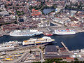
Deutsch: Der Schwedenkai ist eine Hafenanlage und gleichnamige Zufahrtsstraße in Kiel-Altstadt und -Vorstadt mit dem Stena Line-Terminal.
.
English: Schwedenkai is a wharf and access road in the districts of Kiel'sAltstadt and Vorstadt with the Stena Line Sweden terminal.
Svenska: Schwedenkai är en hamnanläggning och tillfartsväg med Stena Lines Sverigeterminal i distrikten Altstadt och Vorstadt i Kiel
Subcategories
This category has the following 2 subcategories, out of 2 total.
B
- Bahnhofsbrücke (Kiel) (28 F)
S
- Schwedenkai 1 (39 F)
Media in category "Schwedenkai (Kiel)"
The following 63 files are in this category, out of 63 total.
-
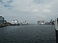
 00 148 Kieler Hafen - Schwedenkai.jpg 2,490 × 1,660; 1.47 MB
-
 KielerFaehrenLuftaufnahme.jpg 1,024 × 768; 271 KB
-
 Kiel Schwedenkai Ostseekai hafen IMG 3820.JPG 2,592 × 985; 590 KB
-
 2020-12-09-Hörnblick bei Nacht.jpg 6,904 × 4,512; 7.91 MB
-
 Kieler Woche 2013 - Flickr - tm-md (133).jpg 2,047 × 1,356; 326 KB
-
 Abriss Karstadt.JPG 2,048 × 1,536; 1.18 MB
-
 Altes Schwedenterminal Zufahrt.jpg 2,816 × 1,880; 2.93 MB
-
 Altes Terminal Schwedenkai.jpg 2,560 × 1,920; 2.25 MB
-
 Altes und neues Schwedenterminal 1.jpg 2,816 × 1,880; 2.29 MB
-
 Am Bootshafen (01) (28164642622).jpg 5,184 × 3,456; 9.18 MB
-
 Baustelle Schwedenterminal 3.jpg 2,272 × 1,704; 1.18 MB
-
 Bow of M S Stena Scandinavica 2 (234889767).jpg 1,024 × 768; 247 KB
-
 Brannvernskip (3479411526).jpg 3,888 × 2,592; 4.04 MB
-
 Cap San Diego Kiel.jpg 1,824 × 1,368; 350 KB
-
 Center panorama IMG 4281 kiel.jpg 7,650 × 2,196; 3.54 MB
-
 Eggerstedtstraße, Kiel (04) (22031816281).jpg 5,184 × 3,456; 8.71 MB
-
 Fährschiff STENA SCANDINAVICA (schwed.) (Kiel 40.072).jpg 1,007 × 664; 130 KB
-
 Kaistraße, Höhe Stresemannplatz (Kiel 40.062).jpg 1,007 × 664; 108 KB
-
 Kiel - 5. Mai 2013 - panoramio (21).jpg 2,048 × 1,366; 377 KB
-
 Kiel - hamn - panoramio.jpg 2,560 × 1,920; 1.04 MB
-
 Kiel - panoramio - Mijdrecht.jpg 1,200 × 1,600; 476 KB
-
 Kiel central Schwedenkai IMG 3708.JPG 2,592 × 1,728; 1.98 MB
-
 Kiel harbour 2018 3.jpg 3,648 × 2,736; 4.09 MB
-
 Kiel Port.jpg 4,608 × 3,456; 6.28 MB
-
 Kiel schwedenkai containers IMG 3817.JPG 2,443 × 1,538; 738 KB
-
 Kiel schwedenkai containers IMG 3818.JPG 2,592 × 1,728; 1.13 MB
-
 Kiel schwedenkai containers IMG 3819.JPG 2,484 × 1,269; 723 KB
-
 Kiel Schwedenkai IMG 3665.JPG 2,592 × 1,728; 2.02 MB
-
 Kiel schwedenkai IMG 3821.JPG 2,592 × 1,728; 1.01 MB
-
 Kiel schwedenkai rathaus IMG 3816.JPG 2,592 × 1,458; 814 KB
-
 Kieler Hafen (27839157674).jpg 5,184 × 3,456; 10.99 MB
-
 Kieler Woche 2003 (Kiel 40.040).jpg 1,007 × 664; 141 KB
-
 Matthias Suessen Kiel-6579.jpg 4,435 × 2,432; 2.5 MB
-
 Missionsschiff LOGOS (Kiel 74.786).jpg 1,024 × 683; 87 KB
-
 Neues Schwedenterminal.jpg 2,816 × 1,880; 2.4 MB
-
 Raddampfer FREYA (Kiel 40.083).jpg 1,007 × 664; 106 KB
-
 Schwedenkai (1) (30102801043).jpg 5,184 × 3,456; 6.8 MB
-
 Schwedenkai (20252759764).jpg 5,184 × 3,456; 7.32 MB
-
 Schwedenkai (Kiel 74.878).jpg 1,024 × 683; 114 KB
-
 Schwedenkai (Kiel 74.881).jpg 1,024 × 683; 116 KB
-
 Schwedenkai Kiel, Kühlung eines Tankcontainers-3516.jpg 5,100 × 3,400; 10.29 MB
-
 Schwedenkai Kiel, Kühlung eines Tankcontainers-3517.jpg 5,184 × 3,456; 11.34 MB
-
 Schwedenkai Kiel, Kühlung eines Tankcontainers-3518.jpg 3,456 × 5,184; 11.79 MB
-
 Schwedenkai, Kiel (25977153936).jpg 5,184 × 3,456; 4.69 MB
-
 Seewind 07 (16094300394).jpg 3,456 × 5,184; 8.13 MB
-
 Seewind 09 (16529072688).jpg 3,456 × 5,184; 5.77 MB
-
 Seewind 10 (16530553989).jpg 5,184 × 3,456; 8.43 MB
-
 Seewind 11 (16096750503).jpg 3,338 × 5,011; 7.59 MB
-
 Stena Freighter Hafenhaus.jpg 3,264 × 2,448; 2.21 MB
-
 Stena Freighter Neues Terminal.jpg 3,264 × 2,448; 2.34 MB
-
 STENA GERMANICA 5492.jpg 3,076 × 2,130; 1.35 MB
-
 Stena Germanica III 2010.jpg 2,816 × 1,880; 2.09 MB
-
 Stena Germanica in the port of Kiel.jpg 4,998 × 3,331; 8.69 MB
-
 Stena Germanica Kiel 2021.jpg 6,000 × 4,000; 6.97 MB
-
 Stena Line (25112547922).jpg 5,836 × 3,513; 8.25 MB
-
 Stena Line Feuerwehr.jpg 1,600 × 1,200; 465 KB
-
 Stena Scandinavica 1988 2.jpg 3,008 × 2,000; 2.88 MB
-
 Stena Scandinavica und Stena Germanica.jpg 2,560 × 1,920; 2.64 MB
-
 Terminal am Schwedenkai (Kiel 39.642).jpg 1,007 × 664; 78 KB
-
 Terminal am Schwedenkai (Kiel 39.645).jpg 1,007 × 664; 88 KB
-
 Terminal am Schwedenkai (Kiel 39.837).jpg 1,007 × 664; 83 KB
-
 Vorbereitungsarbeiten am Bootshafen zur Kieler Woche 2004 (Kiel 40.052).jpg 1,007 × 664; 114 KB
-
 Киль at night.jpg 1,515 × 1,011; 990 KB


.jpg)


_(28164642622).jpg)

.jpg)
.jpg)

_(22031816281).jpg)
_(Kiel_40.072).jpg)
.jpg)
.jpg)


.jpg)
.jpg)

.jpg)

.jpg)
_(30102801043).jpg)
.jpg)
.jpg)
.jpg)


.jpg)
.jpg)
.jpg)
.jpg)
.jpg)


.jpg)


.jpg)
.jpg)
.jpg)
.jpg)
