Category:Seeweiher (Veldensteiner Forst)
| Object location | | View all coordinates using: OpenStreetMap |
|---|
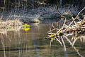
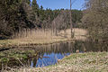
Deutsch: Der Seeweiher ist ein Gewässer im Naturschutzgebiet Pegnitzau zwischen Ranna und Michelfeld in Bayern.
Media in category "Seeweiher (Veldensteiner Forst)"
The following 4 files are in this category, out of 4 total.
-
 Seeweiher 1.jpg 4,288 × 2,848; 8 MB
-
 Seeweiher 2.jpg 4,288 × 2,848; 6.39 MB
-
 Seeweiher 2015 04.jpg 5,047 × 3,365; 3.64 MB
-
 Seeweiher 2015 06.jpg 5,184 × 3,456; 5.88 MB


