<nowiki>Seljatino; Selyatino; Sielatino; Seljatino; Селятино; Seljatino; Селятино; Selyatino; Սելյատինո (քաղաքատիպ ավան, Նարո-Ֆոմինսկի շրջան); 谢利亚季诺; سلیاتینو; commune urbaine de Russie; населений пункт у Росії; nederzetting in Rusland; рабочий посёлок в Наро-Фоминском районе Московской области России; Siedlung in Russland; human settlement in Russia; urban-type settlement in Moscow Oblast, Russia; human settlement in Russia; 俄罗斯莫斯科州的市级镇; مستوطنة في روسيا; Selyatino; Selyatino</nowiki>

.svg)


 Gerb Selyatino.png 150 × 187; 8 KB
 Selyatino Houses.jpg 3,266 × 2,280; 4.75 MB
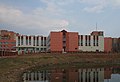 Selyatino School.jpg 3,340 × 2,288; 4.44 MB