Category:Senate Atlas
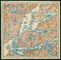
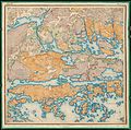
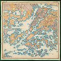
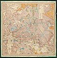
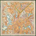
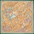
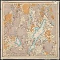
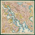
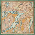
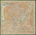
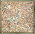
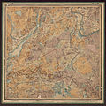
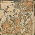
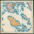
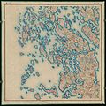
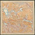
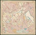
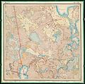
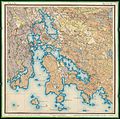
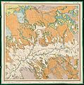
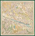
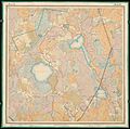
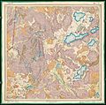
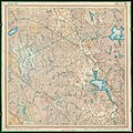
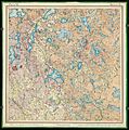
English: The Senate Atlas is a series of maps of Southern Finland drawn by the Russian Army topographic troops in the end of the 19th and the beginning of the 20th centuries in scale 1:21 000. The Senate Atlas consists of 2 individual series with different colouring traditions, the Russian and the Finnish.
Suomi: Senaatin kartastoiksi kutsutaan Venäjän armeijan topografisten joukkojen mittakaavassa 1:21 000 Etelä-Suomesta 1800-luvun lopulla ja 1900-luvun alussa tekemiä karttoja. Kartastosta on tehty kaksi eri alkuperäistä sarjaa, toinen venäläiseen ja toinen suomalaiseen kartan väritysperinteeseen pohjautuen.
 |
 |
|||||||||||||||||||||||||||||||||||||||||||||||||||||

| ||||||||||||||||||||||||||||||||||||||||||||||||||||||
 |
 |
 |
 |

| ||||||||||||||||||||||||||||||||||||||||||||||||||
 |
 |
 |
 |
 |
 |
 |
 |
 |
 |
|||||||||||||||||||||||||||||||||||||||||||||
 |
 |
 |
 |
 |
 |
|||||||||||||||||||||||||||||||||||||||||||||||||
 |
 |
 |
 |
 |
 |
|||||||||||||||||||||||||||||||||||||||||||||||||
 |
||||||||||||||||||||||||||||||||||||||||||||||||||||||
 |
 |
|||||||||||||||||||||||||||||||||||||||||||||||||||||
 |
||||||||||||||||||||||||||||||||||||||||||||||||||||||
 |
||||||||||||||||||||||||||||||||||||||||||||||||||||||
| Upload media | |||||
| Instance of | |||||
|---|---|---|---|---|---|
| |||||
Media in category "Senate Atlas"
The following 200 files are in this category, out of 420 total.
(previous page) (next page)-
 Koivusaari ja Leppäsaari, Helsinki (Senate Atlas).jpg 544 × 544; 46 KB
-
 Kyrkosund.png 723 × 687; 1.33 MB
-
 Nurmijärvi Senaatin kartta 1871 (cropped).jpeg 449 × 300; 50 KB
-
 Nurmijärvi Senaatin kartta 1871.jpeg 1,024 × 1,017; 313 KB
-
 Painetujen 1-21000 topografisten karttojen lehtijako.jpg 2,544 × 1,358; 774 KB
-
 Senaatin kartasto Turku IX 16 out RealESRGAN x2plus.jpg 28,860 × 29,132; 190.22 MB
-
 Senaatin kartasto Turku IX 16 out RealESRGAN x4plus anime.jpg 28,860 × 29,132; 144.05 MB
-
 Senaatin kartasto Turku IX 16 out RealESRGAN x4plus.jpg 28,860 × 29,132; 184.24 MB
-
 Senate Atlas, 1870–1907. Sheet III 20 Hanko.jpg 8,720 × 7,066; 6.66 MB
-
 Senate Atlas, 1870–1907. Sheet III 21 Tammisaari.jpg 7,176 × 7,173; 6.47 MB
-
 Senate Atlas, 1870–1907. Sheet IV 17 Hiittinen.jpg 7,178 × 7,082; 7.28 MB
-
 Senate Atlas, 1870–1907. Sheet IV 18 Hiittinen.jpg 8,859 × 8,674; 8.22 MB
-
 Senate Atlas, 1870–1907. Sheet IV 19 Bromarv.jpg 7,143 × 7,111; 5.21 MB
-
 Senate Atlas, 1870–1907. Sheet IV 20 Bromarv.jpg 7,315 × 7,206; 7.69 MB
-
 Senate Atlas, 1870–1907. Sheet IV 21 Tenhola.jpg 7,120 × 7,111; 8.1 MB
-
 Senate Atlas, 1870–1907. Sheet IV 22 Tammisaari.jpg 7,278 × 7,145; 7.9 MB
-
 Senate Atlas, 1870–1907. Sheet IV 23 Snappertuna.jpg 7,160 × 7,071; 7.75 MB
-
 Senate Atlas, 1870–1907. Sheet IV 24 Inkoo.jpg 7,215 × 7,144; 7.63 MB
-
 Senate Atlas, 1870–1907. Sheet IV 27 Kirkkonummi.jpg 7,228 × 7,187; 4.91 MB
-
 Senate Atlas, 1870–1907. Sheet IV 5-7 Föglö.jpg 9,341 × 12,113; 11.26 MB
-
 Senate Atlas, 1870–1907. Sheet IX 13 Veikua.jpg 7,092 × 7,122; 6.67 MB
-
 Senate Atlas, 1870–1907. Sheet IX 14 Merimasku.jpg 7,055 × 7,043; 7.65 MB
-
 Senate Atlas, 1870–1907. Sheet IX 15 Naantali.jpg 7,066 × 7,078; 8.3 MB
-
 Senate Atlas, 1870–1907. Sheet IX 16 Turku.jpg 7,215 × 7,283; 7.95 MB
-
 Senate Atlas, 1870–1907. Sheet IX 17 Piikkiö.jpg 7,176 × 7,099; 8.19 MB
-
 Senate Atlas, 1870–1907. Sheet IX 18 Paimio.jpg 7,240 × 7,186; 8.53 MB
-
 Senate Atlas, 1870–1907. Sheet IX 19 Paimio.jpg 7,044 × 7,181; 7.75 MB
-
 Senate Atlas, 1870–1907. Sheet IX 20 Halikko.jpg 7,179 × 7,185; 8.63 MB
-
 Senate Atlas, 1870–1907. Sheet IX 21 Pertteli.jpg 7,154 × 7,133; 7.75 MB
-
 Senate Atlas, 1870–1907. Sheet IX 22 Kiikala.jpg 7,136 × 7,061; 8.47 MB
-
 Senate Atlas, 1870–1907. Sheet IX 23 Kiikala.jpg 7,190 × 7,120; 8.69 MB
-
 Senate Atlas, 1870–1907. Sheet IX 24 Nummi.jpg 7,151 × 7,117; 8.63 MB
-
 Senate Atlas, 1870–1907. Sheet IX 25 Pusula.jpg 7,112 × 7,013; 8.82 MB
-
 Senate Atlas, 1870–1907. Sheet IX 26 Vihti.jpg 7,128 × 7,077; 8.87 MB
-
 Senate Atlas, 1870–1907. Sheet IX 27 Vihti.jpg 7,080 × 7,029; 8.5 MB
-
 Senate Atlas, 1870–1907. Sheet IX 28 Nurmijärvi.jpg 7,179 × 7,096; 7.72 MB
-
 Senate Atlas, 1870–1907. Sheet IX 29 Nurmijärvi.jpg 7,095 × 7,049; 9.06 MB
-
 Senate Atlas, 1870–1907. Sheet IX 30 Tuusula. Duplicate.jpg 7,101 × 7,185; 7.65 MB
-
 Senate Atlas, 1870–1907. Sheet IX 30 Tuusula.jpg 7,135 × 7,097; 7.11 MB
-
 Senate Atlas, 1870–1907. Sheet IX 31 Sipoo.jpg 7,167 × 7,089; 7.86 MB
-
 Senate Atlas, 1870–1907. Sheet IX 32 Pornainen.jpg 7,193 × 7,149; 8.02 MB
-
 Senate Atlas, 1870–1907. Sheet IX 33 Porvoo.jpg 7,173 × 7,145; 7.95 MB
-
 Senate Atlas, 1870–1907. Sheet IX 34 Porvoo.jpg 7,203 × 7,177; 9.04 MB
-
 Senate Atlas, 1870–1907. Sheet IX 35 Pernaja.jpg 7,104 × 7,137; 7.64 MB
-
 Senate Atlas, 1870–1907. Sheet IX 36 Loviisa.jpg 7,078 × 7,095; 7.5 MB
-
 Senate Atlas, 1870–1907. Sheet IX 37 Ruotsinpyhtää.jpg 7,203 × 7,121; 7.17 MB
-
 Senate Atlas, 1870–1907. Sheet IX 38 Pyhtää.jpg 7,151 × 7,195; 6.41 MB
-
 Senate Atlas, 1870–1907. Sheet IX 39 Pyhtää.jpg 7,160 × 7,145; 6.33 MB
-
 Senate Atlas, 1870–1907. Sheet IX 40 Kotka.jpg 7,116 × 7,137; 5.75 MB
-
 Senate Atlas, 1870–1907. Sheet IX 41 Hiitola.jpg 7,096 × 7,121; 3.88 MB
-
 Senate Atlas, 1870–1907. Sheet IX 42 Vehkalahti.jpg 7,260 × 7,173; 5.46 MB
-
 Senate Atlas, 1870–1907. Sheet IX 43 Virolahti.jpg 7,152 × 7,089; 4.33 MB
-
 Senate Atlas, 1870–1907. Sheet IX 44 Virolahti.jpg 6,912 × 7,049; 3.33 MB
-
 Senate Atlas, 1870–1907. Sheet V 17 Dragsfjärd.jpg 7,141 × 7,108; 7.36 MB
-
 Senate Atlas, 1870–1907. Sheet V 18 Västanfjärd.jpg 7,177 × 7,143; 7.5 MB
-
 Senate Atlas, 1870–1907. Sheet V 19 Finby.jpg 7,278 × 7,128; 7.09 MB
-
 Senate Atlas, 1870–1907. Sheet V 20 Tenhola.jpg 7,176 × 7,117; 7.68 MB
-
 Senate Atlas, 1870–1907. Sheet V 21 Pohja.jpg 7,202 × 7,140; 8.42 MB
-
 Senate Atlas, 1870–1907. Sheet V 22 Pohja.jpg 7,144 × 7,069; 8.48 MB
-
 Senate Atlas, 1870–1907. Sheet V 23 Karjaa.jpg 7,227 × 7,116; 8.55 MB
-
 Senate Atlas, 1870–1907. Sheet V 24 Karjaa.jpg 7,260 × 7,259; 8.75 MB
-
 Senate Atlas, 1870–1907. Sheet V 26 Inkoo.jpg 7,136 × 7,045; 6.89 MB
-
 Senate Atlas, 1870–1907. Sheet V 27 Kirkkonummi.jpg 7,216 × 7,061; 7.98 MB
-
 Senate Atlas, 1870–1907. Sheet V 28 Kirkkonummi.jpg 7,177 × 7,194; 5.01 MB
-
 Senate Atlas, 1870–1907. Sheet V-VI 2-4 Jomala.jpg 7,213 × 7,173; 6.25 MB
-
 Senate Atlas, 1870–1907. Sheet V-VI 5-7 Maarianhamina.jpg 7,344 × 7,269; 7.74 MB
-
 Senate Atlas, 1870–1907. Sheet VI 17 Kemiö.jpg 7,278 × 7,159; 6.53 MB
-
 Senate Atlas, 1870–1907. Sheet VI 18 Kemiö.jpg 7,224 × 7,145; 8.03 MB
-
 Senate Atlas, 1870–1907. Sheet VI 19 Kemiö.jpg 7,067 × 7,171; 8.35 MB
-
 Senate Atlas, 1870–1907. Sheet VI 20 Finby.jpg 7,166 × 7,132; 8.16 MB
-
 Senate Atlas, 1870–1907. Sheet VI 21 Perniö.jpg 7,314 × 7,132; 9.53 MB
-
 Senate Atlas, 1870–1907. Sheet VI 22 Pohja.jpg 7,240 × 7,051; 8.81 MB
-
 Senate Atlas, 1870–1907. Sheet VI 23 Pohja.jpg 7,240 × 7,108; 8.97 MB
-
 Senate Atlas, 1870–1907. Sheet VI 24 Karjaa.jpg 7,224 × 7,147; 9.3 MB
-
 Senate Atlas, 1870–1907. Sheet VI 25 Inkoo.jpg 7,253 × 7,141; 8.95 MB
-
 Senate Atlas, 1870–1907. Sheet VI 26 Siuntio.jpg 7,216 × 7,103; 9.01 MB
-
 Senate Atlas, 1870–1907. Sheet VI 27 Kirkkonummi.jpg 7,216 × 7,104; 8.15 MB
-
 Senate Atlas, 1870–1907. Sheet VI 28 Espoo.jpg 7,200 × 7,063; 8.42 MB
-
 Senate Atlas, 1870–1907. Sheet VI 29 Espoo.jpg 7,116 × 7,191; 6.37 MB
-
 Senate Atlas, 1870–1907. Sheet VI 30 Helsinki.jpg 7,080 × 7,095; 6.97 MB
-
 Senate Atlas, 1870–1907. Sheet VI 31 Sipoo.jpg 7,227 × 7,345; 3.88 MB
-
 Senate Atlas, 1870–1907. Sheet VII 15 Nauvo.jpg 7,178 × 7,183; 6.32 MB
-
 Senate Atlas, 1870–1907. Sheet VII 16 Parainen.jpg 7,120 × 7,011; 6.91 MB
-
 Senate Atlas, 1870–1907. Sheet VII 17 Parainen.jpg 7,166 × 7,083; 6.83 MB
-
 Senate Atlas, 1870–1907. Sheet VII 18 Karuna.jpg 7,144 × 7,147; 8.39 MB
-
 Senate Atlas, 1870–1907. Sheet VII 19 Kemiö.jpg 7,128 × 7,183; 7.82 MB
-
 Senate Atlas, 1870–1907. Sheet VII 20 Perniö.jpg 7,216 × 7,187; 8.55 MB
-
 Senate Atlas, 1870–1907. Sheet VII 21 Perniö.jpg 7,109 × 7,157; 8.81 MB
-
 Senate Atlas, 1870–1907. Sheet VII 22 Kisko.jpg 7,252 × 7,186; 7.99 MB
-
 Senate Atlas, 1870–1907. Sheet VII 23 Karjalohja.jpg 7,224 × 7,137; 8.56 MB
-
 Senate Atlas, 1870–1907. Sheet VII 24 Karjalohja.jpg 7,215 × 7,111; 7.81 MB
-
 Senate Atlas, 1870–1907. Sheet VII 25 Lohja. Duplicate.jpg 7,176 × 7,157; 6.81 MB
-
 Senate Atlas, 1870–1907. Sheet VII 25 Lohja.jpg 7,219 × 7,106; 7.29 MB
-
 Senate Atlas, 1870–1907. Sheet VII 26 Siuntio.jpg 7,241 × 7,148; 8.61 MB
-
 Senate Atlas, 1870–1907. Sheet VII 27 Kirkkonummi.jpg 7,088 × 7,013; 8.37 MB
-
 Senate Atlas, 1870–1907. Sheet VII 28 Espoo.jpg 7,175 × 7,077; 8.23 MB
-
 Senate Atlas, 1870–1907. Sheet VII 29 Helsinki.jpg 7,247 × 7,224; 9.5 MB
-
 Senate Atlas, 1870–1907. Sheet VII 30 Helsinki.jpg 7,113 × 7,445; 8.82 MB
-
 Senate Atlas, 1870–1907. Sheet VII 31 Sipoo.jpg 7,124 × 7,349; 9.3 MB
-
 Senate Atlas, 1870–1907. Sheet VII 32 Sipoo.jpg 7,305 × 7,215; 8.46 MB
-
 Senate Atlas, 1870–1907. Sheet VII 33 Porvoo.jpg 7,143 × 7,196; 7.24 MB
-
 Senate Atlas, 1870–1907. Sheet VII 34 Porvoo.jpg 7,257 × 7,596; 9.02 MB
-
 Senate Atlas, 1870–1907. Sheet VII 35 Pernaja.jpg 7,314 × 7,262; 7.49 MB
-
 Senate Atlas, 1870–1907. Sheet VII-VIII 3-4 Hammarland.jpg 7,192 × 7,173; 8.54 MB
-
 Senate Atlas, 1870–1907. Sheet VII-VIII 5-6 Saltvik.jpg 7,181 × 7,209; 9.8 MB
-
 Senate Atlas, 1870–1907. Sheet VIII 14 Rymättylä.jpg 7,203 × 7,183; 7.01 MB
-
 Senate Atlas, 1870–1907. Sheet VIII 15 Rymättylä.jpg 7,139 × 7,185; 7.12 MB
-
 Senate Atlas, 1870–1907. Sheet VIII 16 Kakskerta.jpg 7,128 × 7,169; 7.31 MB
-
 Senate Atlas, 1870–1907. Sheet VIII 17 Parainen.jpg 7,116 × 7,149; 8.47 MB
-
 Senate Atlas, 1870–1907. Sheet VIII 18 Sauvo.jpg 7,215 × 7,133; 7.89 MB
-
 Senate Atlas, 1870–1907. Sheet VIII 19 Sauvo.jpg 7,248 × 7,153; 8.87 MB
-
 Senate Atlas, 1870–1907. Sheet VIII 20 Muurla.jpg 7,184 × 7,145; 8.07 MB
-
 Senate Atlas, 1870–1907. Sheet VIII 21 Muurla.jpg 7,128 × 7,161; 8.13 MB
-
 Senate Atlas, 1870–1907. Sheet VIII 22 Kisko.jpg 7,184 × 7,149; 8.7 MB
-
 Senate Atlas, 1870–1907. Sheet VIII 23 Suomusjärvi.jpg 7,188 × 7,105; 8.65 MB
-
 Senate Atlas, 1870–1907. Sheet VIII 24 Sammatti.jpg 7,129 × 7,045; 8.8 MB
-
 Senate Atlas, 1870–1907. Sheet VIII 25 Nummi.jpg 7,160 × 7,069; 8.71 MB
-
 Senate Atlas, 1870–1907. Sheet VIII 26 Vihti.jpg 7,128 × 7,049; 8.08 MB
-
 Senate Atlas, 1870–1907. Sheet VIII 27 Vihti.jpg 7,166 × 7,106; 9 MB
-
 Senate Atlas, 1870–1907. Sheet VIII 28 Espoo.jpg 7,156 × 7,117; 8.58 MB
-
 Senate Atlas, 1870–1907. Sheet VIII 29 Helsinki.jpg 7,080 × 7,231; 8.22 MB
-
 Senate Atlas, 1870–1907. Sheet VIII 30 Tuusula.jpg 7,144 × 7,031; 7.51 MB
-
 Senate Atlas, 1870–1907. Sheet VIII 31 Sipoo.jpg 7,240 × 7,098; 8.38 MB
-
 Senate Atlas, 1870–1907. Sheet VIII 32 Porvoo.jpg 7,119 × 7,062; 7.49 MB
-
 Senate Atlas, 1870–1907. Sheet VIII 33 Porvoo.jpg 7,252 × 7,176; 7.69 MB
-
 Senate Atlas, 1870–1907. Sheet VIII 34 Porvoo.jpg 7,117 × 7,134; 8.35 MB
-
 Senate Atlas, 1870–1907. Sheet VIII 35 Pernaja.jpg 7,302 × 7,256; 8.09 MB
-
 Senate Atlas, 1870–1907. Sheet VIII 36 Pernaja.jpg 7,144 × 7,105; 5.27 MB
-
 Senate Atlas, 1870–1907. Sheet VIII 37 Ruotsinpyhtää.jpg 7,180 × 7,129; 6.08 MB
-
 Senate Atlas, 1870–1907. Sheet X 11 Kustavi.jpg 7,116 × 7,106; 6.66 MB
-
 Senate Atlas, 1870–1907. Sheet X 12 Kustavi.jpg 7,072 × 7,073; 7.35 MB
-
 Senate Atlas, 1870–1907. Sheet X 13 Taivassalo.jpg 7,116 × 7,094; 7.3 MB
-
 Senate Atlas, 1870–1907. Sheet X 14 Askainen.jpg 7,119 × 7,145; 6.48 MB
-
 Senate Atlas, 1870–1907. Sheet X 15 Masku.jpg 7,128 × 7,105; 7.61 MB
-
 Senate Atlas, 1870–1907. Sheet X 16 Rusko.jpg 7,103 × 7,081; 7.04 MB
-
 Senate Atlas, 1870–1907. Sheet X 17 Lieto.jpg 7,116 × 7,117; 7.85 MB
-
 Senate Atlas, 1870–1907. Sheet X 18 Lieto.jpg 7,048 × 7,081; 8.29 MB
-
 Senate Atlas, 1870–1907. Sheet X 19 Marttila.jpg 7,203 × 7,192; 7.19 MB
-
 Senate Atlas, 1870–1907. Sheet X 20 Marttila.jpg 7,176 × 7,213; 7.92 MB
-
 Senate Atlas, 1870–1907. Sheet X 21 Kuusjoki.jpg 7,139 × 7,115; 8.67 MB
-
 Senate Atlas, 1870–1907. Sheet X 22 Kiikala.jpg 7,195 × 7,149; 8.46 MB
-
 Senate Atlas, 1870–1907. Sheet X 23 Somero.jpg 7,081 × 7,167; 8.64 MB
-
 Senate Atlas, 1870–1907. Sheet X 24 Somerniemi. Duplicate.jpg 7,011 × 7,053; 8.36 MB
-
 Senate Atlas, 1870–1907. Sheet X 24 Somerniemi.jpg 7,187 × 7,124; 8.24 MB
-
 Senate Atlas, 1870–1907. Sheet X 25 Pusula. Duplicate.jpg 7,119 × 7,033; 9.42 MB
-
 Senate Atlas, 1870–1907. Sheet X 25 Pusula.jpg 6,989 × 7,071; 9.86 MB
-
 Senate Atlas, 1870–1907. Sheet X 26 Pyhäjärvi.jpg 7,147 × 7,093; 9.19 MB
-
 Senate Atlas, 1870–1907. Sheet X 27 Pyhäjärvi.jpg 7,269 × 7,207; 8.59 MB
-
 Senate Atlas, 1870–1907. Sheet X 28 Hyvinkää.jpg 7,069 × 7,055; 8.24 MB
-
 Senate Atlas, 1870–1907. Sheet X 29 Nurmijärvi.jpg 7,215 × 7,143; 7.66 MB
-
 Senate Atlas, 1870–1907. Sheet X 30 Tuusula.jpg 7,048 × 7,065; 7.32 MB
-
 Senate Atlas, 1870–1907. Sheet X 31 Mäntsälä.jpg 7,215 × 7,144; 7.53 MB
-
 Senate Atlas, 1870–1907. Sheet X 32 Pornainen.jpg 7,136 × 7,129; 7.98 MB
-
 Senate Atlas, 1870–1907. Sheet X 33 Askola. Duplicate.jpg 7,175 × 7,149; 7.17 MB
-
 Senate Atlas, 1870–1907. Sheet X 33 Askola.jpg 7,104 × 7,167; 8.18 MB
-
 Senate Atlas, 1870–1907. Sheet X 34 Pernaja.jpg 7,032 × 7,105; 8.01 MB
-
 Senate Atlas, 1870–1907. Sheet X 35 Liljendal.jpg 7,217 × 7,119; 7.43 MB
-
 Senate Atlas, 1870–1907. Sheet X 36 Lapinjärvi.jpg 7,098 × 7,121; 7.53 MB
-
 Senate Atlas, 1870–1907. Sheet X 37 Ruotsinpyhtää.jpg 7,179 × 7,121; 7.38 MB
-
 Senate Atlas, 1870–1907. Sheet X 38 Pyhtää.jpg 7,178 × 7,171; 7.79 MB
-
 Senate Atlas, 1870–1907. Sheet X 39 Kymi.jpg 7,080 × 7,147; 7.92 MB
-
 Senate Atlas, 1870–1907. Sheet X 40 Vehkalahti.jpg 7,142 × 7,141; 9.05 MB
-
 Senate Atlas, 1870–1907. Sheet X 41 Hamina.jpg 7,151 × 7,113; 8.43 MB
-
 Senate Atlas, 1870–1907. Sheet X 42 Virolahti.jpg 7,266 × 7,272; 11.12 MB
-
 Senate Atlas, 1870–1907. Sheet X 43 Virolahti.jpg 7,237 × 7,263; 9.79 MB
-
 Senate Atlas, 1870–1907. Sheet X 44 Virolahti.jpg 6,855 × 7,133; 5.33 MB
-
 Senate Atlas, 1870–1907. Sheet XI 11 Kustavi.jpg 7,117 × 7,171; 6.09 MB
-
 Senate Atlas, 1870–1907. Sheet XI 12 Lokalahti.jpg 7,056 × 7,103; 7.84 MB
-
 Senate Atlas, 1870–1907. Sheet XI 13 Vehmaa.jpg 7,141 × 7,169; 8.18 MB
-
 Senate Atlas, 1870–1907. Sheet XI 14 Mietoinen.jpg 7,140 × 7,115; 7.77 MB
-
 Senate Atlas, 1870–1907. Sheet XI 15 Mynämäki.jpg 7,116 × 7,156; 7.66 MB
-
 Senate Atlas, 1870–1907. Sheet XI 16 Nousiainen.jpg 7,024 × 7,075; 7.73 MB
-
 Senate Atlas, 1870–1907. Sheet XI 17 Vahto.jpg 7,079 × 7,157; 7.93 MB
-
 Senate Atlas, 1870–1907. Sheet XI 18 Prunkkala.jpg 7,139 × 7,199; 7.39 MB
-
 Senate Atlas, 1870–1907. Sheet XI 19 Karinainen.jpg 7,065 × 7,099; 6.83 MB
-
 Senate Atlas, 1870–1907. Sheet XI 20 Koski.jpg 7,137 × 7,172; 7.42 MB
-
 Senate Atlas, 1870–1907. Sheet XI 21 Koski.jpg 7,168 × 7,207; 7.39 MB
-
 Senate Atlas, 1870–1907. Sheet XI 22 Somero.jpg 7,112 × 7,143; 7.35 MB
-
 Senate Atlas, 1870–1907. Sheet XI 23 Somero.jpg 7,068 × 7,197; 8.49 MB
-
 Senate Atlas, 1870–1907. Sheet XI 24 Somerniemi. Duplicate.jpg 7,127 × 7,129; 7.69 MB
-
 Senate Atlas, 1870–1907. Sheet XI 24 Somerniemi.jpg 7,141 × 7,162; 8.81 MB
-
 Senate Atlas, 1870–1907. Sheet XI 25 Tammela.jpg 7,167 × 7,241; 8.52 MB
-
 Senate Atlas, 1870–1907. Sheet XI 26 Loppi.jpg 7,016 × 7,143; 8.72 MB
-
 Senate Atlas, 1870–1907. Sheet XI 27 Loppi.jpg 7,092 × 7,202; 8.27 MB
-
 Senate Atlas, 1870–1907. Sheet XI 28 Hyvinkää.jpg 7,139 × 7,155; 7.81 MB
-
 Senate Atlas, 1870–1907. Sheet XI 29 Hyvinkää.jpg 7,123 × 7,059; 7.2 MB
-
 Senate Atlas, 1870–1907. Sheet XI 30 Hyvinkää.jpg 7,153 × 7,111; 6.72 MB
-
 Senate Atlas, 1870–1907. Sheet XI 31 Mäntsälä.jpg 7,128 × 7,101; 7.35 MB
-
 Senate Atlas, 1870–1907. Sheet XI 32 Mäntsälä.jpg 7,129 × 7,124; 6.99 MB
-
 Senate Atlas, 1870–1907. Sheet XI 33 Pukkila.jpg 7,079 × 7,148; 6.98 MB
-
 Senate Atlas, 1870–1907. Sheet XI 34 Myrskylä.jpg 7,166 × 7,098; 7.17 MB
-
 Senate Atlas, 1870–1907. Sheet XI 35 Lapinjärvi.jpg 7,040 × 7,061; 7.47 MB
-
 Senate Atlas, 1870–1907. Sheet XI 36 Lapinjärvi.jpg 7,079 × 7,132; 7.79 MB
-
 Senate Atlas, 1870–1907. Sheet XI 37 Elimäki.jpg 7,096 × 7,135; 6.59 MB
-
 Senate Atlas, 1870–1907. Sheet XI 38 Elimäki.jpg 7,178 × 7,187; 8.25 MB
-
 Senate Atlas, 1870–1907. Sheet XI 39 Anjala.jpg 7,104 × 7,047; 7.78 MB
-
 Senate Atlas, 1870–1907. Sheet XI 40 Vehkalahti.jpg 7,120 × 7,091; 8.12 MB
-
 Senate Atlas, 1870–1907. Sheet XI 41 Vehkalahti.jpg 7,188 × 7,243; 9.37 MB
-
 Senate Atlas, 1870–1907. Sheet XI 42 Vehkalahti.jpg 7,191 × 7,199; 8.57 MB
-
 Senate Atlas, 1870–1907. Sheet XI 43 Miehikkälä.jpg 7,144 × 7,125; 8.18 MB
.jpg)

.jpeg)


