Category:Send, Surrey
English: Send is a village in the English county of Surrey. It reputedly got its name as a corruption of the word sand, which was extracted until the 1990s for construction and other purposes at pits nearby. Send is mentioned in the Domesday Book of 1086 where it is named Sande.
Nederlands: Send is een plaats in het bestuurlijke gebied Guildford, in het Engelse graafschap Surrey. De plaats telt 4.138 inwoners.
village and civil parish in Surrey, Southern England  | |||||
| Upload media | |||||
| Instance of | |||||
|---|---|---|---|---|---|
| Location | Guildford, Surrey, South East England, England | ||||
| Area |
| ||||
| Said to be the same as | Send (Wikimedia duplicated page, civil parish) | ||||
 | |||||
Subcategories
This category has the following 7 subcategories, out of 7 total.
N
- New Inn, Send (8 F)
P
- Papercourt Lock (18 F)
S
- Send Evangelical Church (6 F)
- Send Marsh (5 F)
T
- Triggs Lock (12 F)
W
Media in category "Send, Surrey"
The following 200 files are in this category, out of 344 total.
(previous page) (next page)-
 "And you are" - geograph.org.uk - 2648873.jpg 480 × 640; 126 KB
-

-
 A field of moles and goats - geograph.org.uk - 6244839.jpg 1,024 × 768; 511 KB
-
 A House Door In Send Surrey UK.jpg 1,134 × 753; 92 KB
-
 A seat on the village green at Send Marsh - geograph.org.uk - 3036347.jpg 1,024 × 657; 296 KB
-
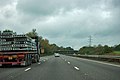
 A237 Send Road - geograph.org.uk - 2296436.jpg 1,600 × 1,200; 557 KB
-
 A237 Send Road - geograph.org.uk - 2296450.jpg 1,600 × 1,200; 587 KB
-
 A247 north of Cartbridge - geograph.org.uk - 2925426.jpg 3,357 × 2,442; 1.21 MB
-
 A247 through Send - geograph.org.uk - 2857761.jpg 640 × 428; 92 KB
-
 A3 approaching A247 bridge - geograph.org.uk - 2686922.jpg 640 × 428; 68 KB
-
-
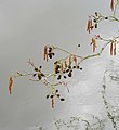
 Alder tree by the Tanyard Bridge, in January - geograph.org.uk - 3826842.jpg 716 × 1,024; 278 KB
-
 Alder, River Wey - geograph.org.uk - 3267639.jpg 1,456 × 1,941; 756 KB
-
 Alders at the tip of Mid Island (2) - geograph.org.uk - 4347132.jpg 758 × 1,024; 199 KB
-
 Alders at the tip of Mid Island - geograph.org.uk - 4345988.jpg 1,024 × 789; 195 KB
-
 Along the Broadmead Cut in November - geograph.org.uk - 5194643.jpg 1,024 × 768; 240 KB
-
 An autumnal Boughton Hall Avenue - geograph.org.uk - 2648404.jpg 480 × 640; 93 KB
-
 An autumnal Send Barns Lane - geograph.org.uk - 2648796.jpg 640 × 480; 104 KB
-
 Anglers' pond, Prews Farm - geograph.org.uk - 3407767.jpg 1,024 × 768; 234 KB
-

-

-

-

-

-

-

-
-

-

-

-
-

-
 Ashburton Bridge on the River Wey Navigation - geograph.org.uk - 2513811.jpg 2,272 × 1,704; 2.51 MB
-
 Autumn in Send Barns Lane - geograph.org.uk - 2648789.jpg 640 × 480; 94 KB
-
 B368 is Send Marsh Road - geograph.org.uk - 2924902.jpg 3,537 × 2,664; 1.57 MB
-
 Barge at jetty, River Wey - geograph.org.uk - 6244759.jpg 1,024 × 768; 313 KB
-
 Barge, Cartbridge - geograph.org.uk - 702504.jpg 640 × 480; 109 KB
-
 Beer Garden - geograph.org.uk - 2183832.jpg 1,669 × 1,192; 807 KB
-

-
 Blackthorn blossom by the Wey Navigation - geograph.org.uk - 4437497.jpg 842 × 1,024; 116 KB
-
 Boardwalk near Cartbridge - geograph.org.uk - 1047407.jpg 480 × 640; 152 KB
-
 Bridge over the River Wey - geograph.org.uk - 3443738.jpg 2,048 × 1,536; 1.76 MB
-
 Broad Mead cut - geograph.org.uk - 3443757.jpg 2,048 × 1,536; 1.31 MB
-
 Broad Mead meadows - geograph.org.uk - 3443746.jpg 2,048 × 1,536; 1.87 MB
-
 Broadmead Bridge - geograph.org.uk - 60673.jpg 640 × 427; 108 KB
-
 Broadmead bunker - geograph.org.uk - 2850341.jpg 1,935 × 1,452; 548 KB
-
 Broadmead Cut by Papercourt Meadows, November - geograph.org.uk - 5194421.jpg 759 × 1,024; 240 KB
-
 Broadmead Cut in March - geograph.org.uk - 3902231.jpg 758 × 1,024; 213 KB
-

-
 Broadmead Cut near Papercourt Lock - geograph.org.uk - 5194418.jpg 1,024 × 832; 273 KB
-

-
 Broadmead Meadows - geograph.org.uk - 2850255.jpg 2,048 × 1,536; 464 KB
-
 Broadmead meadows - geograph.org.uk - 2850271.jpg 2,048 × 1,536; 662 KB
-
 Broadmead Meadows - geograph.org.uk - 2850283.jpg 2,048 × 1,536; 653 KB
-
 Broadmead meadows - geograph.org.uk - 2850346.jpg 2,048 × 1,536; 591 KB
-
 Broadmead meadows anti aircraft control bunker - geograph.org.uk - 2850332.jpg 1,974 × 1,461; 498 KB
-
 Broadmead meadows entrance - geograph.org.uk - 2850248.jpg 2,048 × 1,536; 1.36 MB
-
 Broadmead Road, Cartbridge - geograph.org.uk - 4155423.jpg 2,560 × 1,920; 1.98 MB
-
 Brook by the path - geograph.org.uk - 3445181.jpg 2,048 × 1,536; 1.81 MB
-
 Burntcommon - Field Way - geograph.org.uk - 5980086.jpg 1,275 × 911; 480 KB
-
 Burntcommon next to the A3 Dual Carriageway - geograph.org.uk - 5980008.jpg 1,440 × 876; 219 KB
-
 Burntcommon Roundabout - geograph.org.uk - 2387104.jpg 4,320 × 3,240; 4.54 MB
-
 Burntcommon roundabout - geograph.org.uk - 3463686.jpg 2,048 × 1,536; 1.18 MB
-
 Burntcommon Roundabout, near Send - geograph.org.uk - 2951811.jpg 2,816 × 2,112; 1.32 MB
-
 Bus bay in Portsmouth Road - geograph.org.uk - 2648905.jpg 480 × 640; 119 KB
-
 Bus shelter in Send Barns Lane - geograph.org.uk - 2648865.jpg 640 × 480; 94 KB
-
 Bus shelter, Send Road - geograph.org.uk - 2296445.jpg 1,600 × 1,200; 569 KB
-
 Bush Lane, Send - geograph.org.uk - 3459035.jpg 1,988 × 1,491; 1.11 MB
-
 Car Park at Send Business Centre - geograph.org.uk - 4193283.jpg 2,304 × 1,728; 826 KB
-
 Cart Bridge, River Wey Navigation - geograph.org.uk - 6243834.jpg 1,024 × 768; 447 KB
-
 Cart Bridge, Send - geograph.org.uk - 6025600.jpg 1,335 × 780; 827 KB
-
 Cart Bridge, Wey Navigation - geograph.org.uk - 1777859.jpg 800 × 587; 113 KB
-
 Cart Bridge, Wey Navigation, Surrey - geograph.org.uk - 621452.jpg 640 × 500; 98 KB
-
 Cartbridge Wharf - geograph.org.uk - 949193.jpg 640 × 427; 203 KB
-
 Cartbridge, Send - geograph.org.uk - 3276762.jpg 2,048 × 1,536; 2.76 MB
-
 Cartbridge, Send - geograph.org.uk - 702498.jpg 640 × 480; 103 KB
-
 Carters Bridge - geograph.org.uk - 2183835.jpg 3,008 × 2,000; 1.59 MB
-
-
 Clandon Road (A248), Burntcommon - geograph.org.uk - 4434760.jpg 1,024 × 773; 286 KB
-
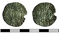 COIN (FindID 998122).jpg 3,146 × 1,788; 1.25 MB
-
 Cottage by Prews Farm, Send - geograph.org.uk - 4193395.jpg 2,304 × 1,728; 819 KB
-
 Cycle path ending in Send Barns Lane - geograph.org.uk - 2648891.jpg 480 × 640; 91 KB
-

-
 Danesfield - Send Marsh - geograph.org.uk - 5981293.jpg 1,298 × 860; 268 KB
-
 Dead end in Boughton Hall Avenue - geograph.org.uk - 2648700.jpg 640 × 480; 102 KB
-
 Derelict shed - geograph.org.uk - 3443073.jpg 2,029 × 1,520; 1.4 MB
-
 Dinghy at Papercourt - geograph.org.uk - 962629.jpg 640 × 480; 130 KB
-
 Drive to Sutton Place - geograph.org.uk - 60615.jpg 640 × 427; 126 KB
-
 Electricity sub station, Send Road - geograph.org.uk - 3610321.jpg 640 × 480; 108 KB
-

-
 Eroded riverside footpath - geograph.org.uk - 6109446.jpg 3,840 × 2,160; 4.85 MB
-
-

-
 Evening view across fishing lake at Send - geograph.org.uk - 3544545.jpg 640 × 427; 110 KB
-

-
 Ewbank's Auction Rooms - geograph.org.uk - 5950904.jpg 3,809 × 1,601; 408 KB
-
 Exit to Potters Lane on the A3 - geograph.org.uk - 2576088.jpg 1,600 × 1,200; 574 KB
-
 Farm access road, Send - geograph.org.uk - 3459055.jpg 1,994 × 1,495; 901 KB
-
 Farmland south of the Tannery site, November - geograph.org.uk - 5194929.jpg 1,024 × 784; 260 KB
-
 Field west of Send Hill - geograph.org.uk - 3459061.jpg 2,048 × 1,536; 1.17 MB
-
 Fields by the A3, approaching Burntcommon - geograph.org.uk - 2576112.jpg 1,600 × 1,200; 555 KB
-
 Fields near Send Barn - geograph.org.uk - 5978927.jpg 1,434 × 919; 400 KB
-
 Fields near Sendcourt Farm - geograph.org.uk - 5978894.jpg 1,440 × 939; 552 KB
-
 Fields, Prews Farm - geograph.org.uk - 3443079.jpg 2,048 × 1,536; 1.3 MB
-
-
 Footbridge across the River Wey - geograph.org.uk - 2514180.jpg 2,272 × 1,704; 2.18 MB
-
 Footbridge by Papercourt Lock, River Wey Navigation - geograph.org.uk - 2043619.jpg 3,072 × 2,304; 3.89 MB
-

-
 Footbridge over Wey Navigation - geograph.org.uk - 6244633.jpg 1,024 × 768; 561 KB
-
 Footpath crossroads - geograph.org.uk - 3459052.jpg 2,048 × 1,536; 1.33 MB
-
 Footpath near Boughton Hall - geograph.org.uk - 3463419.jpg 2,048 × 1,536; 1.52 MB
-
 Footpath, Burntcommon - geograph.org.uk - 3463452.jpg 2,048 × 1,536; 1.44 MB
-
 Footpath, Burntcommon - geograph.org.uk - 3463683.jpg 2,048 × 1,536; 1.09 MB
-
 Footpath, Send Barns Farm - geograph.org.uk - 3459059.jpg 2,048 × 1,536; 1.58 MB
-
 Footpath, Send fishing lakes - geograph.org.uk - 3276781.jpg 2,048 × 1,536; 3.07 MB
-
 Footpaths near Send Hill - geograph.org.uk - 3459073.jpg 2,048 × 1,536; 1.85 MB
-
 Former gravel pits - geograph.org.uk - 3443093.jpg 2,013 × 1,510; 1.57 MB
-
 Gates, Send Cemetery - geograph.org.uk - 6344397.jpg 1,024 × 768; 415 KB
-
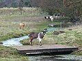 Goat on a bridge near Send, Surrey - geograph.org.uk - 701169.jpg 640 × 480; 102 KB
-
 Heath Drive - Send - geograph.org.uk - 5981269.jpg 1,306 × 811; 311 KB
-
 House at Worsfold Flood Gates - geograph.org.uk - 949208.jpg 640 × 427; 191 KB
-
 House on Tannery Lane - geograph.org.uk - 5980363.jpg 1,354 × 923; 320 KB
-
 Houses on A247 Cartbridge - geograph.org.uk - 2296701.jpg 1,600 × 1,200; 656 KB
-
 Houses on Potters Lane - geograph.org.uk - 6246722.jpg 1,024 × 768; 193 KB
-
 Houses on Potters Lane - geograph.org.uk - 6246729.jpg 1,024 × 768; 180 KB
-
 Houses on Send Marsh Road - geograph.org.uk - 4193653.jpg 2,304 × 1,728; 823 KB
-
 Industrial Heritage near Cartbridge - geograph.org.uk - 1047452.jpg 640 × 480; 84 KB
-

-
 Industrial units, River Wey navigation - geograph.org.uk - 3442989.jpg 1,968 × 1,533; 1.03 MB
-

-

-
 Kevan Drive, Burntcommon - geograph.org.uk - 3463482.jpg 2,013 × 1,510; 561 KB
-
 Lamppost in Portsmouth Road - geograph.org.uk - 2648360.jpg 640 × 480; 72 KB
-
 Lancaster Hall, Send - geograph.org.uk - 2980779.jpg 800 × 600; 84 KB
-
 Lane by Papercourt Farm - geograph.org.uk - 962641.jpg 640 × 480; 146 KB
-
 Larch cones - geograph.org.uk - 3426809.jpg 768 × 1,024; 202 KB
-
 Larch plantation near Whitehouse Farm - geograph.org.uk - 3426800.jpg 1,024 × 768; 181 KB
-
 Large flat field - geograph.org.uk - 3459060.jpg 2,048 × 1,536; 1.44 MB
-
 Leaf Litter - geograph.org.uk - 1047364.jpg 640 × 480; 87 KB
-
 Little Owl Pre-School next to Lancaster Hall - geograph.org.uk - 5981279.jpg 1,319 × 908; 323 KB
-
 Little Stanyard Farm - geograph.org.uk - 3267644.jpg 2,048 × 1,536; 2.61 MB
-
 Lock keeper's cottage, Papercourt Lock - geograph.org.uk - 3398737.jpg 2,048 × 1,536; 577 KB
-
 Lock keeper's House, Papercourt Lock - geograph.org.uk - 3629651.jpg 640 × 430; 71 KB
-

-
-
 Lock-keeper's cottage, Papercourt Lock - geograph.org.uk - 3443258.jpg 2,048 × 1,536; 1.62 MB
-
 London Road, Burntcommon - geograph.org.uk - 3463491.jpg 2,048 × 1,536; 1.46 MB
-

-

-

-

-

-

-

-
-
-

-
 Maple Road, Send Marsh - geograph.org.uk - 2296408.jpg 1,600 × 1,200; 592 KB
-
 Maple Road, Send Marsh - geograph.org.uk - 2296417.jpg 1,600 × 1,200; 605 KB
-
 Meadow Below Broadoak Bridge - geograph.org.uk - 2904922.jpg 4,288 × 3,216; 3.56 MB
-
 Medieval moated site, Send - geograph.org.uk - 3463443.jpg 2,048 × 1,536; 1.62 MB
-
 Mid section of Send Barns Lane - geograph.org.uk - 2648835.jpg 640 × 480; 114 KB
-
 Moat near Send - geograph.org.uk - 3463434.jpg 2,048 × 1,536; 1.56 MB
-
 Moored boats at Cartbridge - geograph.org.uk - 3544766.jpg 640 × 427; 110 KB
-
 Moored boats, Wey Navigation - geograph.org.uk - 6244620.jpg 1,024 × 768; 598 KB
-
 Narrowboat Bramshott. Wey Navigation Send Surrey UK.jpg 1,134 × 756; 59 KB
-

-
 Narrowboat On Wey Navigation Send Surrey UK.jpg 1,134 × 755; 77 KB
-
 Near Papercourt Lock - geograph.org.uk - 3443735.jpg 2,048 × 1,536; 1.35 MB
-
 Nutbourne Fruit Farm - geograph.org.uk - 130525.jpg 640 × 480; 95 KB
-
 Oldlands Copse - geograph.org.uk - 1001410.jpg 480 × 640; 160 KB
-
 Open sky Papercourt lock - geograph.org.uk - 2171633.jpg 3,008 × 2,000; 1.2 MB
-
 Orchard Way, Send - geograph.org.uk - 5571480.jpg 800 × 600; 115 KB
-
 Overgrown field near Prews Farm - geograph.org.uk - 3544512.jpg 640 × 427; 84 KB
-
 Papercourt lake, Send, angling.jpg 3,000 × 2,250; 1.39 MB
-
 Papercourt Lock - geograph.org.uk - 3629655.jpg 640 × 430; 78 KB
-
 Papercourt Lock Cottage - geograph.org.uk - 6344664.jpg 1,024 × 768; 355 KB
-
 Papercourt Meadows in November - geograph.org.uk - 5194433.jpg 1,024 × 816; 239 KB
-
 Path between the Send Heath Ponds - geograph.org.uk - 4319050.jpg 1,944 × 2,592; 1.11 MB
-

-

-
 Pavement in Portsmouth Road - geograph.org.uk - 2648899.jpg 640 × 480; 126 KB
-
 Petrol station, Burntcommon - geograph.org.uk - 2387100.jpg 4,320 × 3,240; 4.27 MB
-
 Playground, Maple Road, Send Marsh - geograph.org.uk - 2043665.jpg 3,072 × 2,304; 4.4 MB
-
 Playing Field, Send - geograph.org.uk - 3459038.jpg 2,048 × 1,536; 1.35 MB
-
 Polesden Lane, Send Marsh - geograph.org.uk - 2296399.jpg 1,600 × 1,200; 517 KB
-
 Polesden Lane, Send Marsh - geograph.org.uk - 3443063.jpg 2,048 × 1,536; 1.32 MB
-
 Prews Farm - geograph.org.uk - 3443069.jpg 2,048 × 1,536; 1.4 MB
-
 Prews Farm track - geograph.org.uk - 3443085.jpg 2,048 × 1,536; 1.82 MB
-

-
 Recreation Ground, Send - geograph.org.uk - 702563.jpg 640 × 480; 97 KB
-
 Relic of the old days - geograph.org.uk - 60552.jpg 427 × 640; 134 KB
-
 Ripley exit on the A3 - geograph.org.uk - 2576136.jpg 1,600 × 1,200; 522 KB
-
 River Wey - geograph.org.uk - 2854479.jpg 640 × 480; 99 KB
-
 River Wey - geograph.org.uk - 3267650.jpg 2,048 × 1,536; 3.01 MB
-
 River Wey - geograph.org.uk - 6245618.jpg 1,024 × 768; 396 KB
-
 River Wey above Worsfold Gates - geograph.org.uk - 6244773.jpg 1,024 × 768; 345 KB
-
 River Wey Navigation - geograph.org.uk - 2850263.jpg 2,048 × 1,536; 1.44 MB
-
 River Wey Navigation - geograph.org.uk - 3276770.jpg 2,048 × 1,536; 3.35 MB
-
 River Wey Navigation - geograph.org.uk - 3445214.jpg 2,010 × 1,507; 1.22 MB


_-_geograph.org.uk_-_4347132.jpg)


_-_geograph.org.uk_-_2648720.jpg)
_-_geograph.org.uk_-_2648775.jpg)
_-_geograph.org.uk_-_2648779.jpg)
_-_geograph.org.uk_-_2648781.jpg)
_-_geograph.org.uk_-_2648725.jpg)
_-_geograph.org.uk_-_2648727.jpg)
_-_geograph.org.uk_-_2648731.jpg)
_-_geograph.org.uk_-_2648744.jpg)
_-_geograph.org.uk_-_2648746.jpg)
_-_geograph.org.uk_-_2648755.jpg)
_-_geograph.org.uk_-_2648762.jpg)
_-_geograph.org.uk_-_2648766.jpg)


,_Burntcommon_-_geograph.org.uk_-_4434760.jpg)
.jpg)


