Category:Sender Gera-Ronneburg
| Object location | | View all coordinates using: OpenStreetMap |
|---|
 | |||||
| Upload media | |||||
| Instance of | |||||
|---|---|---|---|---|---|
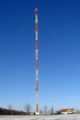
| Location | Rückersdorf, Greiz, Thuringia, Germany | ||||
| Owned by | |||||
| Height |
| ||||
 | |||||
Media in category "Sender Gera-Ronneburg"
This category contains only the following file.
-
 Sender Ronneburg.png 2,000 × 3,008; 8.19 MB