Category:Sentiero 4 Piamuro - Monti di Madri
|
Sentiero 4 Piamuro - Monti di Madri has an entry on OpenStreetMap (show). |
Subcategories
This category has the following 8 subcategories, out of 8 total.
Media in category "Sentiero 4 Piamuro - Monti di Madri"
The following 40 files are in this category, out of 40 total.
-
 Beginning at Mulino Carliseppi of path towards Monti di Madri.jpg 3,451 × 2,651; 6.48 MB
-
 Beginning in Monti di Madri of path 4 towards Mulino Chioderia.jpg 2,736 × 3,648; 7.51 MB
-
 Branching of path 4a to Barna and 4 to Sass Corbee.jpg 2,736 × 3,648; 7.94 MB
-
 End of Via Molini.jpg 6,008 × 2,605; 10.33 MB
-
 Guidepost between Sass Corbee and Monti di Madri.jpg 1,423 × 2,077; 1.89 MB
-
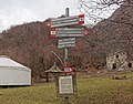 Guidepost Monti di Madri 570 and information board.jpg 2,816 × 2,202; 2.84 MB
-
 Guidepost Monti di Madri 570.jpg 2,695 × 2,597; 2.24 MB
-
 Information board on limekiln between Sass Corbee and Monti di Madri.jpg 1,296 × 1,532; 913 KB
-
 Last housenumber of Via Molini.jpg 2,115 × 1,544; 1.05 MB
-
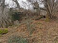
 Limekiln, between Sass Corbee and Monti di Madri.jpg 5,120 × 3,840; 9.66 MB
-
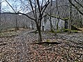
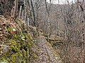
 Path 4 between junction with path 4a from Barna and Monti di Madri 01.jpg 2,736 × 3,648; 6.98 MB
-
 Path 4 between junction with path 4a from Barna and Monti di Madri 02.jpg 3,648 × 2,736; 7.2 MB
-
 Path 4 between junction with path 4a from Barna and Monti di Madri 03.jpg 3,648 × 2,736; 6.89 MB
-
 Path 4 between junction with path 4a from Barna and Monti di Madri 04.jpg 3,648 × 2,736; 7.54 MB
-
 Path 4 between junction with path 4a from Barna and Monti di Madri 05.jpg 3,648 × 2,736; 7.34 MB
-
 Path 4 between junction with path 4a from Barna and Monti di Madri 06.jpg 5,120 × 3,840; 11.45 MB
-
 Path 4 between junction with path 4a from Barna and Monti di Madri 07.jpg 5,120 × 3,840; 10.43 MB
-
 Path 4 between junction with path 4a from Barna and Monti di Madri 08.jpg 2,736 × 3,648; 6.23 MB
-
 Path 4 between junction with path 4a from Barna and Monti di Madri 09.jpg 5,120 × 3,840; 9.07 MB
-
 Path 4 between junction with path 4a from Barna and Monti di Madri 10.jpg 3,648 × 2,736; 7.13 MB
-
 Path 4 between junction with path 4a from Barna and Monti di Madri 11.jpg 3,648 × 2,736; 7.27 MB
-
 Path 4 between junction with path 4a from Barna and Monti di Madri 12.jpg 3,648 × 2,736; 7.25 MB
-
 Path 4 between junction with path 4a from Barna and Monti di Madri 13.jpg 3,648 × 2,736; 7.41 MB
-
 Path 4 between junction with path 4a from Barna and Monti di Madri 14.jpg 3,648 × 2,736; 7.14 MB
-
 Path 4 between junction with path 4a from Barna and Monti di Madri 15.jpg 5,120 × 3,840; 12.08 MB
-
 Path 4 between junction with path 4a from Barna and Monti di Madri 16.jpg 5,120 × 3,840; 12.41 MB
-
 Path 4 between junction with path 4a from Barna and Monti di Madri 17.jpg 4,276 × 2,047; 7.42 MB
-
 Path 4 between junction with path 4a from Barna and Monti di Madri 18.jpg 2,736 × 3,648; 5.59 MB
-
 Path 4 between junction with path 4a from Barna and Monti di Madri 19.jpg 3,648 × 2,736; 7.1 MB
-
 Path 4 towards Mulino Carliseppi, just upstream of Sass Corbee.jpg 3,840 × 5,120; 9.96 MB
-
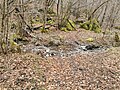
 Path 4 towards Sass Corbee and limekiln.jpg 3,204 × 2,240; 4.92 MB
-
 Path 4a from Barna ends on path 4 between Sass Corbee and Monti di Madri.jpg 5,120 × 3,840; 11.59 MB
-
 Path number 4 between.jpg 3,648 × 2,736; 6.8 MB
-
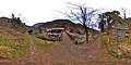 Photosphere at Mulino Carliseppi.jpg 5,376 × 2,688; 5.51 MB
-
 Photosphere in front of a limekiln, between Sass Corbee and Monti di Madri.jpg 5,322 × 2,661; 5.99 MB
-
 Photosphere of steps to climb on top of Sass Corbee 01.jpg 5,376 × 2,688; 4.09 MB
-
 Photosphere of steps to climb on top of Sass Corbee 02.jpg 5,376 × 2,688; 3.88 MB
-
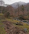 Pic-nic table along the path to Sass Corbee.jpg 2,365 × 2,774; 4.3 MB
-
 Steep steps to descend from the top of Sass Corbee.jpg 2,736 × 3,648; 7.01 MB
-
 Steps ad the side of Sass Corbee.jpg 3,840 × 5,120; 10.82 MB


