Category:September 2007 in County Down
English: Images taken in County Down, Northern Ireland in this month of 2007 (not the date of the upload).
| Jan | Feb | Mar | Apr | May | Jun | Jul | Aug | Sep | Oct | Nov | Dec | ||
| ← | 32 | 14 | 70 | 47 | 139 | 43 | 36 | 57 | 72 | 42 | 38 | 30 | → |
|---|
Subcategories
This category has only the following subcategory.
Media in category "September 2007 in County Down"
The following 71 files are in this category, out of 71 total.
-
 (Green) leaf - geograph.org.uk - 567872.jpg 640 × 426; 80 KB
-
 A railway bridge - geograph.org.uk - 566537.jpg 640 × 426; 116 KB
-
 A railway bridge - geograph.org.uk - 566539.jpg 640 × 415; 110 KB
-
 Aghnatrisk.jpg 2,592 × 1,944; 843 KB
-
 Annaclone Presbyterian Church - geograph.org.uk - 551504.jpg 640 × 480; 112 KB
-
 Annaghanoon Road, Waringstown. - geograph.org.uk - 567676.jpg 640 × 480; 85 KB
-
 Ballykelly Road, Banbridge. - geograph.org.uk - 567714.jpg 640 × 480; 90 KB
-
 Berries, Hillsborough - geograph.org.uk - 549888.jpg 640 × 415; 95 KB
-
 Bridge, Newcastle - geograph.org.uk - 562167.jpg 640 × 426; 96 KB
-
 Carnalroe Lane near Leitrim - geograph.org.uk - 562381.jpg 640 × 426; 122 KB
-
 Castlewellan Castle - geograph.org.uk - 550486.jpg 640 × 360; 86 KB
-
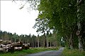
 Castlewellan forest park (1) - geograph.org.uk - 550498.jpg 640 × 426; 104 KB
-
 Castlewellan forest park (2) - geograph.org.uk - 550513.jpg 640 × 426; 131 KB
-
 Castlewellan forest park (3) - geograph.org.uk - 550528.jpg 640 × 426; 114 KB
-
 Castlewellan forest park (4) - geograph.org.uk - 550545.jpg 640 × 426; 89 KB
-
 Castlewellan forest park (5) - geograph.org.uk - 550561.jpg 640 × 426; 129 KB
-
 Castlewellan forest park (6) - geograph.org.uk - 550571.jpg 640 × 426; 123 KB
-
 Castlewellan forest park (7) - geograph.org.uk - 550582.jpg 640 × 426; 133 KB
-
 Christ Church, Annaclone. - geograph.org.uk - 551507.jpg 640 × 480; 98 KB
-

-
 Countryside near Moneyslane - geograph.org.uk - 550452.jpg 640 × 426; 80 KB
-
 Derrylough Hill near Banbridge - geograph.org.uk - 547151.jpg 640 × 426; 126 KB
-
 Doyle's Road near Katesbridge - geograph.org.uk - 543545.jpg 640 × 426; 124 KB
-
 Fallen tree - geograph.org.uk - 549849.jpg 640 × 426; 115 KB
-

-
 Fernhill Road - geograph.org.uk - 567226.jpg 640 × 480; 77 KB
-
 Footbridge, Newcastle - geograph.org.uk - 562161.jpg 640 × 426; 83 KB
-
 Footpath near Katesbridge - geograph.org.uk - 543595.jpg 640 × 426; 109 KB
-
 Full flow - geograph.org.uk - 781111.jpg 640 × 480; 103 KB
-
 Fungus (2) - geograph.org.uk - 550616.jpg 640 × 426; 78 KB
-
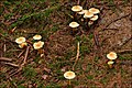
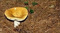 Fungus 1-07 - geograph.org.uk - 549700.jpg 640 × 354; 95 KB
-
 Fungus 2-07 - geograph.org.uk - 549723.jpg 640 × 396; 100 KB
-
 Fungus 3-07 - geograph.org.uk - 549799.jpg 640 × 347; 100 KB
-
 Fungus 4-07 - geograph.org.uk - 549834.jpg 640 × 420; 93 KB
-
 Fungus 5-07 - geograph.org.uk - 566333.jpg 640 × 426; 143 KB
-
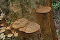 Fungus, Huntly, Banbridge (1) - geograph.org.uk - 554671.jpg 640 × 426; 108 KB
-
 Fungus, Huntly, Banbridge (2) - geograph.org.uk - 554681.jpg 640 × 427; 103 KB
-
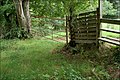 Gate and stile near Banbridge - geograph.org.uk - 549394.jpg 640 × 426; 124 KB
-
 Growell Gospel Hall - geograph.org.uk - 551630.jpg 640 × 480; 70 KB
-
 Hillsborough Fort, Co Down (2) - geograph.org.uk - 566342.jpg 595 × 640; 98 KB
-
 Hillsborough masonic hall - geograph.org.uk - 554551.jpg 640 × 426; 109 KB
-
 Iveagh Road-Fernhill road junction - geograph.org.uk - 551491.jpg 640 × 480; 105 KB
-

-
 Kearney near Portaferry (1) - geograph.org.uk - 562883.jpg 625 × 412; 106 KB
-
 Kearney near Portaferry (4) - geograph.org.uk - 562915.jpg 632 × 418; 123 KB
-
 Kesh Road at Aghnatrisk - geograph.org.uk - 1387318.jpg 640 × 480; 97 KB
-
 Laird's Road near Katesbridge - geograph.org.uk - 543576.jpg 640 × 424; 99 KB
-
 Lane near Katesbridge - geograph.org.uk - 549482.jpg 640 × 426; 106 KB
-
 Law's Lane, Banbridge - geograph.org.uk - 549360.jpg 640 × 426; 140 KB
-
 Mays Corner road (B10) - geograph.org.uk - 551494.jpg 640 × 480; 91 KB
-
 Moorhen and swan - geograph.org.uk - 549873.jpg 640 × 426; 104 KB
-
 Nendrum Monastery 1.jpg 2,304 × 1,728; 1.68 MB
-
 New Line, Waringstown. - geograph.org.uk - 567682.jpg 640 × 480; 110 KB
-
 New passenger shelter - geograph.org.uk - 566535.jpg 640 × 426; 141 KB
-
 St Malachi's church, Hillsborough (7) - geograph.org.uk - 554485.jpg 640 × 426; 107 KB
-
 St. Colman's Church - geograph.org.uk - 567215.jpg 640 × 480; 97 KB
-
 Stormin' the Holywood Bank - geograph.org.uk - 564882.jpg 640 × 394; 88 KB
-
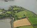
 Stubble field near Kearney (1) - geograph.org.uk - 562981.jpg 630 × 347; 50 KB
-
 The Banbridge - Castlewellan road (7) - geograph.org.uk - 543674.jpg 640 × 426; 84 KB
-

-
 The Circular Road near Banbridge - geograph.org.uk - 560597.jpg 640 × 426; 83 KB
-
 The Corbet Road near Banbridge (2) - geograph.org.uk - 560619.jpg 640 × 426; 106 KB
-
 The Drone Hill Road near Banbridge - geograph.org.uk - 558458.jpg 640 × 426; 85 KB
-
 The Drumbuck Road near Castlewellan - geograph.org.uk - 562329.jpg 640 × 375; 73 KB
-
 The Drumbuck Road, Castlewellan - geograph.org.uk - 562301.jpg 640 × 426; 92 KB
-
 The Newcastle Road near Portaferry - geograph.org.uk - 562855.jpg 640 × 426; 102 KB
-
 The Sentry Box Road near Banbridge - geograph.org.uk - 547127.jpg 640 × 426; 70 KB
-
 The Shore Road, Ballyhalbert - geograph.org.uk - 562803.jpg 640 × 426; 85 KB
-
 The sun on Carlingford Lough - geograph.org.uk - 1216299.jpg 640 × 480; 75 KB
-
 Tollymore forest park near Newcastle - geograph.org.uk - 569094.jpg 640 × 426; 93 KB
-
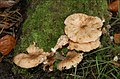
 Wood mushroom - geograph.org.uk - 553581.jpg 640 × 539; 88 KB
_leaf_-_geograph.org.uk_-_567872.jpg)


_-_geograph.org.uk_-_550498.jpg)
_-_geograph.org.uk_-_550513.jpg)
_-_geograph.org.uk_-_550528.jpg)
_-_geograph.org.uk_-_550545.jpg)
_-_geograph.org.uk_-_550561.jpg)
_-_geograph.org.uk_-_550571.jpg)
_-_geograph.org.uk_-_550582.jpg)


_-_geograph.org.uk_-_550616.jpg)


_-_geograph.org.uk_-_554671.jpg)
_-_geograph.org.uk_-_554681.jpg)


_-_geograph.org.uk_-_566342.jpg)


_-_geograph.org.uk_-_562883.jpg)
_-_geograph.org.uk_-_562915.jpg)


_-_geograph.org.uk_-_551494.jpg)


_-_geograph.org.uk_-_554485.jpg)


_-_geograph.org.uk_-_562981.jpg)
_-_geograph.org.uk_-_543674.jpg)
_-_geograph.org.uk_-_543452.jpg)

_-_geograph.org.uk_-_560619.jpg)


