Category:September 2008 in Leeds
Subcategories
This category has only the following subcategory.
Media in category "September 2008 in Leeds"
The following 65 files are in this category, out of 65 total.
-
 Aire Street, Leeds - geograph.org.uk - 983421.jpg 640 × 480; 85 KB
-
 Albion Street - Clifford - geograph.org.uk - 949960.jpg 640 × 481; 227 KB
-
 Allotments - Green Lane - geograph.org.uk - 962140.jpg 640 × 430; 196 KB
-
 Barton Terrace - Barton Road - geograph.org.uk - 962840.jpg 640 × 485; 196 KB
-
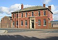
 Boston Spa Post Office - High Street - geograph.org.uk - 958633.jpg 430 × 640; 187 KB
-
 Bridge Garth - Boston Road, Clifford - geograph.org.uk - 949944.jpg 640 × 412; 188 KB
-
 Burton House - Burton Avenue - geograph.org.uk - 963970.jpg 640 × 483; 284 KB
-
 Butterley Street - Leathley Road - geograph.org.uk - 986078.jpg 640 × 426; 196 KB
-
 Clifford Fisheries - Albion Street - geograph.org.uk - 949963.jpg 640 × 511; 285 KB
-
-

-
 Cross Green 1.jpg 1,600 × 771; 159 KB
-
 Drop off chaos - geograph.org.uk - 985486.jpg 640 × 480; 63 KB
-
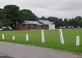
 Football Pitches - Temple Newsam Road - geograph.org.uk - 961984.jpg 640 × 389; 138 KB
-

-
-
 Gas Holder - Cross Myrtle Street - geograph.org.uk - 986172.jpg 640 × 503; 203 KB
-
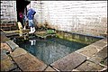 Gipton spa bath - geograph.org.uk - 1018332.jpg 640 × 426; 102 KB
-
 Gipton spa bath - geograph.org.uk - 1018336.jpg 640 × 426; 126 KB
-
 Grocer's Cottage - High Street, Clifford - geograph.org.uk - 949904.jpg 640 × 573; 258 KB
-
 Halton Post Office - Pinfold Lane - geograph.org.uk - 962148.jpg 640 × 511; 227 KB
-

-
 High Street - Clifford - geograph.org.uk - 949898.jpg 640 × 494; 205 KB
-

-
 Jack Lane - geograph.org.uk - 986089.jpg 640 × 473; 215 KB
-
 Joseph Priestley College - Primrose Lane - geograph.org.uk - 963959.jpg 640 × 414; 143 KB
-

-
 Leeds Bradford airport terminal - geograph.org.uk - 985485.jpg 640 × 480; 95 KB
-
 Leeds Methodist Mission - Oxford Place - geograph.org.uk - 974696.jpg 480 × 640; 218 KB
-
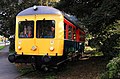 Leeds Middleton railway - geograph.org.uk - 1018379.jpg 620 × 406; 91 KB
-
 Leeds Middleton railway - geograph.org.uk - 1018397.jpg 633 × 418; 87 KB
-
 Linden Terrace - Linden Avenue - geograph.org.uk - 963989.jpg 640 × 473; 230 KB
-
 Longroyd Terrace - off Burton Road - geograph.org.uk - 963979.jpg 640 × 480; 183 KB
-

-

-
 Meanwood donkey 2008.jpg 3,264 × 2,448; 4.15 MB
-
 Meanwood Farm Pig.jpg 3,264 × 2,448; 3.6 MB
-

-
 Middleton railway - geograph.org.uk - 1018373.jpg 624 × 406; 92 KB
-
 Monarch House, Queen Street, Leeds - geograph.org.uk - 983413.jpg 450 × 600; 106 KB
-
 Mount St Mary`s church - geograph.org.uk - 986164.jpg 640 × 480; 105 KB
-

-

-
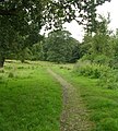
 Nursery Way - Clifford - geograph.org.uk - 949956.jpg 640 × 459; 193 KB
-
 Park Farm - Park Road, Colton - geograph.org.uk - 961435.jpg 640 × 451; 200 KB
-
 Park Road - Colton - geograph.org.uk - 961432.jpg 640 × 468; 254 KB
-
 Park Road Farm - Colton - geograph.org.uk - 961429.jpg 640 × 480; 242 KB
-
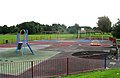 Playground - Burton Row - geograph.org.uk - 963951.jpg 640 × 417; 181 KB
-
 Police Station - Belle Vue Road - geograph.org.uk - 974650.jpg 640 × 427; 236 KB
-
 Sarah Ferguson in Leeds 2008 (1).jpg 1,100 × 1,467; 664 KB
-
 Sarah Ferguson in Leeds 2008.jpg 1,105 × 1,690; 730 KB
-

-

-

-

-
 St Luke's Church - Bramham Road, Clifford - geograph.org.uk - 949877.jpg 640 × 471; 234 KB
-

-

-
 Tetley's Brewery - from Black Bull Street - geograph.org.uk - 986071.jpg 640 × 498; 189 KB
-
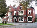
 The Albion - Boston Road. Clifford - geograph.org.uk - 949932.jpg 640 × 450; 186 KB
-

-
 The Blooming Rose Inn - Burton Row - geograph.org.uk - 963952.jpg 640 × 483; 315 KB
-
 The Hunslet Engine Co - Jack Lane - geograph.org.uk - 986098.jpg 640 × 442; 222 KB
-
 The Leodis - Cross Green Lane - geograph.org.uk - 962141.jpg 640 × 419; 193 KB
-
 Wellesley Hotel, or City Central - geograph.org.uk - 983475.jpg 640 × 480; 82 KB


.jpg)


