Category:Seregélyes
| Object location | | View all coordinates using: OpenStreetMap |
|---|
village in Hungary    | |||||
| Upload media | |||||
| Instance of |
| ||||
|---|---|---|---|---|---|
| Location | Székesfehérvár District, Fejér County, Hungary | ||||
| Head of government |
| ||||
| Population |
| ||||
| Area |
| ||||
| official website | |||||
 | |||||
Subcategories
This category has the following 11 subcategories, out of 11 total.
C
E
G
P
- Plaques in Seregélyes (2 F)
R
S
- Seregélyes railway station (66 F)
- Sárosd–Seregélyes vízfolyás (4 F)
W
Z
- Zichy mansion in Seregélyes (57 F)
Media in category "Seregélyes"
The following 23 files are in this category, out of 23 total.
-
 Blason ville hu SEREGÉLYES.svg 512 × 563; 21 KB
-
 Flag of Seregélyes (ceremonial).svg 1,200 × 600; 88 KB
-
 Flag of Seregélyes (vertical).svg 600 × 1,200; 82 KB
-
 Flag of Seregélyes.svg 1,200 × 600; 82 KB
-
 HUN Seregélyes COA.jpg 2,000 × 2,828; 563 KB
-
 HUN Seregélyes Címer.svg 613 × 850; 159 KB
-
 Seregelyes rovastabla.png 120 × 40; 7 KB
-
 Seregélyes – Fortuna Pizzéria.jpg 1,600 × 1,200; 576 KB
-
 Seregélyes – Labdarúgó-pálya bejárat.jpg 1,577 × 1,170; 646 KB
-
 Seregélyes – Labdarúgó-pálya.jpg 1,549 × 1,133; 499 KB
-
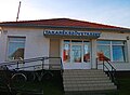
 Seregélyes – Magyar Posta.jpg 1,600 × 1,200; 794 KB
-
 Seregélyes – Melódia Cukrázda.jpg 1,587 × 1,184; 915 KB
-
 Seregélyes – Második világháborús emlékmű.jpg 1,200 × 1,600; 695 KB
-
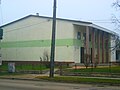 Seregélyes – Művelődési ház.jpg 1,600 × 1,200; 802 KB
-
 Seregélyes – Seregélyesi Pékség.jpg 1,600 × 1,200; 578 KB
-
 Seregélyes – Takarékszövetkezet.jpg 1,553 × 1,136; 637 KB
-
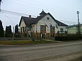 Seregélyes – Town hall.jpg 1,600 × 1,200; 710 KB
-
 Seregélyes – Trianoni emlékmű.jpg 1,600 × 1,200; 801 KB
-
 Seregélyes-első-katonai-felmérés-térképe.jpg 838 × 680; 198 KB
-
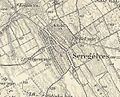 Seregélyes-harmadik-katonai-felmérés-térképe.jpg 841 × 679; 220 KB
-
 Seregélyes-második-katonai-felmérés-térképe.jpg 863 × 706; 286 KB
-
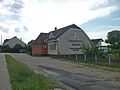 Seregélyesi Pékség, Seregélyes 01.jpg 1,600 × 1,200; 987 KB
-
 Seregélyesi Pékség, Seregélyes 02.jpg 1,200 × 1,600; 1.05 MB

.svg)
.svg)


