Category:Settrington
village and civil parish in North Yorkshire, United Kingdom  | |||||
| Upload media | |||||
| Instance of | |||||
|---|---|---|---|---|---|
| Location | Ryedale, North Yorkshire, Yorkshire and the Humber, England | ||||
| Population |
| ||||
 | |||||
English: Settrington is a village and civil parish in the Ryedale district of North Yorkshire, England. It once had a railway station that lay on the Malton and Driffield Railway.
Subcategories
This category has the following 2 subcategories, out of 2 total.
A
S
Media in category "Settrington"
The following 200 files are in this category, out of 336 total.
(previous page) (next page)-
 A64 near Brambling Fields - geograph.org.uk - 3482545.jpg 640 × 427; 80 KB
-
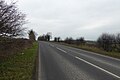
 A64 westbound towards Malton - geograph.org.uk - 1964490.jpg 640 × 480; 51 KB
-
 Access road from Kirk Hill over Settrington Beck - geograph.org.uk - 4146345.jpg 3,456 × 4,608; 5.83 MB
-
 Across a Cornfield to Keepers Cottage - geograph.org.uk - 2549997.jpg 3,264 × 2,448; 1.86 MB
-
 Across Beverley Road - geograph.org.uk - 6523259.jpg 1,024 × 683; 458 KB
-
 All Saints, Settrington - geograph.org.uk - 5074643.jpg 3,111 × 4,149; 2.45 MB
-
 Along Langton Lane - geograph.org.uk - 6523235.jpg 1,024 × 683; 683 KB
-
 Approaching Brambling Fields - geograph.org.uk - 3482541.jpg 640 × 427; 80 KB
-
 Approaching Brambling Fields - geograph.org.uk - 6853749.jpg 1,024 × 683; 449 KB
-
 Around Town Wold - geograph.org.uk - 1376576.jpg 640 × 480; 73 KB
-
 At the edge of the Wolds - geograph.org.uk - 2406065.jpg 3,938 × 2,220; 1.79 MB
-
 B1248 towards North Grimston - geograph.org.uk - 1999250.jpg 640 × 479; 83 KB
-
 Back Lane - geograph.org.uk - 3482681.jpg 640 × 427; 120 KB
-
 Back Lane - geograph.org.uk - 6854053.jpg 1,024 × 830; 662 KB
-
 Barley beside Langton Lane - geograph.org.uk - 6523249.jpg 1,024 × 683; 511 KB
-
 Barley beside the railway trackbed - geograph.org.uk - 6523222.jpg 1,024 × 683; 487 KB
-
 Barns on the Centenary Way - geograph.org.uk - 2550024.jpg 3,264 × 2,448; 2.17 MB
-
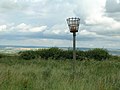
 Beacon above Settrington - geograph.org.uk - 5427603.jpg 640 × 427; 240 KB
-
 Beacon off High Street - geograph.org.uk - 1964154.jpg 640 × 480; 64 KB
-
 Beacon Wold plantation - geograph.org.uk - 5309011.jpg 427 × 640; 281 KB
-
 Bean field near Settrington Beacon - geograph.org.uk - 4498063.jpg 1,024 × 768; 167 KB
-
 Bellmanear Farm - geograph.org.uk - 5065877.jpg 4,320 × 2,538; 1.97 MB
-
 Bellmanear Farm near North Grimston - geograph.org.uk - 2622473.jpg 800 × 600; 318 KB
-
 Bellmanear Farm over Settrington Beck - geograph.org.uk - 4693016.jpg 4,606 × 3,452; 5.45 MB
-
 Beverley Road - geograph.org.uk - 5309102.jpg 640 × 427; 207 KB
-
 Black and white signpost, Settrington - geograph.org.uk - 2844491.jpg 1,024 × 679; 222 KB
-
 Blackening Wax-cap (Hygrocybe nigrescens) - geograph.org.uk - 4692975.jpg 1,353 × 1,926; 1.46 MB
-
 Brambling Fields - geograph.org.uk - 6522988.jpg 1,024 × 683; 461 KB
-
 Brambling Fields junction - geograph.org.uk - 3959772.jpg 800 × 546; 186 KB
-
 Brambling Fields Lane - geograph.org.uk - 6128987.jpg 1,024 × 768; 247 KB
-
 Brambling Fields Lane heading north - geograph.org.uk - 1964252.jpg 640 × 480; 70 KB
-

-
 Buttercups on the Centenary Way - geograph.org.uk - 5777878.jpg 4,608 × 3,456; 7.65 MB
-
 Can Red Campion be harvested^ - geograph.org.uk - 5777868.jpg 4,588 × 3,430; 5.25 MB
-
 Cattle grid, Rabbit Slack and Wood House Farm - geograph.org.uk - 4498898.jpg 1,024 × 768; 167 KB
-
 Centenary Way approaching Kirk Hill - geograph.org.uk - 5065874.jpg 4,161 × 3,121; 3.52 MB
-
 Centenary Way footpath - geograph.org.uk - 3620991.jpg 1,024 × 706; 683 KB
-

-
 Centenary Way goes left of Bellmanear Farm - geograph.org.uk - 4146329.jpg 4,608 × 3,456; 4.8 MB
-
 Centenary Way near Settrington - geograph.org.uk - 6128981.jpg 1,024 × 768; 240 KB
-

-
 Change in direction - geograph.org.uk - 4498059.jpg 1,024 × 768; 168 KB
-
 Chapel Road, Settrington - geograph.org.uk - 2845817.jpg 768 × 1,024; 295 KB
-
 Church Lane, Settrington - geograph.org.uk - 2854003.jpg 1,024 × 743; 377 KB
-
 Cottages by the beck in Settrington - geograph.org.uk - 5065863.jpg 4,320 × 3,240; 3.84 MB
-
 Cottages on Town Street - geograph.org.uk - 6523218.jpg 1,024 × 683; 528 KB
-
 Crop land at Bellmanear Farm - geograph.org.uk - 5065880.jpg 4,157 × 2,235; 1.44 MB
-
 Dead tree near North Grimston - geograph.org.uk - 5378511.jpg 488 × 640; 430 KB
-
 Descent into Settrington - geograph.org.uk - 5309088.jpg 640 × 427; 180 KB
-
 Descent towards Settrington - geograph.org.uk - 5309093.jpg 427 × 640; 243 KB
-
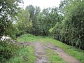 Dismantled Railway - geograph.org.uk - 2518677.jpg 3,264 × 2,448; 3.02 MB
-
 Dismantled railway - geograph.org.uk - 3627063.jpg 1,024 × 768; 1.03 MB
-

-

-
 Down Doodale Hill - geograph.org.uk - 6523253.jpg 1,024 × 683; 655 KB
-
 Down the hill into Settrington - geograph.org.uk - 6058655.jpg 1,024 × 768; 248 KB
-
 Drive to Bellmanear Farm - geograph.org.uk - 3482702.jpg 640 × 427; 102 KB
-
 Elderberries in the hedgerow and lichen covered dead branch - geograph.org.uk - 4693005.jpg 2,303 × 3,072; 4.33 MB
-
 Embankment of dismantled railway - geograph.org.uk - 2844460.jpg 1,024 × 768; 451 KB
-
 Entering Settrington Wood - geograph.org.uk - 2621074.jpg 800 × 600; 415 KB
-
 Entrance to Settrington House - geograph.org.uk - 6058659.jpg 1,024 × 768; 287 KB
-
 Family gathering - geograph.org.uk - 4498904.jpg 1,024 × 768; 162 KB
-
 Farm Buildings, Sparrow Hall - geograph.org.uk - 1964267.jpg 640 × 480; 76 KB
-
 Farm reflected in the pond - geograph.org.uk - 4692952.jpg 4,516 × 3,330; 5.06 MB
-
 Farm Track on a Wet Day - geograph.org.uk - 2518683.jpg 3,264 × 2,448; 1.87 MB
-
 Farmland beside the A64 - geograph.org.uk - 6522989.jpg 1,024 × 683; 542 KB
-

-
 Farmland from the Settrington road - geograph.org.uk - 5309094.jpg 640 × 427; 213 KB
-
 Farmland in Town Wold - geograph.org.uk - 5309092.jpg 640 × 427; 219 KB
-

-

-
 Farmland near High Bellmanear - geograph.org.uk - 5309007.jpg 640 × 427; 209 KB
-
 Farmland near High Bellmanear Farm - geograph.org.uk - 1964068.jpg 640 × 480; 99 KB
-
 Farmland near Kirk Hill - geograph.org.uk - 1964210.jpg 640 × 480; 56 KB
-
 Farmland near North Grimston - geograph.org.uk - 1999254.jpg 640 × 479; 61 KB
-
 Farmland near Settrington - geograph.org.uk - 1964232.jpg 640 × 480; 77 KB
-
 Farmland near Whinflower Hall - geograph.org.uk - 1964483.jpg 640 × 480; 66 KB
-
 Farmland off Beverley Road (B1248) - geograph.org.uk - 1999239.jpg 640 × 479; 79 KB
-
 Farmland off Brambling Fields Lane - geograph.org.uk - 1964254.jpg 640 × 480; 63 KB
-
 Farmland off Forkers Lane - geograph.org.uk - 6523200.jpg 1,024 × 683; 467 KB
-
 Farmland off High Street - geograph.org.uk - 5309078.jpg 640 × 427; 208 KB
-
 Farmland off Langton Lane - geograph.org.uk - 6523239.jpg 1,024 × 683; 636 KB
-
 Farmland Settrington Ings - geograph.org.uk - 2441025.jpg 1,600 × 1,200; 241 KB
-
 Field at Settrington Beacon, near Malton - geograph.org.uk - 3197197.jpg 4,608 × 3,072; 1.05 MB
-

-
 Field of red campion - geograph.org.uk - 4500414.jpg 1,024 × 768; 227 KB
-
 Field Track near Settrington - geograph.org.uk - 1852679.jpg 2,872 × 1,716; 1.25 MB
-
 Fields near Brambling Fields interchange - geograph.org.uk - 6522983.jpg 1,024 × 683; 516 KB
-
 Fields towards the Derwent - geograph.org.uk - 3988361.jpg 640 × 368; 46 KB
-
 Fizgig Hole Plantation - geograph.org.uk - 1852451.jpg 3,200 × 2,400; 3.29 MB
-
 Flat landscape, The Moor - geograph.org.uk - 3627071.jpg 1,024 × 768; 852 KB
-
 Flood marker on Chapel Road - geograph.org.uk - 6523214.jpg 1,024 × 683; 513 KB
-
 Footbridge over Settrington Beck - geograph.org.uk - 2844486.jpg 1,024 × 693; 311 KB
-
 Footpath and garden wall, Low Field - geograph.org.uk - 6134668.jpg 1,024 × 768; 248 KB
-
 Footpath at Low Field - geograph.org.uk - 6134671.jpg 1,024 × 768; 318 KB
-
 Footpath through Sheep at Low Bellmanear - geograph.org.uk - 4692941.jpg 4,602 × 3,448; 5.62 MB
-
 Footpath to Low Bellmanear - geograph.org.uk - 4492505.jpg 1,024 × 768; 186 KB
-
 Footpath to Many Thorns Farm - geograph.org.uk - 4492656.jpg 768 × 1,024; 178 KB
-
 Ford at Bellmanear Farm - geograph.org.uk - 5508804.jpg 4,032 × 3,024; 3.56 MB
-
 Ford at Settrington - geograph.org.uk - 3804900.jpg 3,872 × 2,592; 5.46 MB
-
 Ford at Settrington - geograph.org.uk - 5065858.jpg 4,320 × 3,240; 4.27 MB
-
 Ford through Settrington Beck - geograph.org.uk - 2844484.jpg 1,024 × 768; 406 KB
-
 Ford through Settrington Beck - geograph.org.uk - 4146338.jpg 4,608 × 3,456; 3.22 MB
-
 Forkers Lane - geograph.org.uk - 2854293.jpg 1,024 × 768; 249 KB
-
 Forkers Lane in Settrington - geograph.org.uk - 6523203.jpg 1,024 × 683; 412 KB
-
 Gateway on the Holms - geograph.org.uk - 6129169.jpg 1,024 × 768; 170 KB
-
 Gentle uphill on the Wolds Way - geograph.org.uk - 5066245.jpg 4,289 × 2,012; 1.96 MB
-
 Gently rising land and a cottonwool sky - geograph.org.uk - 2854010.jpg 1,024 × 768; 189 KB
-
 Grainstore, High Bellmanear - geograph.org.uk - 4492497.jpg 1,024 × 768; 144 KB
-
 Grassland and woods at Nine Spring Dale - geograph.org.uk - 5066237.jpg 4,320 × 3,240; 4.21 MB
-
 Grazing land west of Settrington - geograph.org.uk - 1964244.jpg 640 × 480; 62 KB
-
 Grimston Lane and Railway Plantation - geograph.org.uk - 6854062.jpg 1,024 × 683; 499 KB
-
 Harvest in bales to collect - geograph.org.uk - 4149173.jpg 4,608 × 3,456; 3.91 MB
-
 Harvest in only the bales remain - geograph.org.uk - 4138096.jpg 4,608 × 3,456; 3.7 MB
-
 Heavy machinery on the old railway line - geograph.org.uk - 6129000.jpg 1,024 × 768; 379 KB
-
 Hedgerow along Grimston Lane - geograph.org.uk - 6854054.jpg 1,024 × 683; 501 KB
-
 Help, where are we^ - geograph.org.uk - 2622389.jpg 800 × 600; 296 KB
-
 High Bellmanear Farm - geograph.org.uk - 1963897.jpg 640 × 480; 54 KB
-
 High Street above Settrington - geograph.org.uk - 5309081.jpg 640 × 427; 200 KB
-

-
 High Wold View - geograph.org.uk - 2550018.jpg 3,264 × 2,448; 1.35 MB
-
 Horse Course Lane - geograph.org.uk - 5309099.jpg 640 × 427; 289 KB
-
 Horse Gallops of Beverley Road - geograph.org.uk - 1999245.jpg 640 × 479; 40 KB
-
 Horse Training Ground - geograph.org.uk - 185907.jpg 640 × 480; 122 KB
-
 Horses in Field - geograph.org.uk - 2518670.jpg 3,264 × 2,448; 2.06 MB
-
 Houses in Settrington - geograph.org.uk - 6523216.jpg 1,024 × 683; 550 KB
-
 In a country churchyard - geograph.org.uk - 5074654.jpg 3,240 × 4,320; 4.31 MB
-

-
 Kirk Hill - geograph.org.uk - 1376528.jpg 640 × 480; 54 KB
-
 Kirk Hill Farm - geograph.org.uk - 6058667.jpg 1,024 × 768; 124 KB
-
 Kirk Hill Farm near Settrington - geograph.org.uk - 2622447.jpg 800 × 600; 268 KB
-
 Kirk Hill Settrington - geograph.org.uk - 245982.jpg 640 × 426; 259 KB
-
 Lake near Settrington House - geograph.org.uk - 1407517.jpg 640 × 482; 83 KB
-
 Lambing pens from above - geograph.org.uk - 4498890.jpg 1,024 × 768; 216 KB
-
 Lambing pens, Wood House Farm - geograph.org.uk - 4498886.jpg 1,024 × 768; 156 KB
-
 Langton Lane (track) - geograph.org.uk - 4138115.jpg 4,608 × 3,456; 6.52 MB
-
 Langton Lane - geograph.org.uk - 5090672.jpg 1,024 × 768; 234 KB
-
 Langton Lane - geograph.org.uk - 5772146.jpg 2,048 × 1,536; 1.45 MB
-
 Langton Lane - geograph.org.uk - 6523230.jpg 1,024 × 683; 668 KB
-
 Langton Lane at Doodale Hill - geograph.org.uk - 6523244.jpg 1,024 × 683; 650 KB
-
 Langton Lane becomes less of a track - geograph.org.uk - 6523247.jpg 1,024 × 683; 543 KB
-
 Langton Lane from Beverley Road - geograph.org.uk - 6523258.jpg 1,024 × 683; 621 KB
-
 Langton Lane heading south - geograph.org.uk - 1964261.jpg 640 × 480; 84 KB
-
 Langton Lane near Doodale Hill - geograph.org.uk - 6523241.jpg 1,024 × 683; 719 KB
-
 Langton Lane path - geograph.org.uk - 6523256.jpg 683 × 1,024; 734 KB
-
 Left hand bend on Folkers Lane - geograph.org.uk - 3910625.jpg 4,000 × 3,000; 2.69 MB
-
 Logged Off - geograph.org.uk - 1852462.jpg 3,200 × 2,400; 4.12 MB
-

-
 Looking up the hill - geograph.org.uk - 5309091.jpg 640 × 427; 244 KB
-
 Low Bellmanear - geograph.org.uk - 1375163.jpg 640 × 480; 75 KB
-
 Low Field - geograph.org.uk - 6134674.jpg 1,024 × 768; 325 KB
-
 Mature trees, winter view - geograph.org.uk - 2853997.jpg 768 × 1,024; 448 KB
-
 Minor Road N E of Settrington - geograph.org.uk - 2087319.jpg 2,304 × 1,728; 1.67 MB
-
 Minor road to Settrington from Norton-on-Derwent - geograph.org.uk - 2853986.jpg 1,024 × 654; 360 KB
-
 Minor road towards Malton - geograph.org.uk - 1964217.jpg 640 × 480; 89 KB
-
 Misty view from Fizgig Hill^ - geograph.org.uk - 1375121.jpg 640 × 480; 75 KB
-
 Misty Wolds^ - geograph.org.uk - 1376559.jpg 640 × 480; 48 KB
-
 Moor Lane heading West - geograph.org.uk - 1964238.jpg 640 × 480; 128 KB
-
 Near South Wold - geograph.org.uk - 6547263.jpg 640 × 480; 186 KB
-
 Oilseed rape and Keeper's Cottage - geograph.org.uk - 4492525.jpg 1,024 × 768; 162 KB
-
 Oilseed rape at Brambling Fields - geograph.org.uk - 6128990.jpg 1,024 × 768; 172 KB
-
 Old water pump, Settrington - geograph.org.uk - 2845017.jpg 1,024 × 768; 370 KB
-
 On Cinquefoil Hill, near North Grimston - geograph.org.uk - 5378590.jpg 640 × 480; 405 KB
-
 One path, two ways - geograph.org.uk - 5066225.jpg 3,219 × 3,832; 3.08 MB
-
 Open Fields - geograph.org.uk - 6771135.jpg 3,072 × 2,048; 2.84 MB
-
 Pallets on Forkers Lane - geograph.org.uk - 6523206.jpg 1,024 × 683; 470 KB
-
 Parkland for Kirk Hill - geograph.org.uk - 3482685.jpg 640 × 427; 83 KB
-
 Partly harvested field - geograph.org.uk - 3627077.jpg 1,024 × 768; 955 KB
-
 Pasture near North Grimston - geograph.org.uk - 5378589.jpg 640 × 480; 168 KB
-
 Pasture west of Settrington - geograph.org.uk - 1376565.jpg 640 × 427; 353 KB
-
 Path along Langton Lane - geograph.org.uk - 6523254.jpg 683 × 1,024; 789 KB
-
 Path below Wold House - geograph.org.uk - 5066286.jpg 4,320 × 3,240; 4.15 MB
-
 Path crossing the road - geograph.org.uk - 6522982.jpg 1,024 × 683; 401 KB
-
 Path from Many Thorns through the barley towards Town Wold (geograph 5066283).jpg 3,033 × 4,043; 3.27 MB
-
 Path in Screed Plantation - geograph.org.uk - 6058696.jpg 1,024 × 768; 338 KB
-
 Path junction by Screed Plantation - geograph.org.uk - 5066256.jpg 4,320 × 2,125; 2.31 MB
-
 Path to Wold House - geograph.org.uk - 5066294.jpg 4,049 × 3,037; 3.6 MB
-
 Pond at Buckton Holms - geograph.org.uk - 6058669.jpg 1,024 × 768; 339 KB
-
 Pond at Low Field - geograph.org.uk - 6134678.jpg 1,024 × 768; 271 KB
-
 Pond next to the Settrington North Grimston Footpath - geograph.org.uk - 1852620.jpg 3,200 × 2,400; 3.01 MB
-
 Pond next to the Settrington North Grimston Footpath - geograph.org.uk - 1852642.jpg 3,200 × 2,400; 2.62 MB
-
 Pool near Settrington House - geograph.org.uk - 5309096.jpg 640 × 427; 220 KB
-
 Poplar line beyond a harvested field - geograph.org.uk - 3620998.jpg 1,024 × 768; 1.05 MB
-
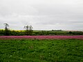
 Poppies galore^ - geograph.org.uk - 1357410.jpg 640 × 480; 107 KB
-

-
 Private track across The Moor - geograph.org.uk - 3627068.jpg 1,600 × 1,200; 687 KB
-
 Pumping Station - geograph.org.uk - 1376540.jpg 640 × 480; 93 KB
-
 Railway Embankment - geograph.org.uk - 166520.jpg 640 × 480; 126 KB
-
 Railway embankment near Bellmanear Farm - geograph.org.uk - 2845830.jpg 1,024 × 768; 207 KB
-
 Railway Plantation - geograph.org.uk - 3482697.jpg 640 × 427; 103 KB
-
 Raindrops on the pond at Low Bellmanear Farm - geograph.org.uk - 5777874.jpg 4,596 × 3,440; 5.9 MB
-
 Rapeseed and Fizgig Hole Plantation - geograph.org.uk - 1852476.jpg 3,072 × 1,752; 1.97 MB
-
 Rapeseed on the wold top - geograph.org.uk - 2406056.jpg 3,000 × 4,000; 2.79 MB
-
 Recently planted woodland - geograph.org.uk - 1964170.jpg 640 × 480; 88 KB
-
 River Derwent passing under the A64 - geograph.org.uk - 3429569.jpg 1,024 × 768; 366 KB
-
 Road and course of the railway - geograph.org.uk - 6523225.jpg 1,024 × 683; 581 KB
-
 Road Junction - geograph.org.uk - 5772144.jpg 2,048 × 1,536; 913 KB
-
 Road leading to West Lutton - geograph.org.uk - 5308985.jpg 640 × 427; 222 KB
-
 Road near High Bellmanear - geograph.org.uk - 5308983.jpg 640 × 427; 195 KB
-
 Road on Gallows Hill - geograph.org.uk - 5309103.jpg 640 × 427; 225 KB


_-_geograph.org.uk_-_4692975.jpg)


_-_geograph.org.uk_-_1999239.jpg)


_-_geograph.org.uk_-_4138115.jpg)


.jpg)


