Category:Sevier County, Arkansas
Counties of Arkansas: Arkansas · Ashley · Baxter · Benton · Boone · Bradley · Calhoun · Carroll · Chicot · Clark · Clay · Cleburne · Cleveland · Columbia · Conway · Craighead · Crawford · Crittenden · Cross · Dallas · Desha · Drew · Faulkner · Franklin · Fulton · Garland · Grant · Greene · Hempstead · Hot Spring · Howard · Independence · Izard · Jackson · Jefferson · Johnson · Lafayette · Lawrence · Lee · Lincoln · Little River · Logan · Lonoke · Madison · Marion · Miller · Mississippi · Monroe · Montgomery · Nevada · Newton · Ouachita · Perry · Phillips · Pike · Poinsett · Polk · Pope · Prairie · Pulaski · Randolph · Saline · Scott · Searcy · Sebastian · Sevier · Sharp · St. Francis · Stone · Union · Van Buren · Washington · White · Woodruff · Yell
county in Arkansas, United States   | |||||
| Upload media | |||||
| Instance of | |||||
|---|---|---|---|---|---|
| Location | Arkansas | ||||
| Capital | |||||
| Inception |
| ||||
| Population |
| ||||
| Area |
| ||||
| Different from | |||||
| official website | |||||
 | |||||
Subcategories
This category has the following 4 subcategories, out of 4 total.
A
M
Media in category "Sevier County, Arkansas"
The following 23 files are in this category, out of 23 total.
-
 Acalypha virginica Arkansas.jpg 3,456 × 4,608; 4.09 MB
-
 ARMap-doton-Ben Lomond.png 300 × 262; 13 KB
-
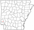
 ARMap-doton-De Queen.png 300 × 262; 13 KB
-
 ARMap-doton-Gillham.png 300 × 262; 13 KB
-
 ARMap-doton-Horatio.png 300 × 262; 13 KB
-
 ARMap-doton-Lockesburg.png 300 × 262; 13 KB
-
 Cuscuta pentagona.jpg 2,344 × 1,920; 1.11 MB
-
 FEMA - 40822 - PDA crew in Arkansas.jpg 2,100 × 1,500; 2.21 MB
-
 Highway 27 southern terminus at US 59 and US 71.jpg 2,974 × 2,232; 2.88 MB
-
 Map of Arkansas highlighting Sevier County.svg 1,278 × 1,113; 90 KB
-
 Old US 71-Little River Approach.JPG 4,928 × 3,264; 9.85 MB
-
 Phyllanthus caroliniensis.jpg 3,444 × 4,260; 3.65 MB
-
 Rolling Fork Arkansas.jpg 4,608 × 3,096; 4.41 MB
-

-

-

-

-

-
 The Horatio, Horatio, Arkansas (88164).jpg 3,331 × 2,114; 2.99 MB
-
 The Horatio, Horatio, Arkansas.jpg 1,500 × 952; 1.01 MB
-
 US 59 and US 71 in Lockesburg, Arkansas.jpg 2,345 × 1,760; 1.66 MB
-
 US 71 and US 59 south of Lockesburg.jpg 2,565 × 1,933; 2.07 MB
-
 USA Sevier County, Arkansas age pyramid.svg 520 × 600; 7 KB


.jpg)


