Category:ShakeMaps of earthquakes in Alaska
Media in category "ShakeMaps of earthquakes in Alaska"
The following 21 files are in this category, out of 21 total.
-
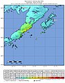
 2002 Denali earthquake.jpg 787 × 912; 434 KB
-
 2019-11-24 Adak, Alaska M6.3 earthquake shakemap (USGS).jpg 811 × 1,029; 166 KB
-
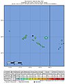
 2019-12-02 Amatignak Island, Alaska M6 earthquake shakemap (USGS).jpg 815 × 1,028; 166 KB
-
 2020-01-26 Amatignak Island, Alaska M6.1 earthquake shakemap (USGS).jpg 836 × 1,026; 159 KB
-
 2021 Chignik earthquake shakemap.jpg 640 × 800; 393 KB
-
 2021-07-29 Perryville, Alaska M6.1 earthquake shakemap (USGS).jpg 787 × 1,001; 182 KB
-
 2021-08-14 Perryville, Alaska M6.9 earthquake shakemap (ak).jpg 807 × 953; 250 KB
-
 2021-08-14 Perryville, Alaska M6.9 earthquake shakemap (USGS).jpg 786 × 1,001; 198 KB
-
 2021-09-24 Adak, Alaska M6.1 earthquake shakemap (ak).jpg 787 × 996; 135 KB
-
 2021-09-24 Adak, Alaska M6.1 earthquake shakemap (USGS).jpg 787 × 1,001; 141 KB
-
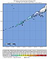
 2021-10-11 Chignik, Alaska M6.9 earthquake shakemap (ak).jpg 787 × 961; 278 KB
-
 2021-10-11 Chignik, Alaska M6.9 earthquake shakemap (USGS).jpg 786 × 1,001; 239 KB
-
 2022-01-11 Nikolski, Alaska M6.6 earthquake shakemap (ak).jpg 809 × 990; 171 KB
-
 2022-01-11 Nikolski, Alaska M6.6 earthquake shakemap (USGS).jpg 786 × 1,001; 164 KB
-
 2022-01-11 Nikolski, Alaska M6.8 earthquake shakemap (ak).jpg 787 × 994; 171 KB
-
 2022-01-11 Nikolski, Alaska M6.8 earthquake shakemap (USGS).jpg 787 × 1,001; 157 KB
-
 2022-01-22 Unalaska, Alaska M6.2 earthquake shakemap (ak).jpg 787 × 995; 171 KB
-
 2022-01-22 Unalaska, Alaska M6.2 earthquake shakemap (USGS).jpg 785 × 1,001; 167 KB
-

-

-

.jpg)
.jpg)
.jpg)

.jpg)
.jpg)
.jpg)
.jpg)
.jpg)
.jpg)
.jpg)
.jpg)
.jpg)
.jpg)
.jpg)
.jpg)
.jpg)
.jpg)
.jpg)
.jpg)