Category:Shakotan Peninsula
English: Shakotan Peninsula
日本語: 積丹半島
peninsula in Hokkaidō Prefecture, Japan   | |||||
| Upload media | |||||
| Instance of | |||||
|---|---|---|---|---|---|
| Named after |
| ||||
| Location | Shiribeshi Subprefecture, Hokkaido, Japan | ||||
| Located in or next to body of water | |||||
 | |||||
Subcategories
This category has the following 4 subcategories, out of 4 total.
C
- Cape Shakotan (3 F)
- Shimamui Coast (15 F)
K
- Cape Kamui (52 F)
S
- Shakotan Demisaki Lighthouse (2 F)
Media in category "Shakotan Peninsula"
The following 7 files are in this category, out of 7 total.
-
 Admiralty Chart No 3438 O Shima to Furubira Wan, Published 1904.jpg 11,341 × 17,710; 55.67 MB
-
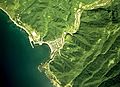
 Furubira town center area Aerial photograph.1976.jpg 3,884 × 4,923; 15.84 MB
-
 Kamoenai village center area Aerial photograph.1976.jpg 3,198 × 2,316; 5.34 MB
-
 Shakotan peninsula Relief Map, SRTM-1.jpg 800 × 600; 304 KB
-
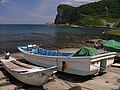 Shimadomari-Fishing port 島泊漁港7030107.jpg 1,024 × 768; 259 KB
-
 Siripa-misaki7020429.jpg 1,024 × 768; 140 KB
-
 島武意海岸(Shimamui beach, Shyakotan) - panoramio.jpg 2,288 × 1,712; 318 KB


