Category:Shalford, Surrey
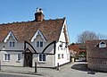
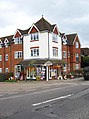
English: Shalford is a village in Surrey, England, situated on the busy A281 Horsham road immediately south of Guildford. It has a railway station which is between Guildford and Dorking on the North Downs Line.
Nederlands: Shalford is een plaats in het bestuurlijke gebied Guildford, in het Engelse graafschap Surrey. De plaats telde in 2001 2.338 inwoners.

village and civil parish in Surrey, England, UK _(3).jpg) | |||||
| Upload media | |||||
| Instance of | |||||
|---|---|---|---|---|---|
| Location | Guildford, Surrey, South East England, England | ||||
| Area |
| ||||
 | |||||
Subcategories
This category has the following 12 subcategories, out of 12 total.
C
M
- Maps of Peasmarsh, Surrey (1 F)
- Maps of Shalford, Surrey (1 F)
- Shalford Mill (4 F)
P
- Peasmarsh, Surrey (11 F)
Q
- Queen Victoria pub, Shalford (6 F)
S
- Shalford Methodist Church (6 F)
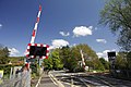
- Shalford Railway Bridge (15 F)
Media in category "Shalford, Surrey"
The following 200 files are in this category, out of 701 total.
(previous page) (next page)-
 20 22 The Street Shalford.jpg 6,100 × 4,575; 6.42 MB
-
 2016, a year on Geograph (Day 294) - geograph.org.uk - 5163341.jpg 640 × 480; 32 KB
-
 2016, a year on Geograph (Day 295) - geograph.org.uk - 5163344.jpg 640 × 480; 41 KB
-
 24 to 30 The Street Shalford.jpg 6,100 × 3,764; 6.27 MB
-

-
 A clump of trees - geograph.org.uk - 3432231.jpg 640 × 430; 98 KB
-
-
 A utilities installation - geograph.org.uk - 5144438.jpg 640 × 426; 86 KB
-
 A248 - geograph.org.uk - 5353922.jpg 640 × 426; 79 KB
-
 A248 crossing Broadford Bridge - geograph.org.uk - 2067756.jpg 640 × 430; 148 KB
-
 A248, Chilworth - geograph.org.uk - 4804548.jpg 640 × 426; 72 KB
-
 A248, Chilworth - geograph.org.uk - 5144417.jpg 640 × 411; 77 KB
-
 A248, Shalford - geograph.org.uk - 4083308.jpg 2,048 × 1,536; 1.3 MB
-

-
 A281 looking south - geograph.org.uk - 2065805.jpg 640 × 430; 130 KB
-
 A3100 at Peasmarsh - geograph.org.uk - 5913012.jpg 2,841 × 1,593; 505 KB
-
 A3100, Peasmarsh - geograph.org.uk - 4808612.jpg 2,000 × 1,333; 2.8 MB
-
 Above Unstead Lock - geograph.org.uk - 1415316.jpg 640 × 484; 90 KB
-
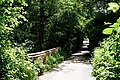
 Access to Shalford Mill - geograph.org.uk - 5744827.jpg 3,474 × 2,500; 1.45 MB
-
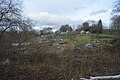 Allotments - geograph.org.uk - 5354000.jpg 640 × 426; 76 KB
-
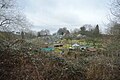
 Allotments on the edge of Shalford - geograph.org.uk - 2272941.jpg 640 × 430; 53 KB
-
 Allotments, Shalford - geograph.org.uk - 4804564.jpg 640 × 426; 74 KB
-
 Along the fence to the crossing - geograph.org.uk - 2951493.jpg 1,024 × 683; 227 KB
-
 An empty car park - geograph.org.uk - 3424822.jpg 640 × 430; 92 KB
-
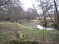
 An Ox Bow Lake - geograph.org.uk - 3432247.jpg 640 × 430; 139 KB
-
 And out of the gate - geograph.org.uk - 2953695.jpg 533 × 800; 231 KB
-
 And over it goes - geograph.org.uk - 2969465.jpg 533 × 800; 145 KB
-
 Animal sculpture - geograph.org.uk - 3158518.jpg 425 × 640; 446 KB
-
 Antiques - geograph.org.uk - 1385367.jpg 640 × 480; 93 KB
-

-
-

-

-
 April sunshine beside the Wey Navigation - geograph.org.uk - 1414881.jpg 640 × 507; 113 KB
-
 At Tilthams Corner Road - geograph.org.uk - 3919345.jpg 3,648 × 2,736; 4.91 MB
-
 Autumn colour at Guildford Crematorium - geograph.org.uk - 3235666.jpg 1,024 × 768; 671 KB
-
 Badger's Hill - geograph.org.uk - 3453993.jpg 640 × 430; 73 KB
-

-
 Barrier on the footpath - geograph.org.uk - 2951548.jpg 533 × 800; 164 KB
-
 Beauty Boutique, Station Approach, Shalford - geograph.org.uk - 2786268.jpg 1,024 × 738; 239 KB
-
 Bend in Shalford Road - geograph.org.uk - 1631615.jpg 480 × 640; 97 KB
-
 Bend in Tilehouse Road - geograph.org.uk - 1631720.jpg 640 × 480; 86 KB
-
 Blossom by the Bridge - geograph.org.uk - 5745015.jpg 3,238 × 2,468; 3.06 MB
-
 Bluebells by the footpath - geograph.org.uk - 2951544.jpg 533 × 800; 169 KB
-

-
 Boats on the River Wey - geograph.org.uk - 2065825.jpg 640 × 430; 149 KB
-
 Bradstone Brook sports ground - geograph.org.uk - 2630844.jpg 640 × 428; 89 KB
-
 Bramley Wey - geograph.org.uk - 2063257.jpg 640 × 430; 198 KB
-
 Bramley Wey through the trees - geograph.org.uk - 2065790.jpg 640 × 430; 201 KB
-
 Bridge over dismantled railway - geograph.org.uk - 5536289.jpg 1,280 × 875; 732 KB
-
 Bridge over the Ox Bow lake - geograph.org.uk - 3432243.jpg 640 × 430; 116 KB
-
 Bridge over the Wey Navigation - geograph.org.uk - 3432656.jpg 640 × 430; 107 KB
-
 Bridge over the Wey navigation - geograph.org.uk - 3987661.jpg 2,048 × 1,536; 1.54 MB
-
 Bridges, Bramley - geograph.org.uk - 2192765.jpg 2,816 × 1,880; 4.15 MB
-
 Bridleway junction - geograph.org.uk - 3454000.jpg 640 × 430; 145 KB
-
 Broadford - geograph.org.uk - 2067664.jpg 640 × 430; 151 KB
-
 Broadford - geograph.org.uk - 2067728.jpg 640 × 430; 135 KB
-
 Broadford - geograph.org.uk - 3916449.jpg 3,648 × 2,736; 4.51 MB
-
 Broadford Bridge - geograph.org.uk - 1385447.jpg 640 × 480; 87 KB
-
 Broadford Bridge - geograph.org.uk - 2067732.jpg 640 × 430; 135 KB
-
 Broadford Bridge - geograph.org.uk - 2067748.jpg 640 × 430; 160 KB
-
 Broadford Bridge - geograph.org.uk - 2067770.jpg 640 × 430; 133 KB
-
 Broadford Bridge - geograph.org.uk - 3021833.jpg 640 × 425; 334 KB
-
 Broadford Bridge - geograph.org.uk - 3156351.jpg 640 × 425; 354 KB
-
 Broadford Bridge - geograph.org.uk - 5464726.jpg 1,024 × 560; 113 KB
-
 Broadford Bridge - geograph.org.uk - 949950.jpg 640 × 427; 188 KB
-

-
 Broadford Meadows - geograph.org.uk - 3987655.jpg 2,048 × 1,536; 1.4 MB
-
 Broadford meadows - geograph.org.uk - 3987788.jpg 2,048 × 1,536; 1.38 MB
-
 Broadford Park Business Park - geograph.org.uk - 3156660.jpg 640 × 425; 406 KB
-
 Building at Broadford - geograph.org.uk - 1881823.jpg 800 × 600; 98 KB
-
 Bungalow, Valley Park - geograph.org.uk - 4804556.jpg 640 × 426; 44 KB
-
 Bunker Hill Wood - geograph.org.uk - 3460094.jpg 640 × 430; 74 KB
-
-
 Bus stop by the hall - geograph.org.uk - 2950425.jpg 1,024 × 683; 158 KB
-
 Bus stop, Shalford - geograph.org.uk - 4083304.jpg 2,048 × 1,536; 1.39 MB
-
 Business premises in Tilehouse Road - geograph.org.uk - 1631706.jpg 640 × 480; 70 KB
-
 Cable in the water - geograph.org.uk - 2953432.jpg 533 × 800; 207 KB
-

-
 Car transporter on the A281 - geograph.org.uk - 1631617.jpg 640 × 480; 86 KB
-
 Carousel, 1 Kings Road, Shalford - geograph.org.uk - 2786301.jpg 763 × 1,024; 180 KB
-
 Carousel, Shalford - geograph.org.uk - 981535.jpg 480 × 640; 121 KB
-
 Cattle by the Railway line - geograph.org.uk - 2063251.jpg 640 × 430; 171 KB
-
 Chantry Cottage - geograph.org.uk - 639452.jpg 640 × 480; 97 KB
-
 Chantry Road, Chilworth - geograph.org.uk - 4844444.jpg 2,048 × 1,536; 1.49 MB
-
 Chantry Road, Chilworth - geograph.org.uk - 4844445.jpg 2,048 × 1,536; 1.5 MB
-
 Chapels, Shalford - geograph.org.uk - 2630496.jpg 640 × 480; 133 KB
-
 Chilworth Level Crossing - geograph.org.uk - 2951506.jpg 1,024 × 683; 181 KB
-
 Chilworth Station direction - geograph.org.uk - 2953441.jpg 1,024 × 683; 276 KB
-
 Chilworth Village Hall - geograph.org.uk - 2950412.jpg 1,024 × 683; 142 KB
-
 Chinthurst Farm - geograph.org.uk - 4201061.jpg 4,240 × 2,832; 6.39 MB
-
 Chinthurst Farm - geograph.org.uk - 5464143.jpg 1,024 × 1,020; 333 KB
-
 Chinthurst Farmhouse - geograph.org.uk - 3424859.jpg 640 × 430; 76 KB
-
 Chinthurst Hill - geograph.org.uk - 3424848.jpg 640 × 430; 54 KB
-
 Chinthurst Hill - geograph.org.uk - 4083354.jpg 2,048 × 1,536; 1.52 MB
-
 Chinthurst Hill - geograph.org.uk - 4086424.jpg 1,954 × 1,465; 847 KB
-
 Chinthurst Hill Farm - geograph.org.uk - 4201193.jpg 4,240 × 2,832; 6.55 MB
-
 Chinthurst Lane - geograph.org.uk - 3424850.jpg 640 × 430; 115 KB
-
 Chinthurst Lane - geograph.org.uk - 3424851.jpg 640 × 430; 118 KB
-
 Chinthurst Lane - geograph.org.uk - 4083369.jpg 1,985 × 1,488; 836 KB
-
 Chinthurst Lane at Shalford - geograph.org.uk - 2239295.jpg 640 × 402; 71 KB
-
 Chinthurst Lane, Shalford - geograph.org.uk - 4083346.jpg 2,048 × 1,536; 1.39 MB
-
 Church along New Road - geograph.org.uk - 2950405.jpg 1,024 × 683; 184 KB
-
 Clan Line on Steam Excursion - geograph.org.uk - 1159787.jpg 640 × 360; 40 KB
-
 Confluence of the two River Weys - geograph.org.uk - 2067686.jpg 640 × 430; 156 KB
-
 Content on the Wey - geograph.org.uk - 1385471.jpg 640 × 480; 117 KB
-
 Cottage on the hillside - geograph.org.uk - 2953680.jpg 1,024 × 683; 242 KB
-
 Cottage with roses on - geograph.org.uk - 2953688.jpg 1,024 × 683; 266 KB
-
 Cottages and cats - geograph.org.uk - 1881810.jpg 800 × 600; 156 KB
-
 Cottages in Shalford - geograph.org.uk - 1881007.jpg 800 × 600; 92 KB
-
 Cottages in the Street, Shalford - geograph.org.uk - 1317683.jpg 640 × 480; 150 KB
-
 Countryside west of Chilworth - geograph.org.uk - 2272762.jpg 640 × 430; 40 KB
-
 Cranleigh Waters - geograph.org.uk - 2063282.jpg 640 × 430; 198 KB
-
 Cranleigh Waters - geograph.org.uk - 2065792.jpg 640 × 430; 183 KB
-
 Cranleigh Waters - geograph.org.uk - 4159866.jpg 2,048 × 1,536; 1.66 MB
-
 Cranleigh Waters in Shalford - geograph.org.uk - 3512308.jpg 640 × 480; 121 KB
-
 Cranleigh Waters, Gosden Weir - geograph.org.uk - 3355264.jpg 640 × 480; 93 KB
-
 Crossing point, A281 - geograph.org.uk - 3987795.jpg 2,048 × 1,536; 1.62 MB
-
 Cutting down a tree - geograph.org.uk - 2969457.jpg 533 × 800; 162 KB
-
 Cycle path near Broadford - geograph.org.uk - 3987651.jpg 2,048 × 1,536; 1.63 MB
-
 Cycle-track along an old railway embankment - geograph.org.uk - 4103400.jpg 768 × 1,024; 296 KB
-
 Cycleroute 222 - geograph.org.uk - 2063287.jpg 640 × 430; 203 KB
-
 Cycleroute 222 - geograph.org.uk - 2063297.jpg 640 × 430; 214 KB
-
 Cycleroute 222 crosses the River Wey - geograph.org.uk - 2065789.jpg 640 × 430; 190 KB
-
 Cycleroute 222 heading north - geograph.org.uk - 2063313.jpg 640 × 430; 197 KB
-

-
 Danger^ Weir - geograph.org.uk - 571273.jpg 640 × 428; 141 KB
-
 David Shepherd Wildlife Foundation Gallery - geograph.org.uk - 4201014.jpg 3,973 × 2,653; 7.27 MB
-
 Deceptive conditions in Tilehouse Road - geograph.org.uk - 1631710.jpg 640 × 480; 124 KB
-
 Demolished bridge over the River Wey - geograph.org.uk - 48515.jpg 640 × 427; 140 KB
-
 Disused building, Shalford Station - geograph.org.uk - 5816040.jpg 1,024 × 681; 243 KB
-
 Downs Link - geograph.org.uk - 2065827.jpg 640 × 430; 196 KB
-
 Downs Link - geograph.org.uk - 3424825.jpg 640 × 430; 139 KB
-
 Downs Link - geograph.org.uk - 3424827.jpg 640 × 430; 135 KB
-
 Downs Link - geograph.org.uk - 3424832.jpg 640 × 430; 103 KB
-
 Downs Link - geograph.org.uk - 3424843.jpg 640 × 430; 106 KB
-
 Downs Link - geograph.org.uk - 3424867.jpg 640 × 430; 82 KB
-
 Downs Link - geograph.org.uk - 3424891.jpg 640 × 430; 125 KB
-
 Downs Link bridge - geograph.org.uk - 1976988.jpg 640 × 425; 210 KB
-
 Downs Link Bridge - geograph.org.uk - 3021808.jpg 640 × 425; 376 KB
-
 Downs Link Bridge across the River Wey - geograph.org.uk - 2067657.jpg 640 × 430; 174 KB
-
 Downs Link bridge over the River Wey - geograph.org.uk - 2065838.jpg 640 × 430; 179 KB
-
 Downs Link goes right - geograph.org.uk - 3424824.jpg 640 × 412; 112 KB
-
 Downs link heading north - geograph.org.uk - 2063222.jpg 640 × 430; 208 KB
-
 Downs Link heading north - geograph.org.uk - 2063229.jpg 640 × 430; 198 KB
-
 Downs Link logo - geograph.org.uk - 3424837.jpg 640 × 430; 49 KB
-
 Downs Link off the B2128 - geograph.org.uk - 3414798.jpg 640 × 430; 129 KB
-
 Downs Link past Chinthurst Farm - geograph.org.uk - 3424849.jpg 640 × 436; 96 KB
-
 Downs Link sign by the A281 - geograph.org.uk - 2065813.jpg 640 × 430; 186 KB
-
 Downs Link signpost - geograph.org.uk - 2065797.jpg 640 × 430; 197 KB
-

-
 Downslink near Bramley - geograph.org.uk - 5450610.jpg 1,024 × 657; 190 KB
-
 Downslink Railway from the A281 - geograph.org.uk - 5464761.jpg 915 × 1,024; 280 KB
-
 East Shalford Lane - geograph.org.uk - 1305208.jpg 640 × 427; 86 KB
-
 East Shalford Lane - geograph.org.uk - 1631682.jpg 640 × 480; 120 KB
-
 East Shalford Lane - geograph.org.uk - 3876734.jpg 2,048 × 1,536; 1.38 MB
-
 East Shalford Lane - geograph.org.uk - 6191955.jpg 3,021 × 2,015; 7.72 MB
-
 East Shalford Lane Crossing - geograph.org.uk - 6191989.jpg 3,419 × 2,280; 7.55 MB
-

-
 Entering Guildford Borough - geograph.org.uk - 2630895.jpg 640 × 428; 151 KB
-
 Fallow fields south of Peasmarsh - geograph.org.uk - 4163925.jpg 2,048 × 1,536; 1.47 MB
-
 Farm access road - geograph.org.uk - 4086434.jpg 2,008 × 1,506; 1.17 MB
-
 Farm buildings by the railway line - geograph.org.uk - 2272930.jpg 640 × 360; 39 KB
-
 Farm by the level crossing - geograph.org.uk - 2272923.jpg 640 × 430; 47 KB
-
 Farm track to Chinthurst farm - geograph.org.uk - 4083363.jpg 2,048 × 1,536; 1.51 MB
-
 Fence round the carpark - geograph.org.uk - 2950418.jpg 1,024 × 683; 184 KB
-
 Field and woodland by the Downs Link - geograph.org.uk - 2065830.jpg 640 × 430; 148 KB
-
 Field near Lower Chinthurst Farm - geograph.org.uk - 3424834.jpg 640 × 430; 54 KB
-
 Fields above Chinthurst Lane - geograph.org.uk - 4150509.jpg 2,048 × 1,536; 1.25 MB
-
 Fields below Bunker's Hill - geograph.org.uk - 4635927.jpg 2,000 × 1,333; 3.53 MB
-
 Fields near Gosden Common - geograph.org.uk - 4163921.jpg 2,048 × 1,536; 864 KB
-
 Flooding, Shalford Meadows - geograph.org.uk - 3953248.jpg 640 × 451; 59 KB
-
 Flooding, Shalford Meadows - geograph.org.uk - 3953249.jpg 640 × 430; 50 KB
-

-
 Floodplain of the River Wey - geograph.org.uk - 2065860.jpg 640 × 430; 148 KB
-
 Footbridge on the Towpath - geograph.org.uk - 5745017.jpg 3,888 × 2,592; 3.28 MB
-
 Footbridge on towpath - geograph.org.uk - 3019449.jpg 640 × 425; 481 KB
-
 Footbridge over railway at Shalford - geograph.org.uk - 1881061.jpg 800 × 600; 135 KB
-

-
 Footbridge, Shalford Station - geograph.org.uk - 3031329.jpg 640 × 430; 80 KB
-
 Footpath , Gosden Common - geograph.org.uk - 3425005.jpg 640 × 430; 156 KB
-
 Footpath along the Wey - geograph.org.uk - 3432688.jpg 640 × 430; 121 KB
-
 Footpath at Bradstone Brook - geograph.org.uk - 2523824.jpg 3,487 × 2,618; 3.7 MB
-
 Footpath at Shalford - geograph.org.uk - 1881852.jpg 800 × 583; 133 KB
-
 Footpath beside the sewage works - geograph.org.uk - 4163929.jpg 2,048 × 1,536; 1.78 MB
-
 Footpath by the railway - geograph.org.uk - 2951542.jpg 533 × 800; 210 KB
-
 Footpath gate west of Shalford - geograph.org.uk - 1881041.jpg 800 × 600; 154 KB
-
 Footpath heading west - geograph.org.uk - 3432199.jpg 640 × 430; 74 KB
-
 Footpath in Shalford, Surrey - geograph.org.uk - 4204444.jpg 4,240 × 2,832; 5.87 MB
-
 Footpath junction near Chinthurst Hill - geograph.org.uk - 4083321.jpg 2,048 × 1,536; 1.78 MB
-
 Footpath near Lower Chinthurst Farm - geograph.org.uk - 4086438.jpg 2,048 × 1,536; 1.59 MB
-
 Footpath near Shalford - geograph.org.uk - 4086416.jpg 1,536 × 2,048; 1.59 MB
-
 Footpath off Chinthurst Lane in Shalford - geograph.org.uk - 2239314.jpg 800 × 600; 176 KB
-
 Footpath past the houses - geograph.org.uk - 2953994.jpg 533 × 800; 185 KB
-
 Footpath past the sewage works - geograph.org.uk - 4163919.jpg 2,048 × 1,536; 1.51 MB
-
 Footpath to Godalming - geograph.org.uk - 3432194.jpg 640 × 430; 138 KB
-
 Footpath to Godalming - geograph.org.uk - 3432210.jpg 640 × 430; 99 KB
-
 Footpath to Gosden Common - geograph.org.uk - 4163930.jpg 2,048 × 1,536; 1.62 MB
-
 Footpath to Lower Chinthurst Farm - geograph.org.uk - 4086461.jpg 2,048 × 1,536; 1.7 MB
-
 Former Wesleyan Chapel (1843), Kings Road, Shalford (May 2014) (1).JPG 2,400 × 2,000; 900 KB

_-_geograph.org.uk_-_5163341.jpg)
_-_geograph.org.uk_-_5163344.jpg)


,_Shalford_-_geograph.org.uk_-_2442167.jpg)


,_Kings_Road,_Shalford_(May_2014)_(1).JPG)