Category:Shawbost
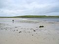
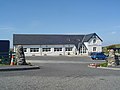
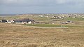
English: Shawbost ( Scottish Gaelic: Siabost) is a large township in the West Side of the Isle of Lewis. The village of Shawbost has a population of around 500 and lies around 20 miles to the west of the island’s capital Stornoway. A recent development in the village was the renovation of the old school into the new community centre. The community is split into three sections: North Shawbost (Siabost bho Thuath), South Shawbost (Siabost bho Dheas)and New Shawbost (Pairc Shiaboist). There is a small museum of folk life and nearby is a small stone circle. The village is also over looked by a small hill named Beinn Bhragair, 261m high, and situated near to a beach.
village in the Outer Hebrides, Scotland, UK  | |||||
| Upload media | |||||
| Instance of | |||||
|---|---|---|---|---|---|
| Location |
| ||||
 | |||||
Subcategories
This category has only the following subcategory.
S
- Shawbost Norse mill and kiln (20 F)
Media in category "Shawbost"
The following 64 files are in this category, out of 64 total.
-
 Atlantic Shore, Shawbost - geograph.org.uk - 413082.jpg 640 × 483; 79 KB
-
 Bad stile near Labost - geograph.org.uk - 2598940.jpg 1,600 × 1,025; 437 KB
-
 Bottom of the track up to the mast - geograph.org.uk - 5223484.jpg 640 × 479; 81 KB
-
 Bragar Tavern - geograph.org.uk - 206715.jpg 640 × 480; 70 KB
-
 Bridge at Loch a' Bhaile - geograph.org.uk - 5900586.jpg 640 × 480; 358 KB
-
 Church at Siabost - geograph.org.uk - 1922459.jpg 3,648 × 2,736; 2.12 MB
-
 Cliffs at Rubh an Dunain - geograph.org.uk - 1453418.jpg 640 × 480; 60 KB
-
 Clifftop colours - geograph.org.uk - 2599698.jpg 640 × 480; 91 KB
-

-
 Coastal rubbish dump - geograph.org.uk - 2598514.jpg 1,600 × 1,200; 705 KB
-
 Croft Houses near Shawbost - panoramio.jpg 4,320 × 3,240; 2.64 MB
-
 Dail Beag Dyke - geograph.org.uk - 2603591.jpg 1,600 × 1,048; 467 KB
-
 Distant Beinn Bhragair - geograph.org.uk - 5521769.jpg 640 × 427; 82 KB
-
 Evening light at Siabost bho Dheas - geograph.org.uk - 1456050.jpg 640 × 612; 61 KB
-
 Fence above Loch Shiaboist - geograph.org.uk - 2599718.jpg 640 × 481; 97 KB
-

-
 Fire station in South Shawbost.JPG 4,752 × 3,168; 3.89 MB
-
 Geodha Neidalt - geograph.org.uk - 1453440.jpg 640 × 350; 44 KB
-
 Grazing land at Siabost bho Dheas - geograph.org.uk - 2599689.jpg 640 × 480; 85 KB
-

-
 Loch a Bhaile - geograph.org.uk - 733240.jpg 640 × 480; 43 KB
-
 Loch a' Bhaile, Siabost - geograph.org.uk - 1254676.jpg 640 × 480; 85 KB
-
 Loch Bacavat - geograph.org.uk - 1453497.jpg 640 × 358; 38 KB
-
 Loch na Muilna - geograph.org.uk - 1265797.jpg 640 × 429; 67 KB
-
 Loch na Muilne - geograph.org.uk - 1252656.jpg 640 × 425; 62 KB
-
 Loch Shiaboist - geograph.org.uk - 5585844.jpg 640 × 386; 82 KB
-
 Looking towards Siabost bho Dheas - geograph.org.uk - 304571.jpg 640 × 480; 88 KB
-
 Low tide in Loch Shiaboist - geograph.org.uk - 1254645.jpg 640 × 480; 46 KB
-
 New Fire Station, Siabost - geograph.org.uk - 503087.jpg 640 × 359; 47 KB
-
 New School at Siabost - geograph.org.uk - 503097.jpg 640 × 359; 48 KB
-
 Old bridge, Siabost, Isle of Lewis - geograph.org.uk - 1959163.jpg 2,304 × 3,072; 3.12 MB
-
 Old enclosures, Shawbost - geograph.org.uk - 1453482.jpg 640 × 480; 74 KB
-
 Old Milestone by the A858, Shawbst - geograph.org.uk - 6035828.jpg 600 × 449; 215 KB
-
 Old School, Shawbost - geograph.org.uk - 206723.jpg 640 × 480; 69 KB
-
 Outflow from Loch a' Bhaile into Loch Shiaboist - geograph.org.uk - 2603676.jpg 1,600 × 1,063; 489 KB
-
 Outlet from Loch a' Bhaile - geograph.org.uk - 5900583.jpg 640 × 480; 311 KB
-
 Rock to the south of Pairc Shiaboist, Isle of Lewis (geograph 5437095).jpg 1,459 × 1,094; 252 KB
-
 Rocks at Loch Shiaboist - geograph.org.uk - 2603734.jpg 4,275 × 2,848; 4.01 MB
-
 Rubha Neidalt - geograph.org.uk - 2603743.jpg 1,600 × 1,051; 423 KB
-
 Sea loch and fresh water loch - geograph.org.uk - 1254690.jpg 640 × 480; 62 KB
-
 Shawbost Beach - geograph.org.uk - 4229429.jpg 1,600 × 1,200; 688 KB
-
 Shawbost Church - geograph.org.uk - 206720.jpg 640 × 480; 77 KB
-
 Shawbost horses - geograph.org.uk - 1474194.jpg 640 × 480; 74 KB
-
 Shawbost sheep - geograph.org.uk - 1255628.jpg 640 × 480; 125 KB
-
 Sheep and moorland below Beinn na Cloich (geograph 5223478).jpg 640 × 483; 91 KB
-
 Sheep and stacks, Siabost bho Dheas - geograph.org.uk - 1255621.jpg 640 × 359; 94 KB
-
 Shiaboist beach (geograph 4018963).jpg 1,439 × 957; 943 KB
-
 Siabost - geograph.org.uk - 1416466.jpg 640 × 359; 71 KB
-
 Siabost bho Thuath - geograph.org.uk - 1346147.jpg 640 × 385; 198 KB
-
 Siabost bho Thuath from the west - geograph.org.uk - 2599706.jpg 640 × 480; 96 KB
-
 Small Wind Turbines near Shawbost - panoramio.jpg 4,320 × 3,240; 2.23 MB
-
 South Shawbost in summer 2012 (1).JPG 4,752 × 3,168; 4.59 MB
-
 South Shawbost in summer 2012 (2).JPG 4,752 × 3,168; 3.73 MB
-
 South Shawbost in summer 2012 (3).JPG 4,752 × 3,168; 4.3 MB
-
 Storm beach, Shawbost - geograph.org.uk - 1453467.jpg 640 × 480; 69 KB
-
 The bar at Shawbost - geograph.org.uk - 5900577.jpg 640 × 480; 281 KB
-
 The beach at Loch Shiaboist - geograph.org.uk - 5900579.jpg 640 × 480; 246 KB
-
 The Butt of the Joke..... - geograph.org.uk - 603382.jpg 640 × 480; 70 KB
-

-
 Tweed Mill, Siabost - geograph.org.uk - 5144160.jpg 640 × 457; 43 KB
-
 West Side coastal walk board - geograph.org.uk - 4229446.jpg 1,600 × 1,200; 663 KB
-
 Wind turbine - geograph.org.uk - 3490266.jpg 2,048 × 1,536; 604 KB
-

-
 Shawbost Beach - geograph.org.uk - 413072.jpg 640 × 483; 63 KB


.jpg)


.jpg)

.jpg)


.JPG)
.JPG)
.JPG)


