Category:Shearsby

village in the United Kingdom | |||||
| Upload media | |||||
| Instance of | |||||
|---|---|---|---|---|---|
| Location | Harborough, Leicestershire, East Midlands, England | ||||
| Population |
| ||||
| Area |
| ||||
 | |||||
Subcategories
This category has only the following subcategory.
S
Media in category "Shearsby"
The following 60 files are in this category, out of 60 total.
-
 Arnesby Road - geograph.org.uk - 5441018.jpg 640 × 428; 111 KB
-
 Arnesby Road leading off Shearsby Road - geograph.org.uk - 2568049.jpg 4,000 × 3,000; 2.87 MB
-
 Back Lane, Shearsby - geograph.org.uk - 2268226.jpg 1,280 × 856; 241 KB
-

-

-
 Chandlers Arms, Shearsby - geograph.org.uk - 2268206.jpg 1,280 × 856; 215 KB
-
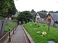
 Church Lane in Shearsby - geograph.org.uk - 737090.jpg 640 × 562; 107 KB
-
 Church Lane, Shearsby - geograph.org.uk - 2268743.jpg 1,280 × 856; 208 KB
-
 Church Lane, Shearsby - geograph.org.uk - 2268905.jpg 1,280 × 856; 169 KB
-
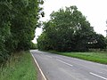
 Country lane to Fleckney - geograph.org.uk - 736931.jpg 640 × 486; 77 KB
-

-
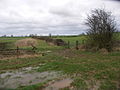
 Farm buildings along Fleckney Road - geograph.org.uk - 4250322.jpg 1,600 × 1,200; 495 KB
-
 Farm track from Bruntingthorpe Road - geograph.org.uk - 5935630.jpg 640 × 456; 128 KB
-
 Fleckney- Rowley Fields Farm - geograph.org.uk - 3927626.jpg 1,024 × 719; 192 KB
-

-
 Grass cutters at work - geograph.org.uk - 224706.jpg 640 × 415; 84 KB
-
 Houses on Church Lane, Shearsby - geograph.org.uk - 5443383.jpg 640 × 480; 125 KB
-
 Public bridleway leading to Fleckney - geograph.org.uk - 4250317.jpg 1,600 × 1,254; 454 KB
-
 Saddington Road towards Saddington - geograph.org.uk - 5935681.jpg 640 × 525; 60 KB
-
 Saddington Road towards Shearsby - geograph.org.uk - 5935682.jpg 640 × 420; 60 KB
-
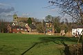 Shearsby - geograph.org.uk - 2268904.jpg 1,280 × 856; 233 KB
-
 Shearsby Bath - geograph.org.uk - 2773647.jpg 640 × 490; 81 KB
-
 Shearsby Chandlers Arms - geograph.org.uk - 2978626.jpg 640 × 480; 221 KB
-
 Shearsby Church - geograph.org.uk - 2270478.jpg 856 × 1,280; 239 KB
-
 Shearsby Church - geograph.org.uk - 2777539.jpg 640 × 480; 108 KB
-
 Shearsby Church - geograph.org.uk - 2777598.jpg 640 × 480; 70 KB
-
 Shearsby church - geograph.org.uk - 5441008.jpg 640 × 480; 140 KB
-
 Shearsby church - geograph.org.uk - 5443323.jpg 640 × 480; 118 KB
-
 Shearsby Main Street - geograph.org.uk - 2773670.jpg 640 × 480; 51 KB
-
 Shearsby Turn, Bruntingthorpe Road - geograph.org.uk - 1292817.jpg 640 × 480; 230 KB
-
 Shearsby Village Hall - geograph.org.uk - 2773655.jpg 640 × 480; 90 KB
-
 Shearsby-Back Lane - geograph.org.uk - 2777558.jpg 640 × 507; 67 KB
-
 Shearsby-Church Lane - geograph.org.uk - 2777582.jpg 640 × 480; 67 KB
-
 Shearsby-The Chandlers Arms - geograph.org.uk - 2773917.jpg 640 × 480; 75 KB
-
 Shearsby-The Square - geograph.org.uk - 2777571.jpg 640 × 447; 61 KB
-
 Sheep, Shearsby - geograph.org.uk - 5441009.jpg 640 × 480; 152 KB
-
 St Mary Magdalene Church - geograph.org.uk - 3809614.jpg 1,600 × 1,200; 402 KB
-
 The Square, Shearsby - geograph.org.uk - 2270264.jpg 1,280 × 856; 153 KB
-
 A5199 south - geograph.org.uk - 224712.jpg 640 × 482; 90 KB
-
 Across the Fields to Fleckney - geograph.org.uk - 737007.jpg 640 × 447; 51 KB
-
 Arnesby Road towards Fleckney - geograph.org.uk - 735224.jpg 640 × 449; 114 KB
-

-
 Brick bridge over stream - geograph.org.uk - 314343.jpg 640 × 480; 161 KB
-
 Don't believe the sign. - geograph.org.uk - 310687.jpg 640 × 480; 90 KB
-
 Down the path - geograph.org.uk - 224707.jpg 640 × 480; 91 KB
-
 Farm buildings along Fleckney Road - geograph.org.uk - 735205.jpg 640 × 513; 86 KB
-
 Farmland east of Shearsby - geograph.org.uk - 737067.jpg 640 × 475; 77 KB
-
 Fleckney Road near Arnesby - geograph.org.uk - 733985.jpg 640 × 454; 69 KB
-

-
 Footpath to open countryside - geograph.org.uk - 314333.jpg 640 × 480; 129 KB
-
 Mill Lane-Bruntingthorpe Road junction - geograph.org.uk - 224704.jpg 640 × 480; 100 KB
-
 Road Junction - geograph.org.uk - 220239.jpg 640 × 459; 66 KB
-
 Rural ford - geograph.org.uk - 314327.jpg 640 × 480; 161 KB
-
 Stile, Footpath and Jump - geograph.org.uk - 310722.jpg 640 × 480; 104 KB
-
 The road to Knaptoft Grange. - geograph.org.uk - 305027.jpg 640 × 480; 63 KB
-
 Towards Fleckney - geograph.org.uk - 220241.jpg 640 × 428; 64 KB
-
 Track - geograph.org.uk - 224711.jpg 640 × 480; 68 KB
-
 Track to Peashill Lodge Farm - geograph.org.uk - 224717.jpg 640 × 410; 69 KB
-
 Welford Road junction - geograph.org.uk - 224718.jpg 640 × 480; 107 KB
-