Category:Sherborne
town and civil parish in Dorset, England  | |||||
| Upload media | |||||
| Instance of | |||||
|---|---|---|---|---|---|
| Location |
| ||||
| Population |
| ||||
| Said to be the same as | Sherborne (Wikimedia duplicated page, civil parish) | ||||
| official website | |||||
 | |||||
Subcategories
This category has the following 7 subcategories, out of 7 total.
Media in category "Sherborne"
The following 200 files are in this category, out of 216 total.
(previous page) (next page)-
 A little river at Sherborne (2866666909).jpg 763 × 1,144; 235 KB
-
 Along Trent Path Lane - geograph.org.uk - 3224747.jpg 3,724 × 2,420; 2.54 MB
-
 Antelope Place, Kitt Hill, Sherborne - geograph.org.uk - 5936390.jpg 4,801 × 3,186; 2.33 MB
-
 Artwork fence - Swan Yard carpark - geograph.org.uk - 980127.jpg 640 × 480; 72 KB
-
 Barclays Bank, Sherborne - geograph.org.uk - 5883589.jpg 1,600 × 1,194; 347 KB
-
 Below New Road - geograph.org.uk - 5705995.jpg 1,024 × 768; 137 KB
-
 Benchmark, Barton Gardens, Sherborne - geograph.org.uk - 5322059.jpg 427 × 640; 82 KB
-
 Castleton Road, Sherborne - geograph.org.uk - 4920695.jpg 2,048 × 1,536; 769 KB
-
 Cheap Street, Sherborne - geograph.org.uk - 6448769.jpg 1,198 × 1,797; 320 KB
-
 Citroën 2CV Sugar City Speed & Custom.jpg 4,119 × 3,010; 2.72 MB
-
 Cold Harbour, Sherborne - geograph.org.uk - 5936397.jpg 5,202 × 3,077; 1.92 MB
-

-
 Connells Estate Agents, Sherborne - geograph.org.uk - 5883582.jpg 1,600 × 1,194; 417 KB
-
 Continuation of the artwork fence - geograph.org.uk - 980141.jpg 640 × 480; 100 KB
-
 Dancing Hill, Sherborne - geograph.org.uk - 5322065.jpg 640 × 427; 24 KB
-
 Dead tree (43109356765).jpg 4,491 × 2,995; 3.28 MB
-
 Ecco Gelato, Long Street, Sherborne - geograph.org.uk - 5883611.jpg 1,600 × 1,194; 352 KB
-
 Entrance to factory in Sherborne - geograph.org.uk - 4831797.jpg 1,600 × 1,200; 215 KB
-
 Estate agency, Sherborne - geograph.org.uk - 5677589.jpg 1,024 × 768; 163 KB
-
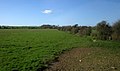
 Farmland North of Sherborne - geograph.org.uk - 3267310.jpg 3,888 × 2,592; 3.82 MB
-
 Fields near Lower Clatcomb Farm - geograph.org.uk - 5936442.jpg 5,202 × 3,465; 3.84 MB
-
 Flags in the garden - geograph.org.uk - 1890925.jpg 1,600 × 1,200; 724 KB
-
 Footbridge on Horsecastles Lane - geograph.org.uk - 6033215.jpg 1,024 × 816; 164 KB
-
 Footbridge over A30, by-passing Sherborne - geograph.org.uk - 4831395.jpg 1,600 × 1,279; 260 KB
-
 Former HSBC Bank, Sherborne - geograph.org.uk - 5883610.jpg 1,600 × 1,194; 328 KB
-
 Gardens off Newland - geograph.org.uk - 3609565.jpg 1,024 × 666; 857 KB
-
 Gas House Hill, Sherborne - geograph.org.uk - 4475965.jpg 800 × 546; 157 KB
-
 Gateway to the water meadow - geograph.org.uk - 3989215.jpg 2,304 × 1,704; 1.56 MB
-
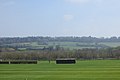
 Gryphon School Sports Field - geograph.org.uk - 3225841.jpg 3,888 × 2,592; 2.04 MB
-
 Half Moon Street - geograph.org.uk - 5705968.jpg 1,024 × 753; 146 KB
-
 Honeycombe Farm Level Crossing - geograph.org.uk - 3208749.jpg 3,648 × 2,736; 2.31 MB
-
 Hound Street (geograph 5755469).jpg 4,032 × 3,024; 2.81 MB
-
 Houses in Hound Street - geograph.org.uk - 5373661.jpg 640 × 427; 90 KB
-
 Houses on Coldharbour - geograph.org.uk - 5373653.jpg 640 × 427; 79 KB
-
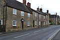
 Houses, Long Street, Sherborne - geograph.org.uk - 5883571.jpg 1,600 × 1,194; 450 KB
-
 In case of flooding - geograph.org.uk - 3989219.jpg 2,304 × 1,704; 1.75 MB
-
 Iron lattice - geograph.org.uk - 3989201.jpg 1,704 × 2,304; 2.14 MB
-
 Junction and traffic lights on Yeovil Road - geograph.org.uk - 6033223.jpg 1,024 × 746; 127 KB
-
 Junction of Cheap Street and Half Moon Street (geograph 7439981).jpg 683 × 1,024; 818 KB
-
 Keep the noise down too - geograph.org.uk - 3989187.jpg 2,304 × 1,704; 1.78 MB
-
 Ladies bowling tournament - Sherborne - geograph.org.uk - 1321758.jpg 640 × 480; 107 KB
-

-
 Lane to Lenthay Dairy House - geograph.org.uk - 1454057.jpg 640 × 480; 216 KB
-
 Lenthay Common - geograph.org.uk - 3473886.jpg 640 × 378; 46 KB
-

-
 Letting the grass grow - geograph.org.uk - 3989339.jpg 1,704 × 2,304; 1.89 MB
-
 Lonely! in need of a dance companion. (4660572829).jpg 2,451 × 3,631; 5.63 MB
-
 Look in to my orange eyes! (4660582713).jpg 3,141 × 2,232; 4.06 MB
-
 Looking across Kitt Hill (A30) - geograph.org.uk - 3455197.jpg 975 × 717; 131 KB
-
 Looking west near the edge of Sherborne - geograph.org.uk - 1899625.jpg 640 × 480; 184 KB
-
 MacMillan Way - geograph.org.uk - 5936445.jpg 5,202 × 3,465; 3.63 MB
-
 Macmillan Way at Sandford Orcas Road - geograph.org.uk - 5936473.jpg 5,202 × 3,465; 4.8 MB
-
 Mallard rushes through Sherborne - geograph.org.uk - 3390594.jpg 640 × 480; 57 KB
-
 Market day, Sherborne - geograph.org.uk - 2817351.jpg 640 × 516; 101 KB
-
 Marshy haven - geograph.org.uk - 3989234.jpg 1,704 × 2,304; 2.05 MB
-
 Mechanical digger on Babylon Hill, Sherborne - geograph.org.uk - 5707293.jpg 2,048 × 1,536; 1.61 MB
-
 Mechanical digger on Babylon Hill, Sherborne - geograph.org.uk - 5707294.jpg 2,012 × 1,488; 1.56 MB
-
-

-
 New Road, Sherborne - geograph.org.uk - 4475978.jpg 800 × 600; 191 KB
-
 Newland (geograph 7439912).jpg 1,024 × 683; 785 KB
-
 Newland North car park - geograph.org.uk - 5755430.jpg 4,032 × 3,024; 3.28 MB
-
 Newland, Sherborne - geograph.org.uk - 5705972.jpg 1,024 × 768; 175 KB
-
 Newland, Sherborne - geograph.org.uk - 5755422.jpg 4,032 × 3,024; 2.7 MB
-
 No Hawkers - geograph.org.uk - 3989422.jpg 1,704 × 2,304; 1.89 MB
-
 No.34067 'Tangmere' - geograph.org.uk - 4280698.jpg 4,000 × 2,999; 7.31 MB
-
 Offices on Cheap Street - geograph.org.uk - 5677564.jpg 1,024 × 753; 178 KB
-
 Old and new, car or bike^ - geograph.org.uk - 3979209.jpg 2,304 × 1,704; 1.62 MB
-
 Old Barn Framing Gallery, Sherborne - geograph.org.uk - 6033211.jpg 1,024 × 788; 169 KB
-
-
 Old sign near Sherborne Railway Station - geograph.org.uk - 2016038.jpg 2,736 × 3,648; 1.97 MB
-
 Ordnance Survey Drawings - Sherborne (OSD 53).jpg 4,000 × 2,703; 4 MB
-
 Ordnance Survey One-Inch Sheet 130 Yeovil & Blandford, Published 1919.jpg 11,555 × 8,414; 42.77 MB
-
 Ordnance Survey One-Inch Sheet 178 Dorchester, Published 1945.jpg 8,196 × 9,562; 11.16 MB
-
 Ordnance Survey One-Inch Sheet 178 Dorchester, Published 1960.jpg 8,580 × 10,678; 19.11 MB
-
 Ordnance Survey One-Inch Sheet 178 Dorchester, Published 1970.jpg 11,068 × 13,196; 58.61 MB
-
 Outskirts of Sherborne - geograph.org.uk - 2593384.jpg 640 × 480; 77 KB
-
 Overgrown Bandstand, Pageant Gardens - geograph.org.uk - 3208768.jpg 3,248 × 2,460; 2.27 MB
-
 Oxycera rara, female. Four-barred Major (42639639795).jpg 1,875 × 1,811; 703 KB
-
 Oxycera rara, female. Four-barred Major (43544901821).jpg 1,986 × 1,770; 720 KB
-

-
 Pageant Gardens bandstand, Sherborne - geograph.org.uk - 4479664.jpg 800 × 627; 196 KB
-
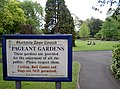
 Pageant Gardens, entrance and information sign, Sherborne - geograph.org.uk - 2019245.jpg 3,648 × 2,736; 2.15 MB
-
 Pageant Gardens, Sherborne - geograph.org.uk - 4479647.jpg 800 × 534; 133 KB
-
 Pageant Park - geograph.org.uk - 3989264.jpg 2,304 × 1,704; 1.63 MB
-
 Parking Of Cycles Prohibited - geograph.org.uk - 5883587.jpg 1,600 × 1,194; 436 KB
-
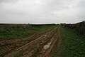
 Path to Lower Clatcomb farm - geograph.org.uk - 5936431.jpg 5,202 × 3,465; 4.14 MB
-
 Path to the Cemetery Gate - geograph.org.uk - 5705960.jpg 1,024 × 768; 236 KB
-
 Perlieu Meadow - geograph.org.uk - 3989226.jpg 2,304 × 1,704; 1.8 MB
-
 Peter Wilson's Gold Postbox, Sherborne - geograph.org.uk - 5883598.jpg 894 × 1,204; 155 KB
-
 Pharmacy sign - geograph.org.uk - 5883607.jpg 1,600 × 1,194; 174 KB
-
 Plaque, gold postbox - geograph.org.uk - 5883602.jpg 1,600 × 1,194; 326 KB
-

-
 Playing fields, Sherborne - geograph.org.uk - 4463561.jpg 800 × 533; 119 KB
-
 Popes seat (2867501382).jpg 1,135 × 763; 209 KB
-
 Postbox, Long Street, Sherborne - geograph.org.uk - 5883569.jpg 783 × 1,024; 162 KB
-
 Protected verge, New Road, Sherborne - geograph.org.uk - 4474079.jpg 800 × 664; 164 KB
-

-
 Public Footpath Sherborne, Dorset - geograph.org.uk - 2015751.jpg 3,648 × 2,736; 2.02 MB
-
 Purlieu Meadow, Sherborne - geograph.org.uk - 4475989.jpg 800 × 600; 160 KB
-
 Quarr Lane - geograph.org.uk - 1561537.jpg 480 × 640; 150 KB
-
 Quarr Lane in winter, Sherborne - geograph.org.uk - 4355187.jpg 640 × 480; 118 KB
-
 Quarr Lane Park - geograph.org.uk - 5936418.jpg 4,712 × 2,784; 2.37 MB
-
 Quarr Lane, near Sherborne - geograph.org.uk - 5936422.jpg 5,202 × 3,465; 4.74 MB
-
 Quarr Lane, Sherborne - geograph.org.uk - 5936406.jpg 5,202 × 3,465; 3.26 MB
-
 Rail Tracks near Sherborne - geograph.org.uk - 4302538.jpg 3,648 × 2,736; 5.37 MB
-

-

-

-

-
 Raising the battlements - geograph.org.uk - 3990375.jpg 1,704 × 2,304; 1.71 MB
-
 Red Hole Lane - geograph.org.uk - 2813762.jpg 640 × 480; 79 KB
-
 Ridgeway, Sherborne - geograph.org.uk - 4463580.jpg 800 × 533; 211 KB
-
 River Yeo, Sherborne - geograph.org.uk - 4479725.jpg 800 × 652; 197 KB
-
 Road sign near Sherborne Railway Station - geograph.org.uk - 2019224.jpg 2,736 × 3,648; 1.92 MB
-
 Road to Lenthay Dairy - geograph.org.uk - 2333269.jpg 640 × 480; 137 KB
-
 Road works on Babylon Hill, Sherborne - geograph.org.uk - 5707292.jpg 1,956 × 1,404; 1.62 MB
-
 Sandford Orcas Road - geograph.org.uk - 1561529.jpg 640 × 472; 130 KB
-
 Seventeenth century houses at Castleton - geograph.org.uk - 5706016.jpg 1,024 × 768; 198 KB
-
 Shady park - geograph.org.uk - 3989270.jpg 2,304 × 1,704; 1.72 MB
-
 Shall we dance? (4660577673).jpg 3,579 × 2,592; 3.94 MB
-
 Sherborne - geograph.org.uk - 4281609.jpg 4,000 × 2,666; 7.89 MB
-
 Sherborne - geograph.org.uk - 4281611.jpg 3,932 × 2,621; 7.17 MB
-
 Sherborne - geograph.org.uk - 4281631.jpg 3,986 × 2,657; 6.65 MB
-
 Sherborne - geograph.org.uk - 4700240.jpg 3,264 × 2,448; 1.7 MB
-
 Sherborne - geograph.org.uk - 5154068.jpg 3,264 × 2,448; 2.33 MB
-
 Sherborne Abbey - geograph.org.uk - 6156234.jpg 3,264 × 2,448; 2.26 MB
-
 Sherborne Abbey - geograph.org.uk - 6181839.jpg 1,600 × 1,200; 652 KB
-
 Sherborne Abbey - geograph.org.uk - 6448764.jpg 1,799 × 1,199; 386 KB
-
 Sherborne Abbey, 1962 – 1 - geograph.org.uk - 6457954.jpg 838 × 1,280; 389 KB
-
 Sherborne Abbey, 1962 – 2 - geograph.org.uk - 6457955.jpg 837 × 1,280; 518 KB
-
 Sherborne Abbey, 1962 – 3 - geograph.org.uk - 6457958.jpg 840 × 1,280; 401 KB
-
 Sherborne Abbey, 1962 – 4 - geograph.org.uk - 6457962.jpg 797 × 1,280; 279 KB
-
 Sherborne Abbey, 1962 – 5 - geograph.org.uk - 6457964.jpg 834 × 1,280; 381 KB
-
 Sherborne Abbey, 1962 – 6 - geograph.org.uk - 6457966.jpg 822 × 1,280; 397 KB
-
 Sherborne Abbey, 1962 – 7 - geograph.org.uk - 6457967.jpg 836 × 1,280; 397 KB
-
 Sherborne Abbey, 1962 – 8 - geograph.org.uk - 6457970.jpg 835 × 1,280; 333 KB
-
 Sherborne Abbey, churchyard and cross - geograph.org.uk - 6181836.jpg 1,600 × 1,200; 528 KB
-
 Sherborne buildings (2) (geograph 7536087).jpg 4,104 × 3,078; 3.18 MB
-
 Sherborne buildings (5) (geograph 7536098).jpg 3,955 × 2,966; 2.48 MB
-
 Sherborne buildings (7) (geograph 7536114).jpg 2,731 × 3,642; 1.89 MB
-
 Sherborne Crossing - geograph.org.uk - 4481168.jpg 800 × 600; 176 KB
-
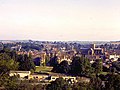 Sherborne from The Terrace - geograph.org.uk - 3493210.jpg 640 × 480; 68 KB
-
 Sherborne houses (3) (geograph 7537079).jpg 3,240 × 4,320; 4.72 MB
-
 Sherborne Library Memorial Bench.jpg 3,727 × 2,409; 2.05 MB
-
 Sherborne Library.jpg 4,032 × 3,024; 3.05 MB
-
 Sherborne Post Office - geograph.org.uk - 5883595.jpg 1,600 × 1,194; 329 KB
-
 Sherborne Station - geograph.org.uk - 6181829.jpg 1,600 × 1,200; 619 KB
-
 Sherborne Town FC - geograph.org.uk - 561541.jpg 640 × 425; 66 KB
-
 Sherborne Valley junction - geograph.org.uk - 561474.jpg 640 × 425; 126 KB
-
 Sherborne, Cheap Street - geograph.org.uk - 5793409.jpg 1,600 × 1,096; 677 KB
-
 Sherborne, Long Street - geograph.org.uk - 4700234.jpg 3,264 × 2,448; 1.65 MB
-
 Sherborne, Newland Garden - geograph.org.uk - 4072220.jpg 640 × 480; 111 KB
-
 Sherborne, Pageant Gardens - geograph.org.uk - 3120123.jpg 900 × 596; 718 KB
-
 Sherborne, Pageant Gardens - geograph.org.uk - 3904362.jpg 640 × 480; 108 KB
-

-
 Sherborne, The London Line - geograph.org.uk - 2932623.jpg 900 × 596; 634 KB
-
 Sherborne, The Old School Rooms - geograph.org.uk - 4700253.jpg 3,264 × 2,448; 2.48 MB
-
 Silverlake Farm - geograph.org.uk - 2593374.jpg 640 × 480; 103 KB
-
 Sleeping piglets (4661216366).jpg 3,888 × 2,592; 4.59 MB
-
 SLOW on New Road, Sherborne - geograph.org.uk - 4474122.jpg 800 × 738; 164 KB
-
 Small water fall (2867498652).jpg 763 × 1,144; 203 KB
-
 Small water feature - geograph.org.uk - 3989266.jpg 2,304 × 1,704; 1.65 MB
-
 South Street - geograph.org.uk - 5677621.jpg 1,024 × 768; 184 KB
-
 South Street, Sherborne - geograph.org.uk - 6181832.jpg 1,024 × 768; 170 KB
-
 St George's Day scouts parade - geograph.org.uk - 5755465.jpg 4,032 × 3,024; 2.91 MB
-
 St Paul's Green - geograph.org.uk - 3224616.jpg 3,648 × 2,736; 2.9 MB
-
 Tadpoles by the bucketload - geograph.org.uk - 3989243.jpg 2,304 × 1,704; 1.46 MB
-
 The Green - Sherborne - geograph.org.uk - 6448772.jpg 1,802 × 1,201; 386 KB
-
 The Gryphon school sport pitches - geograph.org.uk - 561477.jpg 640 × 425; 44 KB
-
 The north side of The Green, Sherborne - geograph.org.uk - 5546586.jpg 1,024 × 768; 182 KB
-
-
-

-

-

-

-

-
-

-

-
 The other end of the artwork fence - geograph.org.uk - 980150.jpg 640 × 480; 83 KB
-
 The Pageant Gardens - geograph.org.uk - 3406289.jpg 640 × 480; 107 KB
-
 The Pear Tree, Half Moon St, Sherborne - geograph.org.uk - 5936385.jpg 5,202 × 3,465; 2.85 MB
-
 The Quarr Local Nature Reserve - geograph.org.uk - 2812846.jpg 1,704 × 2,272; 2.28 MB
-
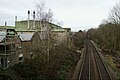
 The railway line to Salisbury and Waterloo - geograph.org.uk - 5706012.jpg 1,024 × 768; 291 KB
-
-
 Track Near Trent Path Lane - geograph.org.uk - 3268943.jpg 3,648 × 2,736; 2.78 MB
-
 Track to Trent Path Lane - geograph.org.uk - 4730987.jpg 640 × 469; 90 KB
-
 Trent Path Lane - geograph.org.uk - 5322074.jpg 427 × 640; 33 KB
-
 Trent Path Lane, looking Souteastwards. - geograph.org.uk - 5939227.jpg 5,202 × 3,465; 2.59 MB
-
 Turning the arm over - geograph.org.uk - 3989416.jpg 2,304 × 1,704; 1.37 MB
-
 Undergoing renovation - geograph.org.uk - 5706003.jpg 1,024 × 768; 179 KB
-
 View from New Road B3145 - geograph.org.uk - 6181817.jpg 1,024 × 768; 158 KB
-
 View from Raleigh's Seat - geograph.org.uk - 6181860.jpg 1,600 × 1,200; 488 KB
-
 View North from Sherborne Hill - geograph.org.uk - 1180203.jpg 640 × 445; 86 KB
-
 View of road from Raleigh's Seat, Sherborne Castle - geograph.org.uk - 5174935.jpg 3,648 × 2,736; 3.82 MB
-
 View Southwestwards from Macmillan Way (Quarr Lane) - geograph.org.uk - 5936452.jpg 5,202 × 3,465; 2.47 MB
-
 View Towards Sherborne Old Castle - geograph.org.uk - 4280764.jpg 4,000 × 2,666; 6.6 MB
-
 View towards the south end of South Street - geograph.org.uk - 5705999.jpg 1,024 × 768; 147 KB
.jpg)


.jpg)


.jpg)


.jpg)


.jpg)
.jpg)
_-_geograph.org.uk_-_3455197.jpg)


.jpg)


.jpg)


.jpg)
.jpg)


.jpg)


.jpg)


_(geograph_7536087).jpg)
_(geograph_7536098).jpg)
_(geograph_7536114).jpg)


_(geograph_7537079).jpg)


.jpg)

.jpg)


_-_geograph.org.uk_-_3153983.jpg)
_-_geograph.org.uk_-_3154004.jpg)
_-_geograph.org.uk_-_3154019.jpg)
_-_geograph.org.uk_-_3154037.jpg)
_-_geograph.org.uk_-_3154058.jpg)
_-_geograph.org.uk_-_3154067.jpg)
_-_geograph.org.uk_-_3154083.jpg)
_-_geograph.org.uk_-_3154096.jpg)
_-_geograph.org.uk_-_3155040.jpg)


_-_geograph.org.uk_-_5936452.jpg)

