Category:Shercock
human settlement  | |||||
| Upload media | |||||
| Instance of | |||||
|---|---|---|---|---|---|
| Location | County Cavan, Ulster, Ireland | ||||
 | |||||
English: Shercock is a small town situated in the east of County Cavan, Ireland. The current population of the town is around 700 people with almost triple this amount in the surrounding areas.
Slovenčina: Shercock ( ír. Searcóg) je malé mesto v severovýchodnej časti Írska, v grófstve Cavan. Žije tu 461 obyvateľov (2006).
Media in category "Shercock"
The following 36 files are in this category, out of 36 total.
-

-

-
 Bush Island - geograph.org.uk - 5574018.jpg 640 × 480; 230 KB
-
 Church Street, Shercock - geograph.org.uk - 2661071.jpg 1,024 × 763; 124 KB
-
 Cootehill Road, Shercock - geograph.org.uk - 3236270.jpg 1,024 × 767; 133 KB
-
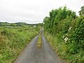 Country road, Drumad, Co. Cavan - geograph.org.uk - 863667.jpg 640 × 480; 96 KB
-
 Duffy's Costcutter Store at Shercock - geograph.org.uk - 5011416.jpg 3,674 × 2,463; 4.86 MB
-
 Empty store in Main Street - geograph.org.uk - 5011666.jpg 3,984 × 2,978; 3.97 MB
-
 Former restaurant for sale in Main Street, Shercock - geograph.org.uk - 5011684.jpg 3,163 × 2,304; 2.87 MB
-
 Junction of the R162 and the Canningstown Road at Shercock - geograph.org.uk - 5011413.jpg 3,850 × 2,572; 5.36 MB
-

-
 Launching slip area at Shercock Marina - geograph.org.uk - 3236262.jpg 1,024 × 768; 109 KB
-
 Launching slip on Lough Sillan - geograph.org.uk - 5010944.jpg 2,509 × 1,778; 1.7 MB
-
 Lough Sillan from the R162 - geograph.org.uk - 2661105.jpg 1,024 × 768; 93 KB
-
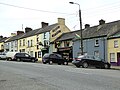
 Main Street, Shercock - geograph.org.uk - 2644195.jpg 1,024 × 645; 110 KB
-
 Main Street, Shercock - geograph.org.uk - 5574022.jpg 640 × 480; 250 KB
-
 Methodist Chapel, Shercock, Co. Cavan - geograph.org.uk - 933136.jpg 640 × 480; 80 KB
-

-
 New housing estate off the R178 at Shercock - geograph.org.uk - 5011712.jpg 1,753 × 1,393; 1.61 MB
-
 Newly built houses in Englewood Drive, Shercock - geograph.org.uk - 5011709.jpg 3,054 × 1,756; 1.88 MB
-
 Plaque on Methodist Chapel, Shercock - geograph.org.uk - 933145.jpg 640 × 480; 135 KB
-
 Plaque on St. Patrick's Church, Shercock - geograph.org.uk - 933124.jpg 640 × 480; 100 KB
-
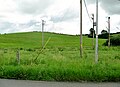 Power lines on the outskirts of Shercock - geograph.org.uk - 5038945.jpg 3,842 × 2,778; 4.19 MB
-
 Shercock Credit Union, Main Street, Shercock - geograph.org.uk - 5011420.jpg 3,986 × 2,982; 5.35 MB
-
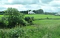
 Shercock, Co. Cavan - geograph.org.uk - 933102.jpg 640 × 480; 65 KB
-
 Small jetty on Lough Sillan - geograph.org.uk - 5574016.jpg 640 × 480; 274 KB
-
 St Patrick's Church, Shercock - geograph.org.uk - 5011106.jpg 2,332 × 1,339; 1.39 MB
-
 St Patrick's Roman Catholic Church, Shercock - geograph.org.uk - 2661095.jpg 1,024 × 661; 107 KB
-

-
-
 The junction of the R178 and R162 in Main Street, Shercock - geograph.org.uk - 5011699.jpg 1,863 × 2,269; 1.96 MB
-

-

-
 The upper end of Coothill Road, Shercock - geograph.org.uk - 2644187.jpg 1,024 × 686; 127 KB
-
 Track at eastern end of Lough Sillan - geograph.org.uk - 5574026.jpg 640 × 480; 460 KB
-
 View West along Main Street, Shercock - geograph.org.uk - 5011687.jpg 2,667 × 1,998; 2.39 MB


