Category:Shichinohe, Aomori
日本語: 日本国青森県上北郡七戸町に関するカテゴリ。
town in Kamikita district, Aomori prefecture, Japan     | |||||
| Upload media | |||||
| Instance of | |||||
|---|---|---|---|---|---|
| Location | Kamikita district, Aomori Prefecture, Japan | ||||
| Legal form |
| ||||
| Inception |
| ||||
| Population |
| ||||
| Area |
| ||||
| Replaces |
| ||||
| official website | |||||
 | |||||
Subcategories
This category has the following 15 subcategories, out of 15 total.
E
- Einodaigakko-mae Station (1 F)
F
H
- Hakkōda Tunnel (2 F)
M
- Michinoeki Shichinohe (5 F)
- Michinokami Station (1 F)
- Michinoku Toll Road (5 F)
- Moritabokujo-mae Station (1 F)
N
- Nakano Station (Aomori) (2 F)
S
- Shichinohe Castle (3 F)
- Shichinohe-Towada Station (25 F)
T
- Temmabayashi Station (1 F)
- Tsubogawa Station (Aomori) (2 F)
U
- Ushirotai Station (2 F)
Media in category "Shichinohe, Aomori"
The following 53 files are in this category, out of 53 total.
-
 Aomori Countryside 2010 (4723201476).jpg 1,728 × 3,072; 2.2 MB
-
 Aomori Prefectural Shichinohe High School 1.jpg 5,023 × 3,713; 3.72 MB
-
 Chubu Kamikita Fire Department 1.jpg 5,184 × 3,888; 4.33 MB
-
 Emblem of Shichinohe, Aomori (1971–2005).svg 500 × 500; 1 KB
-
 Emblem of Shichinohe, Aomori.svg 403 × 353; 2 KB
-
 Emblem of Tenmabayashi, Aomori (1961–2005).svg 512 × 444; 2 KB
-
 Flag of Shichinohe Aomori.JPG 237 × 157; 7 KB
-
 Flag of Shichinohe Aomori.svg 2,560 × 1,707; 5 KB
-
 Flag of Shichinohe, Aomori (1971–2005).png 1,036 × 664; 33 KB
-
 Flag of Shichinohe, Aomori (1971–2005).svg 324 × 216; 4 KB
-
 Flag of Tenmabayashi Aomori.png 347 × 200; 4 KB
-
 Flag of Tenmabayashi, Aomori (1961–2005).svg 324 × 216; 4 KB
-
 Former Shichinohe Aomori chapter.JPG 260 × 255; 19 KB
-
 JP-Network Shichinohe-84005.jpg 2,048 × 1,536; 646 KB
-
 JP-Network Tenmabayashi-84118.jpg 2,048 × 1,536; 676 KB
-
 Kamikita District in Aomori Prefecture.png 1,081 × 801; 38 KB
-
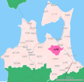 Location of Shichinohe town, Aomori prefecture, Japan.svg 779 × 755; 16 KB
-
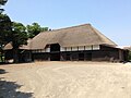 Morita bokujo magariya.jpg 1,000 × 750; 128 KB
-
 Morita bokujo nigou kyuusha.jpg 1,000 × 750; 216 KB
-
 NanbuJyuukann Line 4 19970326.jpg 3,089 × 2,048; 2.5 MB
-
 Nannbujyuukann.JPG 2,368 × 1,776; 759 KB
-
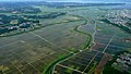 Paddy fields in Aomori Prefecture (3646592676).jpg 3,054 × 1,718; 1.93 MB
-
 Population distribution of Shichinohe, Aomori, Japan.svg 512 × 256; 22 KB
-
 Shichinohe Aomori chapter.JPG 210 × 200; 10 KB
-
 Shichinohe in Aomori Prefecture Ja.svg 800 × 770; 30 KB
-
 Shichinohe in Aomori Prefecture.png 1,081 × 801; 38 KB
-
 Shichinohe Police Station 1.jpg 3,975 × 2,948; 1.95 MB
-
 Shichinohe Police Station.JPG 2,816 × 2,112; 1.56 MB
-
 Shichinohe Public Hospital 1.jpg 5,184 × 3,888; 5.11 MB
-
 Shichinohe Sports Park.jpg 1,561 × 1,004; 611 KB
-
 Shichinohe staion old and new.png 520 × 684; 9 KB
-
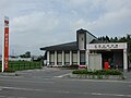
 Shichinohe tourist center 20200717.jpg 1,210 × 908; 338 KB
-
 Shichinohe tourist center.JPG 1,600 × 1,200; 331 KB
-
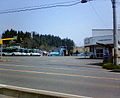
 Shichinohe, Aomori (3646590004).jpg 3,328 × 1,872; 3.04 MB
-
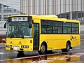 Shichinohe-town-bus-91.jpg 1,024 × 765; 227 KB
-
 ShichinoheTownOffice-Shichinohe.jpg 2,048 × 1,536; 636 KB
-
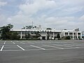 ShichinoheTownOffice.jpg 2,048 × 1,536; 678 KB
-
 Sueki-MorigaswaIseki.jpg 288 × 220; 45 KB
-
 Tenmabayashi Aomori chapter.JPG 326 × 283; 20 KB
-
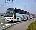 TohokuToshiKotsu U-MS729S.jpg 352 × 288; 25 KB
-
 TowadaKanko ERGAmio OriginalColor Shichinohe.jpg 352 × 288; 29 KB
-
 TowadaKanko Shichinohe.jpg 352 × 288; 23 KB
-
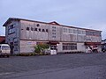
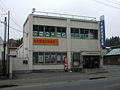 TowadaShinkinBank Shichinohe-014.jpg 2,048 × 1,536; 654 KB
-

-

-

-

-
 Vending 2006 Japan (196705712).jpg 3,840 × 2,160; 1,006 KB
-
 イオン七戸ショッピングセンター(仮称) - panoramio.jpg 4,752 × 3,168; 1.48 MB
-
 七戸十和田駅周辺の風景 - panoramio (1).jpg 4,752 × 3,168; 1.15 MB
-
 七戸十和田駅周辺の風景 - panoramio.jpg 4,752 × 3,168; 1.28 MB
-
 地図-青森県七戸町-2006.png 389 × 260; 7 KB
-
 青森県立七戸高等学校八甲田校舎 Jun 15, 2006.jpg 3,840 × 2,160; 1.56 MB
.jpg)


.svg)
.svg)

.png)
.svg)

.svg)


.jpg)


.jpg)


.jpg)

.jpg)


