Category:Shirenewton
| Object location | | View all coordinates using: OpenStreetMap |
|---|
village and community in Monmouthshire, Wales, UK  Eglwys Sant Thomas a Becket, Drenewydd Gelli-farch | |||||
| Upload media | |||||
| Instance of | |||||
|---|---|---|---|---|---|
| Location | Monmouthshire, Wales | ||||
 | |||||
Cymraeg: Pentref a chymuned yn Sir Fynwy yw Drenewydd Gelli-farch (Cyfeirnod OS: ST4793), weithiau Trenewydd Gelli-farch (Saesneg: Shirenewton). Ceir 'Gelli-farch' arall ger 'Cilfrew' ym Morgannwg, dyna pam y tyfodd yr enw 'Drenewydd' i wahaniaethu'r ddau. Lle coediog ydy 'gelli' ac mae'r ardal yn dal i fod yn gyfoethog ei goed.
English: Shirenewton is a village in Monmouthshire, south east Wales, UK. It is located 3 miles due west of Chepstow, 5 miles (8km) by road. The village stands around 500 feet (154 m) above sea level, and has extensive views of the Severn Estuary and Bristol Channel.
Subcategories
This category has the following 4 subcategories, out of 4 total.
Media in category "Shirenewton"
The following 200 files are in this category, out of 226 total.
(previous page) (next page)-
 2010 Wales Monmouthshire Community Shirenewton map.svg 512 × 682; 699 KB
-
 2024 Wales Monmouthshire Community Shirenewton map.svg 512 × 682; 603 KB
-
 A rather un-loved-looking footpath, near Shirenewton - geograph.org.uk - 4238599.jpg 2,560 × 1,920; 2.16 MB
-
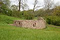 A restored ruin - geograph.org.uk - 4240651.jpg 1,600 × 1,064; 709 KB
-
 Across the fields to Springfield Farm - geograph.org.uk - 5898409.jpg 1,600 × 900; 634 KB
-
 Alpacas at Goytre Farm - geograph.org.uk - 5898396.jpg 1,600 × 1,200; 926 KB
-

-
 Argoed Farm near Earlswood - geograph.org.uk - 3179089.jpg 640 × 407; 82 KB
-
 Autumn colours on Itton Road, Howick, near Chepstow - geograph.org.uk - 5970026.jpg 4,000 × 3,000; 5.03 MB
-
 Autumn scene along the road from Mynydd-bach to Itton - geograph.org.uk - 4238589.jpg 2,560 × 1,920; 2.21 MB
-
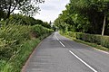
 B4235 at Ross's Wood - geograph.org.uk - 5810448.jpg 1,024 × 768; 180 KB
-
 B4235 from Gaerllwyd towards Usk - geograph.org.uk - 5718358.jpg 800 × 695; 158 KB
-
 B4235 near Coppice Mawr - geograph.org.uk - 5810450.jpg 1,024 × 768; 204 KB
-
 B4235 nears The Carpenters Arms, Mynydd-bach - geograph.org.uk - 5810449.jpg 1,024 × 715; 123 KB
-
 B4235 south of Gove Wood - geograph.org.uk - 5810439.jpg 1,024 × 768; 215 KB
-
 B4235 west of Bullyhole Bottom - geograph.org.uk - 5810434.jpg 1,024 × 769; 201 KB
-

-

-

-
 Bridge over the weir at Coppice Mawr - geograph.org.uk - 6225530.jpg 4,032 × 2,268; 6.9 MB
-
 Brynawel, Earlswood - geograph.org.uk - 2505992.jpg 640 × 531; 107 KB
-
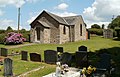
 Bus shelter and chapel - geograph.org.uk - 3188724.jpg 1,024 × 680; 231 KB
-

-

-
 Cadira Beeches - geograph.org.uk - 3195256.jpg 1,024 × 680; 337 KB
-
 Carpenters Arms, Mynydd-Bach - geograph.org.uk - 2251306.jpg 640 × 480; 99 KB
-
 Castrogi Brook in spate - geograph.org.uk - 4238654.jpg 2,560 × 1,920; 2.07 MB
-
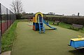 Children's play area in Shirenewton - geograph.org.uk - 5652529.jpg 800 × 520; 79 KB
-
 Church of St Thomas A Becket - geograph.org.uk - 4240021.jpg 1,600 × 1,064; 502 KB
-

-
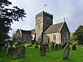 Church of St Thomas Becket, Shirenewton - geograph.org.uk - 3832493.jpg 2,560 × 1,920; 2.05 MB
-
 Churchyard, St Thomas A Becket, Shirenewton - geograph.org.uk - 2027592.jpg 1,496 × 1,122; 871 KB
-
 Clearfell in Wentwood - geograph.org.uk - 5864695.jpg 1,600 × 1,200; 1.08 MB
-
 Clearview, Shirenewton - geograph.org.uk - 3185230.jpg 640 × 494; 110 KB
-

-

-

-
 Cock-a-Roosting postbox, Earlswood - geograph.org.uk - 2506819.jpg 640 × 556; 100 KB
-
 Cock-a-Roosting, Earlswood - geograph.org.uk - 2506785.jpg 640 × 488; 96 KB
-
 Corner of Blethyn Close, Mynydd-bach - geograph.org.uk - 3184868.jpg 640 × 551; 83 KB
-

-
 Country lane opposite Shepherd's Cottage - geograph.org.uk - 5898314.jpg 1,600 × 1,200; 977 KB
-
 Country lane, Earlswood - geograph.org.uk - 2506547.jpg 640 × 480; 94 KB
-
 Country road near Pen-y-Cae-Mawr - geograph.org.uk - 3193774.jpg 1,024 × 680; 290 KB
-
 Crick Road cottages, Shirenewton - geograph.org.uk - 3179061.jpg 640 × 606; 119 KB
-

-

-
-

-
-
 Entrance and drive, Pen-y-Cae-Mawr - geograph.org.uk - 3193771.jpg 1,024 × 680; 236 KB
-
 Entrance to Coombe Farm - geograph.org.uk - 3311348.jpg 640 × 480; 101 KB
-

-
 Evening sunshine at Mynydd-bach, Shirenewton - geograph.org.uk - 2061355.jpg 1,600 × 1,200; 747 KB
-

-
 Farmland at Earlswood - geograph.org.uk - 3191178.jpg 1,024 × 680; 339 KB
-
 Field near Pen-y-Cae-Mawr - geograph.org.uk - 3193770.jpg 1,024 × 680; 260 KB
-
 Field of recently-cut haylage - geograph.org.uk - 5898319.jpg 1,600 × 900; 566 KB
-
 Field, wood and Crossway Farm - geograph.org.uk - 4274638.jpg 800 × 600; 164 KB
-
 Five Bells, Shirenewton - geograph.org.uk - 5652703.jpg 800 × 600; 119 KB
-
 Footbridge over the Castrogi Brook - geograph.org.uk - 4238658.jpg 2,516 × 1,887; 1.98 MB
-
 Footpath going south towards Golden Valley - geograph.org.uk - 4240623.jpg 1,600 × 1,064; 531 KB
-
 Former coaching inn in Shirenewton - geograph.org.uk - 5652707.jpg 714 × 800; 117 KB
-
 Former police station, Shirenewton - geograph.org.uk - 3179262.jpg 640 × 514; 93 KB
-

-
 Gaerllwyd Baptist Chapel - geograph.org.uk - 4514281.jpg 800 × 600; 115 KB
-
 Gaerllwyd Farm, Gaerllwyd, Monmouthshire - geograph.org.uk - 5718338.jpg 800 × 628; 152 KB
-
 Gaerllwydd Baptist chapel - geograph.org.uk - 3294902.jpg 640 × 480; 74 KB
-
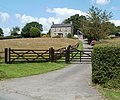
 Gates to Shirenewton Hall, Shirenewton, Monmouthshire, Wales, UK.jpg 1,600 × 1,065; 627 KB
-

-

-
 Green Lane - geograph.org.uk - 411995.jpg 640 × 480; 127 KB
-
 Hairpin bend near Shirenewton - geograph.org.uk - 3179172.jpg 640 × 480; 77 KB
-
 Hope Methodist Chapel at Earlswood - geograph.org.uk - 4427957.jpg 640 × 441; 68 KB
-
-
 Inside Llanmelin hillfort - geograph.org.uk - 3311300.jpg 640 × 480; 99 KB
-

-
 Junction for Mynydd-bach - geograph.org.uk - 3184804.jpg 640 × 514; 80 KB
-

-
 Layby in Gaerllwyd, Monmouthshire - geograph.org.uk - 5717948.jpg 724 × 800; 162 KB
-

-
 Looking along B4235 - geograph.org.uk - 1970002.jpg 4,288 × 2,848; 6.3 MB
-
 Looking along B4235 - geograph.org.uk - 1970010.jpg 4,288 × 2,848; 6.35 MB
-

-
 Milestone - 3 Miles to Chepstow - geograph.org.uk - 202813.jpg 427 × 640; 148 KB
-
 Milestone - To Chepstow 4 Miles - geograph.org.uk - 202810.jpg 640 × 480; 419 KB
-

-

-

-
 Mynders Farm near Shirenewton - geograph.org.uk - 3179135.jpg 640 × 453; 86 KB
-
 Mynydd-bach bench and picnic table - geograph.org.uk - 3185047.jpg 640 × 480; 147 KB
-
 Myrtle Cottage, Earlswood - geograph.org.uk - 2506728.jpg 640 × 480; 100 KB
-
 Narrow Lane - Old Road - geograph.org.uk - 5898406.jpg 1,600 × 1,200; 930 KB
-

-
-
 New Mill, Earlswood - geograph.org.uk - 3191176.jpg 1,024 × 680; 288 KB
-
 Newton Lodge, Shirenewton - geograph.org.uk - 3179282.jpg 640 × 472; 78 KB
-
 North along Ditch Hill Lane, Shirenewton - geograph.org.uk - 5702961.jpg 724 × 800; 117 KB
-
 Northern end of The Laurels, Mynydd-bach - geograph.org.uk - 3185023.jpg 640 × 535; 106 KB
-
 NW boundary of Shirenewton - geograph.org.uk - 3184786.jpg 640 × 578; 105 KB
-
 Oak in late autumn - geograph.org.uk - 4274640.jpg 800 × 602; 185 KB
-
 Old Oak beside footpath in Golden Valley - geograph.org.uk - 4240627.jpg 1,600 × 1,064; 454 KB
-
 Old Road at White Horse Farm - geograph.org.uk - 5898318.jpg 1,600 × 900; 513 KB
-

-
 One of many road junctions near Oxpool Farm, Earlswood - geograph.org.uk - 4238624.jpg 2,560 × 1,920; 2.11 MB
-
 Ornate entrance to Shirenewton Hall - geograph.org.uk - 3179054.jpg 640 × 516; 121 KB
-

-
 Pasture and Footpath - geograph.org.uk - 4239789.jpg 1,600 × 1,064; 479 KB
-
 Pasture near Buckwell - geograph.org.uk - 5898315.jpg 1,600 × 1,200; 1.01 MB
-
 Path To The North - geograph.org.uk - 2027861.jpg 1,496 × 1,122; 828 KB
-
-
 Public footpath across field - geograph.org.uk - 1970701.jpg 4,288 × 2,848; 6.16 MB
-
 Public footpath signpost in Shirenewton - geograph.org.uk - 5652672.jpg 800 × 652; 250 KB
-

-

-
 Recent excavation at Llanmelin hillfort - geograph.org.uk - 3311330.jpg 640 × 480; 115 KB
-
 Red House Lane 1 - geograph.org.uk - 1871276.jpg 640 × 480; 241 KB
-
 Red House Lane 2 - geograph.org.uk - 1871280.jpg 640 × 480; 233 KB
-
 Red House, Earlswood - geograph.org.uk - 2506715.jpg 640 × 575; 115 KB
-

-
 Redd Landes, Shirenewton - geograph.org.uk - 3179200.jpg 640 × 435; 78 KB
-
 Redd Landes, Shirenewton - geograph.org.uk - 5652508.jpg 800 × 600; 88 KB
-
 Right turn ahead for Mynydd-bach - geograph.org.uk - 3185164.jpg 640 × 480; 80 KB
-
 Road and path junction by Oxpool Farm, near Earlswood - geograph.org.uk - 4238621.jpg 2,560 × 1,920; 2.18 MB
-
 Road junction and sign near Gaerllwyd - geograph.org.uk - 1995841.jpg 2,048 × 1,536; 1.31 MB
-
 Road junction at Argoed Farm, near Shirenewton - geograph.org.uk - 4238608.jpg 2,560 × 1,920; 2.12 MB
-
 Road junction in Mynydd-bach, Shirenewton - geograph.org.uk - 2061348.jpg 1,600 × 1,200; 627 KB
-
 Road opposite Shepherds Cottage - geograph.org.uk - 3192271.jpg 1,024 × 680; 224 KB
-
 Road to Argoed Farm and Oxpool - geograph.org.uk - 3179084.jpg 640 × 480; 140 KB
-

-

-
 Road to the B4235 near Shirenewton - geograph.org.uk - 3179117.jpg 640 × 529; 95 KB
-
 Road to the school, Mynydd-bach, Shirenewton - geograph.org.uk - 2061361.jpg 1,600 × 1,200; 651 KB
-

-

-
 Rural Monmouthshire in late March 2018 - geograph.org.uk - 5717923.jpg 800 × 600; 150 KB
-
 Rural scene in Earlswood - geograph.org.uk - 4238671.jpg 2,560 × 1,920; 2.17 MB
-

-
 Sealed up former postbox, Mynydd-bach - geograph.org.uk - 3185112.jpg 640 × 513; 134 KB
-
 Shirenewton Church Clock Tower - geograph.org.uk - 2112389.jpg 3,088 × 2,056; 3.52 MB
-
 Shirenewton Primary School - geograph.org.uk - 3184810.jpg 640 × 369; 65 KB
-
 Shirenewton recreation area - geograph.org.uk - 3179194.jpg 640 × 448; 73 KB
-

-
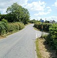
 Shirenewton road junction - geograph.org.uk - 3179067.jpg 640 × 552; 93 KB
-
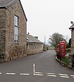
 Shirenewton telephone kiosk - geograph.org.uk - 1969992.jpg 4,288 × 2,848; 6.67 MB
-
 Shirenewton tennis court - geograph.org.uk - 5652573.jpg 800 × 600; 120 KB
-
 Shirenewton war memorial (geograph 6979986).jpg 1,600 × 1,200; 643 KB
-
 Shirenewton War Memorial - geograph.org.uk - 3179301.jpg 640 × 475; 121 KB
-

-
 Small covered reservoir near Shirenewton - geograph.org.uk - 3179127.jpg 640 × 480; 108 KB
-
 South Grove, Earlswood - geograph.org.uk - 2505952.jpg 640 × 433; 73 KB
-
 Southern boundary of Mynydd-bach - geograph.org.uk - 3185158.jpg 640 × 437; 86 KB
-
 Spout Hill, Mynydd-bach - geograph.org.uk - 3185131.jpg 640 × 480; 73 KB
-

-

-

-

-
-

-
 Stone stile into a field, near Shirenewton - geograph.org.uk - 4238602.jpg 2,560 × 1,920; 2.06 MB
-
 Stubble field and woodland - geograph.org.uk - 4274639.jpg 800 × 450; 107 KB
-

-
 Tan House pub sign, Shirenewton - geograph.org.uk - 3185199.jpg 544 × 640; 61 KB
-

-

-
 The Carpenters Arms, Mynydd-bach - geograph.org.uk - 3185089.jpg 640 × 489; 116 KB
-
 The Castrogi Brook in spate - geograph.org.uk - 3311098.jpg 640 × 480; 133 KB
-

-

-
 The Old Post Office, Shirenewton - geograph.org.uk - 5652688.jpg 800 × 466; 89 KB
-
 The Old Rectory, Shirenewton - geograph.org.uk - 3179058.jpg 640 × 437; 85 KB
-

-
 The weir in Coppice Mawr - geograph.org.uk - 6225529.jpg 4,032 × 2,268; 6.45 MB
-
 Towards Shirenewton Beacon - geograph.org.uk - 5652577.jpg 702 × 800; 169 KB
-
 Track into Wentwood - geograph.org.uk - 5864650.jpg 1,600 × 899; 873 KB
-
 Track through the rape crops - geograph.org.uk - 1871272.jpg 640 × 481; 271 KB
-
 Track through Wentwood - geograph.org.uk - 3191174.jpg 1,024 × 680; 330 KB
-
 Track towards the Five Paths - geograph.org.uk - 5864693.jpg 1,600 × 901; 775 KB
-
 Track-footpath from Home Farm Court to Shirenewton - geograph.org.uk - 3832578.jpg 2,560 × 1,920; 2.06 MB
-

-
 Tredegar Arms, Shirenewton - geograph.org.uk - 3179271.jpg 640 × 470; 80 KB
-
 Trees in Wentwood - geograph.org.uk - 3191180.jpg 1,024 × 680; 341 KB
-
 Two choices look the same, Mynydd-bach - geograph.org.uk - 3185082.jpg 640 × 592; 162 KB
-

-

-
 Unnamed lane in Shirenewton - geograph.org.uk - 5652595.jpg 800 × 607; 110 KB
-
 Up Old School Hill, Mynydd-bach - geograph.org.uk - 3185070.jpg 640 × 480; 93 KB
-
 Upper Tump Farm, Earlswood - geograph.org.uk - 2506667.jpg 640 × 480; 110 KB
-
 Usk Road junction, Mynydd-bach - geograph.org.uk - 3185139.jpg 640 × 489; 75 KB
-

-
 Valley below Wentwood - geograph.org.uk - 3188776.jpg 1,024 × 680; 245 KB
-
 View south from Golden Hill - geograph.org.uk - 1871246.jpg 640 × 480; 275 KB
-

-

-
 Warning sign - playground, Shirenewton - geograph.org.uk - 5652557.jpg 800 × 717; 125 KB
-

-

-
 Wentwood at Cadira Beeches, 1 - geograph.org.uk - 5864687.jpg 1,600 × 1,200; 1.07 MB
-
 Wentwood at Cadira Beeches, 2 - geograph.org.uk - 5864690.jpg 1,600 × 1,200; 965 KB
-
 Wentwood Forest picnic area - geograph.org.uk - 4274632.jpg 800 × 600; 165 KB


.jpg)


