Category:Shoeburyness
town and ward of Southend-on-Sea, Essex, England, UK  | |||||
| Upload media | |||||
| Instance of | |||||
|---|---|---|---|---|---|
| Location | Southend-on-Sea, Essex, East of England, England | ||||
 | |||||
Subcategories
This category has the following 20 subcategories, out of 20 total.
A
G
H
- Horseshoe Barracks (15 F)
M
P
R
- Shoeburyness railway station (31 F)
S
- Shoebury Hall, Shoeburyness (17 F)
T
- Thames Boom (13 F)
Media in category "Shoeburyness"
The following 200 files are in this category, out of 401 total.
(previous page) (next page)-
 17.10.15 2 Shoebury 1 (22258474082).jpg 6,016 × 4,000; 6.66 MB
-
 17.10.15 2 Shoebury 2 (22083300730).jpg 6,016 × 4,000; 5.7 MB
-
 17.10.15 2 Shoebury 3 (22083620568).jpg 6,016 × 4,000; 6.65 MB
-
 17.10.15 2 Shoebury 4 (21650355653).jpg 4,000 × 6,016; 5.84 MB
-
 17.10.15 2 Shoebury 5 (22281898761).jpg 6,016 × 4,000; 6.51 MB
-
 2014-09-13 13-40-24 United Kingdom England - Grain.jpg 2,848 × 4,288; 6.16 MB
-
 A cluster of turnstones, Arenaria interpres - geograph.org.uk - 6619755.jpg 2,739 × 1,825; 1.2 MB
-
 A room with a view - geograph.org.uk - 2027570.jpg 640 × 480; 79 KB
-
 Activity on the Phoenix Unit - geograph.org.uk - 6241386.jpg 4,608 × 3,456; 1.86 MB
-

-
 Admiralty Chart No 1607 Thames Estuary Southern Part, Published 1967.jpg 14,926 × 8,420; 41.66 MB
-
 Admiralty Chart No 1975 Kentish Knock and the Naze to The Nore, Published 1934.jpg 16,391 × 11,234; 44.43 MB
-

-

-

-

-

-

-

-

-
 Amenity building, Shoebury East Beach - geograph.org.uk - 5158132.jpg 640 × 480; 134 KB
-
 Angel Inn, North Shoebury - geograph.org.uk - 96106.jpg 640 × 470; 71 KB
-
 Asda, North Shoebury.jpg 600 × 450; 30 KB
-
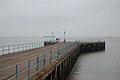
 Barge Pier - geograph.org.uk - 2027557.jpg 640 × 480; 69 KB
-
 Beach at Shoebury Ness - geograph.org.uk - 2739910.jpg 640 × 427; 48 KB
-
 Beach church service - geograph.org.uk - 1817880.jpg 640 × 428; 135 KB
-
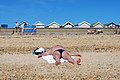
 Beach hut couple - geograph.org.uk - 3425442.jpg 1,200 × 1,600; 362 KB
-
 Beach Huts - geograph.org.uk - 439714.jpg 480 × 640; 51 KB
-
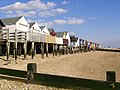
 Beach huts at Shoebury Common - geograph.org.uk - 2715004.jpg 640 × 425; 58 KB
-
 Beach huts, East Beach, Shoeburyness - geograph.org.uk - 3807054.jpg 640 × 435; 68 KB
-
 Beach Huts, Shoebury - geograph.org.uk - 575367.jpg 640 × 480; 100 KB
-
 Beach huts, Shoebury Common - geograph.org.uk - 228923.jpg 640 × 414; 45 KB
-
 Beach huts, Shoeburyness - geograph.org.uk - 5158363.jpg 640 × 480; 115 KB
-
 Beached Whale - geograph.org.uk - 1874660.jpg 640 × 427; 115 KB
-
 Beware of trains - geograph.org.uk - 2203326.jpg 1,024 × 768; 235 KB
-
 Boat moorings, Shoebury - geograph.org.uk - 575380.jpg 640 × 480; 92 KB
-
 Boundary Way, Shoeburyness - geograph.org.uk - 2741183.jpg 640 × 423; 47 KB
-
 Building base, Shoebury Old Ranges - geograph.org.uk - 4608024.jpg 640 × 480; 132 KB
-
 Captain Mannering - geograph.org.uk - 328470.jpg 414 × 640; 61 KB
-
 Captain Mannering's.jpg 1,394 × 2,048; 335 KB
-
 Captain Mannerings Pub - geograph.org.uk - 328472.jpg 640 × 480; 61 KB
-
 Car park, Shoebury Common - geograph.org.uk - 6551660.jpg 640 × 480; 43 KB
-
 Chapel Place, Shoeburyness - geograph.org.uk - 2742928.jpg 640 × 468; 65 KB
-
 Church Road, Shoeburyness - geograph.org.uk - 3929079.jpg 640 × 427; 86 KB
-
 Clerk Of Works House, Horseshoe Barracks.jpg 6,000 × 4,000; 8.82 MB
-
 Coastguard lookout station - geograph.org.uk - 4522272.jpg 3,072 × 1,728; 1.24 MB
-
 Coastguard Station at Shoeburyness - geograph.org.uk - 1175270.jpg 640 × 428; 52 KB
-
 Coastwatch on MOD firing range - geograph.org.uk - 3100630.jpg 3,000 × 1,970; 2.02 MB
-
 Coastwatch Radar at Blackgate Road - geograph.org.uk - 3100638.jpg 4,122 × 2,606; 2.14 MB
-
 Cold War defence boom, Pig's Bay, Shoeburyness - geograph.org.uk - 4778489.jpg 1,064 × 1,600; 489 KB
-
 Cook House To Rear Of Block Lm, Horseshoe Barracks.jpg 6,000 × 4,000; 10.12 MB
-
 Corner of Peel Avenue - geograph.org.uk - 4522223.jpg 3,072 × 1,728; 1.33 MB
-
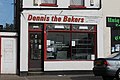 Dennis The Bakers - geograph.org.uk - 3573899.jpg 3,969 × 2,646; 4.12 MB
-
 Dinghies ^ Dunes - geograph.org.uk - 2242125.jpg 640 × 428; 52 KB
-
 Drainage Channel, Gunners Park - geograph.org.uk - 2715009.jpg 640 × 425; 82 KB
-
 Driveway 'NEAR TO' St. Mary's Close - geograph.org.uk - 308632.jpg 450 × 600; 63 KB
-
 Dunlin at Shoebury - geograph.org.uk - 4778471.jpg 1,600 × 1,064; 609 KB
-
 East Beach - geograph.org.uk - 1331189.jpg 640 × 428; 56 KB
-

-
 End of The Line - geograph.org.uk - 66789.jpg 586 × 640; 98 KB
-
 Entrance to Shoebury East Beach - geograph.org.uk - 2150404.jpg 1,024 × 682; 175 KB
-

-
 Foreshore Inspectors Office - geograph.org.uk - 3100601.jpg 4,272 × 2,848; 4.77 MB
-

-
 Former Garrison site, Shoeburyness - geograph.org.uk - 2739879.jpg 640 × 427; 49 KB
-

-
 Former school in Hinguar Street - geograph.org.uk - 6547037.jpg 640 × 480; 60 KB
-

-
 Fridel Meyer (23a).JPG 3,680 × 2,936; 874 KB
-
 Fridel Meyer (23b).jpg 3,680 × 2,936; 885 KB
-
 Fridel Meyer (24a).JPG 3,636 × 2,880; 871 KB
-
 Fridel Meyer (25a).JPG 4,000 × 3,000; 2.42 MB
-

-
 Ganesh Festival - geograph.org.uk - 2595875.jpg 3,008 × 2,000; 2.42 MB
-
 Garrison Beach - geograph.org.uk - 2596593.jpg 2,000 × 3,008; 2.63 MB
-
 Gog and foreshore - geograph.org.uk - 308602.jpg 600 × 450; 52 KB
-
 Gog's Berth - geograph.org.uk - 2715028.jpg 640 × 425; 76 KB
-
 Gog's Berth and pier at Shoebury Ness - geograph.org.uk - 4521595.jpg 1,600 × 900; 208 KB
-
 Graveyard - geograph.org.uk - 314988.jpg 450 × 600; 55 KB
-
 Groyne ^ Outfall - geograph.org.uk - 2242028.jpg 640 × 435; 59 KB
-
 Groynes - geograph.org.uk - 2027601.jpg 480 × 640; 83 KB
-
 Groynes at Shoeburyness - geograph.org.uk - 4778479.jpg 1,600 × 1,064; 406 KB
-
-
 Gunners Park - geograph.org.uk - 2242065.jpg 640 × 428; 50 KB
-

-
 Gunners Park Reserve - geograph.org.uk - 4048840.jpg 640 × 424; 47 KB
-
 Gunners Park, Shoeburyness - geograph.org.uk - 2739881.jpg 640 × 427; 55 KB
-
 Gunnery Drill Shed, Shoeburyness - geograph.org.uk - 2740208.jpg 640 × 427; 75 KB
-
 H M Coastguard station, Shoebury Ness - geograph.org.uk - 4521612.jpg 3,072 × 1,728; 1.04 MB
-
 H. M. Coastguard, Shoebury - geograph.org.uk - 308594.jpg 450 × 600; 19 KB
-
 Hazardous foreshore, Shoeburyness - geograph.org.uk - 5158348.jpg 640 × 480; 142 KB
-

-
-
 Heavy Quick Firing Battery, Shoeburyness, built 1899-1900 2.jpg 6,016 × 4,000; 9.54 MB
-
 Heavy Quick Firing Battery, Shoeburyness, built 1899-1900.jpg 6,016 × 4,000; 9.68 MB
-
 High and dry - geograph.org.uk - 1830331.jpg 640 × 427; 71 KB
-
 High tide to west side of Shoebury Ness - geograph.org.uk - 4521606.jpg 3,072 × 1,728; 1.02 MB
-
 Hinguar Primary School and Nursery - geograph.org.uk - 3202025.jpg 3,090 × 2,060; 2.5 MB
-
 Houses in Hinguar Street - geograph.org.uk - 6551706.jpg 640 × 480; 70 KB
-
 HQF Battery - geograph.org.uk - 2774686.jpg 1,838 × 1,223; 538 KB
-
 Impressive Real Estate - geograph.org.uk - 607365.jpg 640 × 414; 109 KB
-
 Interesting Stone - geograph.org.uk - 792337.jpg 480 × 640; 135 KB
-
 Joseph Mallord William Turner 033.jpg 3,176 × 2,401; 419 KB
-

-
 Kite surfers - geograph.org.uk - 1331181.jpg 640 × 427; 45 KB
-
 Kite surfers - geograph.org.uk - 2027536.jpg 640 × 480; 85 KB
-
 Land at Shoeburyness - geograph.org.uk - 23806.jpg 640 × 480; 19 KB
-

-

-
 Mast on Shoebury Common - geograph.org.uk - 6547018.jpg 480 × 640; 39 KB
-
 Ministry of Defence, Shoeburyness - geograph.org.uk - 308554.jpg 600 × 400; 32 KB
-
 MOD Barge Pier - geograph.org.uk - 2243201.jpg 3,008 × 2,000; 1.37 MB
-
 MoD Barrier across Shoebury East Beach - geograph.org.uk - 1430544.jpg 640 × 465; 132 KB
-
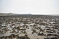
 Mudflats at low tide - geograph.org.uk - 1874657.jpg 1,024 × 683; 281 KB
-
 Mudflats at Shoeburyness - geograph.org.uk - 2242044.jpg 640 × 428; 79 KB
-
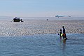
 Mudlarks - geograph.org.uk - 1874665.jpg 640 × 428; 66 KB
-
 Mudlarks take to the water - geograph.org.uk - 1874670.jpg 640 × 427; 87 KB
-
 New sea defences at Shoeburyness - geograph.org.uk - 3835050.jpg 1,600 × 1,064; 353 KB
-
 North Shoebury, Datchet Drive - geograph.org.uk - 299649.jpg 600 × 452; 250 KB
-
 Old Battery - geograph.org.uk - 1925206.jpg 1,024 × 685; 204 KB
-
 Old Quick Firing Battery - geograph.org.uk - 4523048.jpg 3,072 × 1,728; 1.8 MB
-
 One Bedroom Eco Beach Huts - geograph.org.uk - 3643204.jpg 3,872 × 2,592; 6.22 MB
-
 Ordnance Survey One-Inch Sheet 162 Southend-on-Sea, Published 1945.jpg 8,192 × 9,569; 11.03 MB
-
 Ordnance Survey One-Inch Sheet 162 Southend-on-Sea, Published 1957.jpg 8,323 × 9,954; 10.3 MB
-
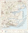 Ordnance Survey One-Inch Sheet 162 Southend-on-Sea, Published 1969.jpg 8,285 × 9,899; 34.34 MB
-
 Outfall ^ Shoeburyness - geograph.org.uk - 2242040.jpg 640 × 428; 47 KB
-
 Outfall, Shoebury East Beach - geograph.org.uk - 5160666.jpg 640 × 480; 124 KB
-
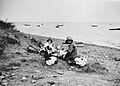 Picnic on the beach at Shoeburyness in 1931 - geograph.org.uk - 4857518.jpg 1,756 × 1,254; 1.11 MB
-
 Post Office, Shoeburyness - geograph.org.uk - 5158143.jpg 640 × 428; 122 KB
-
 Premises on Shoeburyness High Street - geograph.org.uk - 5158388.jpg 640 × 428; 116 KB
-
 Preparing for baptism^ - geograph.org.uk - 5857122.jpg 1,600 × 1,041; 455 KB
-

-
 Public lavatories, Shoebury Common - geograph.org.uk - 3776708.jpg 640 × 480; 74 KB
-
 Railway into Shoeburyness Ranges - geograph.org.uk - 5158127.jpg 640 × 480; 175 KB
-

-
-
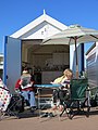
 Refreshments at Shoebury East Beach - geograph.org.uk - 3663794.jpg 2,463 × 1,642; 666 KB
-

-

-
 Remains of Mulberry Harbour, Shoeburyness - geograph.org.uk - 3713377.jpg 1,024 × 768; 664 KB
-
 Remains of Mulberry Harbour, Shoeburyness - geograph.org.uk - 3713382.jpg 1,024 × 768; 639 KB
-
 Remains of Mulberry Harbour, Shoeburyness - geograph.org.uk - 3713386.jpg 1,024 × 768; 584 KB
-
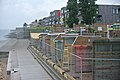
 Rock sea defences, Shoebury East Beach - geograph.org.uk - 4609336.jpg 640 × 480; 111 KB
-
 Rugwood battery - geograph.org.uk - 1412999.jpg 640 × 361; 31 KB
-
 Rusty Old Sign - geograph.org.uk - 792218.jpg 640 × 480; 149 KB
-
 Sainsbury's Local - geograph.org.uk - 3686949.jpg 3,872 × 2,592; 5.74 MB
-
 Sanderling (Calidris alba) - geograph.org.uk - 5302454.jpg 1,390 × 927; 283 KB
-
 Sea front at Shoeburyness - geograph.org.uk - 3835058.jpg 1,600 × 1,064; 433 KB
-
 Sea pool, Shoeburyness east beach - geograph.org.uk - 4522291.jpg 3,072 × 1,728; 1.67 MB
-
 Sea view, from Rampart Street, Shoeburyness - geograph.org.uk - 2470888.jpg 1,024 × 768; 126 KB
-
 Sea wall and beach, Shoebury Ness - geograph.org.uk - 3776714.jpg 640 × 480; 98 KB
-
 Sea Wall at Black Grounds - geograph.org.uk - 792254.jpg 640 × 480; 57 KB
-
 Sea wall junk, Shoeburyness ranges - geograph.org.uk - 302256.jpg 600 × 450; 39 KB
-
 Shoebury Beach - geograph.org.uk - 2242119.jpg 640 × 428; 60 KB
-
 Shoebury Beach.JPG 6,000 × 4,000; 6.32 MB
-
 Shoebury Boats - geograph.org.uk - 2242058.jpg 640 × 428; 55 KB
-
 Shoebury Boom - geograph.org.uk - 2166180.jpg 640 × 421; 74 KB
-
 Shoebury Boom - geograph.org.uk - 302957.jpg 600 × 450; 25 KB
-
 Shoebury Boom - geograph.org.uk - 3082424.jpg 1,886 × 2,837; 1.76 MB
-
 Shoebury boom - geograph.org.uk - 4609383.jpg 480 × 640; 132 KB
-
 Shoebury Boom - geograph.org.uk - 6447328.jpg 5,009 × 3,339; 2.49 MB
-
 Shoebury Boom - geograph.org.uk - 915365.jpg 640 × 480; 103 KB
-
 Shoebury Boom 1 - geograph.org.uk - 311121.jpg 600 × 450; 32 KB
-
 Shoebury Boom 2 - geograph.org.uk - 311128.jpg 600 × 450; 31 KB
-
 Shoebury Coastguard - geograph.org.uk - 66605.jpg 640 × 482; 51 KB
-
 Shoebury Common - geograph.org.uk - 2168716.jpg 1,024 × 628; 142 KB
-
 Shoebury Common Beach - geograph.org.uk - 2032099.jpg 1,024 × 768; 174 KB
-
 Shoebury Common Beach - geograph.org.uk - 2032110.jpg 1,024 × 768; 162 KB
-
 Shoebury Common Beach - geograph.org.uk - 2714999.jpg 640 × 425; 91 KB
-
 Shoebury Common Beach - geograph.org.uk - 575369.jpg 640 × 480; 81 KB
-
 Shoebury Common Beach - geograph.org.uk - 914748.jpg 640 × 480; 96 KB
-
 Shoebury Common Boardwalk - geograph.org.uk - 3417899.jpg 3,446 × 2,297; 3.93 MB
-
 Shoebury Common Boardwalk Tidal Attack - geograph.org.uk - 3851088.jpg 3,815 × 2,543; 2.01 MB
-
 Shoebury Common, The Shorehouse - geograph.org.uk - 914778.jpg 640 × 480; 63 KB
-
 Shoebury Common, Uncle Toms Cabin - geograph.org.uk - 914735.jpg 640 × 480; 69 KB
-
 Shoebury common.jpg 1,875 × 2,376; 943 KB
-
 Shoebury East Beach in the snow - geograph.org.uk - 1429042.jpg 640 × 480; 81 KB
-
 Shoebury East Beach in the snow - geograph.org.uk - 1429046.jpg 640 × 480; 93 KB
-
 Shoebury East Beach, BBQ's - geograph.org.uk - 2150429.jpg 1,024 × 682; 137 KB
-
 Shoebury East Beach, Car Park - geograph.org.uk - 2150412.jpg 1,024 × 682; 154 KB
-
 Shoebury East Beach, Kitesurfing - geograph.org.uk - 2150537.jpg 1,024 × 682; 156 KB
-
 Shoebury East Beach, road - geograph.org.uk - 2150419.jpg 1,024 × 657; 208 KB
-
 Shoebury East Beach, Toilets - geograph.org.uk - 2150590.jpg 1,024 × 682; 241 KB
-
 Shoebury East Beach, Toilets ^ Office - geograph.org.uk - 2150509.jpg 1,024 × 762; 132 KB
-
 Shoebury East Beach.JPG 6,000 × 4,000; 9.31 MB
-
 Shoebury Garrison , Gateway to Exercise Yard - geograph.org.uk - 5857558.jpg 1,231 × 1,600; 553 KB
-
 Shoebury Garrison , Gunnery Drill Shed - geograph.org.uk - 5857639.jpg 1,600 × 1,060; 521 KB
-
 Shoebury Garrison , Gunnery House - geograph.org.uk - 5857660.jpg 1,600 × 1,060; 561 KB
-
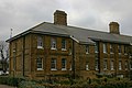
 Shoebury Garrison , Hospital - geograph.org.uk - 5857721.jpg 1,209 × 1,600; 587 KB
-
 Shoebury Garrison , Hospital - geograph.org.uk - 5858168.jpg 1,600 × 1,265; 709 KB
-
 Shoebury Gog - geograph.org.uk - 307766.jpg 450 × 600; 36 KB
-
 Shoebury Hall - geograph.org.uk - 915308.jpg 640 × 480; 60 KB
-
 Shoebury Ness Defense boom.jpg 2,595 × 2,658; 1.85 MB
-
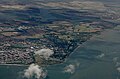
 Shoebury Ness from the air - geograph.org.uk - 3069061.jpg 1,024 × 768; 221 KB
-
 Shoebury Ness from the air - geograph.org.uk - 4668668.jpg 640 × 480; 147 KB
-
 Shoebury Ness from the air - geograph.org.uk - 4668672.jpg 640 × 424; 124 KB
-
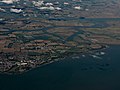 Shoebury Ness from the air - geograph.org.uk - 4680461.jpg 640 × 480; 119 KB
-
 Shoebury Pool.JPG 6,000 × 4,000; 6.99 MB
-
 Shoebury Promenade - geograph.org.uk - 302330.jpg 640 × 426; 41 KB
-
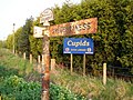
 Shoebury Roundhouse - geograph.org.uk - 2720375.jpg 640 × 425; 71 KB
.jpg)
.jpg)
.jpg)
.jpg)
.jpg)


_-_geograph.org.uk_-_6547027.jpg)
_-_geograph.org.uk_-_6551650.jpg)
_-_geograph.org.uk_-_6551651.jpg)
_-_geograph.org.uk_-_6551652.jpg)
_-_geograph.org.uk_-_6551653.jpg)
_-_geograph.org.uk_-_6551656.jpg)
_-_geograph.org.uk_-_6551657.jpg)
_-_geograph.org.uk_-_6551658.jpg)


.JPG)
.jpg)
.JPG)
.JPG)


_1978_Leyland_National,_Westcliff-on-Sea_MS_livery,_Shoeburyness,_25_September_2011.jpg)


_-_geograph.org.uk_-_5302454.jpg)


