Category:Shops in Huddersfield
Subcategories
This category has the following 22 subcategories, out of 22 total.
- Post offices in Huddersfield (12 F)
B
C
- Cowcliffe Convenience Store (3 F)
D
L
- Shops in Lockwood, Huddersfield (26 F)
M
O
P
- Pharmacies in Huddersfield (3 F)
S
T
W
Media in category "Shops in Huddersfield"
The following 115 files are in this category, out of 115 total.
-
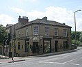 1 Meltham Road, Lockwood.jpg 640 × 525; 69 KB
-
 16.12.15 Huddersfield 5 (23150082584).jpg 4,928 × 2,776; 2.73 MB
-
 38 Chapel Hill, Huddersfield.jpg 505 × 640; 73 KB
-
 71 New Street, Huddersfield.jpg 1,213 × 1,600; 399 KB
-
 A C Electronics - Bradford Road - geograph.org.uk - 1716976.jpg 640 × 573; 81 KB
-
 A C Gallery - Byram Street - geograph.org.uk - 1703478.jpg 480 × 640; 77 KB
-
 A-Z Store - Victoria Road - geograph.org.uk - 1939809.jpg 640 × 480; 68 KB
-
 A1 Stationery Stores - Kirkgate - geograph.org.uk - 1701272.jpg 448 × 640; 78 KB
-
 Al-Faisal Takeaway - Chapel Hill - geograph.org.uk - 1937348.jpg 469 × 640; 75 KB
-
 Al-Makkah halal butcher - geograph.org.uk - 3907684.jpg 1,024 × 768; 161 KB
-

-
 Ann Summers - The Piazza Centre - geograph.org.uk - 1700592.jpg 480 × 640; 72 KB
-
 Argos - Victoria Lane - geograph.org.uk - 1700489.jpg 640 × 480; 95 KB
-
 Argos, Victoria Lane, Huddersfield (April 2010) 001.jpg 3,872 × 2,592; 2.48 MB
-
 Aspley branch of the Huddersfield Industrial Society.jpg 1,024 × 719; 225 KB
-
 Beaverbrooks - King Street - geograph.org.uk - 1702066.jpg 640 × 480; 82 KB
-
 Beech Street branch of the Huddersfield Industrial Society.jpg 1,024 × 719; 250 KB
-
 BHS - The Piazza Centre - geograph.org.uk - 1700582.jpg 480 × 640; 59 KB
-
 Birkby branch of the Huddersfield Industrial Society.jpg 1,024 × 719; 250 KB
-
 Body Image - Chapel Hill - geograph.org.uk - 1937317.jpg 475 × 640; 71 KB
-
 Bodycare - The Piazza Centre - geograph.org.uk - 1701111.jpg 640 × 480; 84 KB
-
 Bridge Street, Lockwood.jpg 640 × 480; 78 KB
-

-
 Caffe Nero - New Street - geograph.org.uk - 1700353.jpg 640 × 511; 86 KB
-
 Caledonian Cafe - Westgate - geograph.org.uk - 1701880.jpg 480 × 640; 62 KB
-
 Carl Stuart - Cloth Hall Street - geograph.org.uk - 1702814.jpg 480 × 640; 86 KB
-
 Casual Wear - Cross Church Street - geograph.org.uk - 1702015.jpg 480 × 640; 97 KB
-
 Chilli Lounge - John William Street - geograph.org.uk - 1704439.jpg 480 × 640; 75 KB
-

-
 Circle - Westgate - geograph.org.uk - 1701897.jpg 446 × 640; 72 KB
-
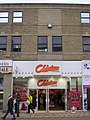 Clinton Cards - New Street - geograph.org.uk - 1700450.jpg 480 × 640; 89 KB
-
 Community Shop - Blackmoorfoot Road - geograph.org.uk - 1949401.jpg 483 × 640; 76 KB
-
 Compufix - Kirkgate - geograph.org.uk - 1701274.jpg 640 × 461; 86 KB
-
 Convenience store on Waingate, Berry Brow - geograph.org.uk - 5980037.jpg 5,184 × 3,888; 3.83 MB
-
 Coral - Westgate - geograph.org.uk - 1701870.jpg 640 × 483; 85 KB
-
 Destiny - Westgate - geograph.org.uk - 1701854.jpg 480 × 640; 63 KB
-
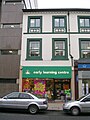 Early learning centre - New Street - geograph.org.uk - 1700299.jpg 480 × 640; 66 KB
-
 Ego - Westgate - geograph.org.uk - 1701914.jpg 640 × 480; 100 KB
-
 Exchange Buildings, Huddersfield.jpg 640 × 480; 90 KB
-
 Fartown Cleaners - Bradford Road - geograph.org.uk - 1716726.jpg 640 × 455; 61 KB
-
 Former central premises of the Huddersfield Industrial Society.jpg 759 × 1,024; 265 KB
-

-
 Gallery - New Street - geograph.org.uk - 1700304.jpg 480 × 640; 70 KB
-
 Gasflair - Queensgate - geograph.org.uk - 2157412.jpg 640 × 389; 50 KB
-

-
 Hardware store on Cross Church Street, Huddersfield - geograph.org.uk - 4900534.jpg 4,637 × 3,388; 3.59 MB
-
 Help the Aged - Kirkgate - geograph.org.uk - 1701547.jpg 480 × 640; 72 KB
-
 Huddersfield Discount Store, Fox Street, Huddersfield (30th November 2023).jpg 5,152 × 3,864; 4.72 MB
-

-
 Intercounty - Westgate - geograph.org.uk - 1701900.jpg 640 × 441; 89 KB
-
 J Dodd Health Food - Byram Street - geograph.org.uk - 1703461.jpg 640 × 480; 90 KB
-
 Johnsons the Cleaners - Market Place - geograph.org.uk - 1700321.jpg 640 × 480; 78 KB
-
 Jonathan james - Victoria Lane - geograph.org.uk - 1700484.jpg 640 × 480; 89 KB
-
 Keldregate Stores - Keldregate - geograph.org.uk - 3950254.jpg 640 × 517; 91 KB
-
 KFC - New Street - geograph.org.uk - 1700350.jpg 640 × 480; 69 KB
-
 KFC on New Street, Huddersfield - geograph.org.uk - 4466346.jpg 2,448 × 1,624; 1.3 MB
-
 Kings News - Cross Church Street - geograph.org.uk - 1702008.jpg 480 × 640; 83 KB
-
 Kirklees Guns - Lord Street - geograph.org.uk - 1703620.jpg 480 × 640; 70 KB
-
 Kitten Heels Boutique - Byram Street - geograph.org.uk - 1703492.jpg 640 × 477; 92 KB
-

-
 Ladbrokes - New Street - geograph.org.uk - 1700313.jpg 480 × 640; 74 KB
-
 Lee Head, Blacker Road, Huddersfield - geograph.org.uk - 5753965.jpg 1,600 × 1,065; 526 KB
-
 Lion Building.JPG 1,280 × 960; 310 KB
-
 Lodging Houses - geograph.org.uk - 324685.jpg 640 × 480; 93 KB
-
 Londis - Blackmoorfoot Road - geograph.org.uk - 1950063.jpg 640 × 480; 56 KB
-
 Mark Riley - Byram Street - geograph.org.uk - 1703474.jpg 480 × 640; 88 KB
-
 Max Spielmann - Kirkgate - geograph.org.uk - 1701557.jpg 480 × 640; 74 KB
-
 McDonald's on John William Street, Huddersfield - geograph.org.uk - 4474085.jpg 2,448 × 1,624; 1.23 MB
-
 Mirfield branch of the Huddersfield Industrial Society.jpg 1,024 × 719; 260 KB
-
 Newsome Village Store - Church Lane - geograph.org.uk - 2156184.jpg 516 × 640; 73 KB
-
 Nisa local - Dryclough Road - geograph.org.uk - 1950232.jpg 640 × 480; 60 KB
-
 Oakes branch and Marsh branch of the Huddersfield Industrial Society.jpg 759 × 1,024; 232 KB
-

-
 Oozephyroo - King Street - geograph.org.uk - 1702799.jpg 640 × 480; 81 KB
-
 Outlane branch of the Huddersfield Industrial Society.jpg 1,024 × 719; 244 KB
-
 Pack Horse Tap Yard 1962 - geograph.org.uk - 3007153.jpg 2,119 × 3,096; 778 KB
-
 Packed Lunch - Lord Street - geograph.org.uk - 1703529.jpg 480 × 640; 81 KB
-
 Parade of Shops - Sycamore Avenue - geograph.org.uk - 4777433.jpg 640 × 480; 89 KB
-
 Pet Warehouse - Queensgate - geograph.org.uk - 2157411.jpg 640 × 480; 50 KB
-
 Peter Jones - New Street - geograph.org.uk - 1700446.jpg 480 × 640; 77 KB
-
 Peters of Huddersfield.jpg 4,844 × 1,384; 3.5 MB
-
 Primrose Hill branch of the Huddersfield Industrial Society.jpg 1,024 × 719; 250 KB
-
 Pronuptia - King Street - geograph.org.uk - 1702805.jpg 480 × 640; 75 KB
-
 Rashcliffe branch of the Huddersfield Industrial Society.jpg 1,024 × 719; 256 KB
-
 Rawcliffes - Byram Street - geograph.org.uk - 1703454.jpg 640 × 480; 92 KB
-

-
 Shaw and Hallas (2111531734).jpg 2,560 × 1,920; 4.08 MB
-
 Shopping in Huddersfield - geograph.org.uk - 3536865.jpg 697 × 1,024; 176 KB
-
 Shops on Manchester Road, Huddersfield. - geograph.org.uk - 4466794.jpg 2,448 × 1,624; 1.01 MB
-
 Shops on New Street, Huddersfield - geograph.org.uk - 4474010.jpg 2,448 × 1,624; 1.37 MB
-

-

-

-
 Sit A While - Something for the Weekend (16825529511).jpg 1,818 × 3,234; 3.83 MB
-
 Stable yard of the Huddersfield Industrial Society.jpg 1,024 × 719; 233 KB
-
 Storeys - Victoria Lane - geograph.org.uk - 1700500.jpg 640 × 480; 103 KB
-
 Texas Chicken - Kirkgate - geograph.org.uk - 1701548.jpg 480 × 640; 63 KB
-
 The Cherry Tree on John William Street, Huddersfield - geograph.org.uk - 4466341.jpg 2,448 × 1,624; 1.1 MB
-

-
 The Piazza - geograph.org.uk - 321433.jpg 640 × 480; 83 KB
-
 The Piazza - geograph.org.uk - 321436.jpg 640 × 480; 100 KB
-

-
 Thornton Lodge branch of the Huddersfield Industrial Society.jpg 1,024 × 719; 237 KB
-
 Toll House - geograph.org.uk - 324654.jpg 640 × 480; 84 KB
-
 Videotech - Kirkgate - geograph.org.uk - 1701545.jpg 640 × 480; 78 KB
-
 Vinyl Tap Huddersfield.jpg 867 × 790; 458 KB
-
 Virgin Media - New Street - geograph.org.uk - 1700440.jpg 640 × 480; 108 KB
-
 Vodaphone - King Street - geograph.org.uk - 1702813.jpg 480 × 640; 84 KB
-
 Wall of sound - John William Street - geograph.org.uk - 1703697.jpg 480 × 640; 86 KB
-
 Waterstone's - New Street - geograph.org.uk - 1700441.jpg 480 × 640; 65 KB
-
 Westgate House, Huddersfield.jpg 925 × 1,024; 805 KB
-
 Wilko on New Street, Huddersfield - geograph.org.uk - 4466741.jpg 2,448 × 1,624; 1.31 MB
-
 Zavvi - New Street - geograph.org.uk - 1700451.jpg 480 × 640; 67 KB
-
-


.jpg)


_001.jpg)


.jpg)


.jpg)


.jpg)


_-_geograph.org.uk_-_760846.jpg)
