Category:Signs in Barnstable County, Massachusetts
Media in category "Signs in Barnstable County, Massachusetts"
The following 21 files are in this category, out of 21 total.
-
 2016 05 Cape Cod Museum of Natural History sign.jpg 3,264 × 2,448; 2.31 MB
-
 Bourne Town Hall sign.jpg 2,448 × 2,448; 1.81 MB
-
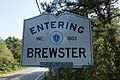 Brewster Massachusetts town sign.jpg 3,000 × 2,000; 1.92 MB
-
 Dennis Sign.JPG 2,280 × 2,280; 368 KB
-
 Dennis town sign (Massachusetts).jpg 2,000 × 3,000; 1.64 MB
-
 Eastham Massachusetts town sign.jpg 3,000 × 3,000; 2.09 MB
-
 First Encounter Beach.jpg 3,168 × 4,752; 11.04 MB
-
 Harwich Massachusetts town sign.jpg 3,000 × 2,000; 2.43 MB
-
 MA Route 130 northbound entering Mashpee MA.jpg 2,592 × 1,944; 1.28 MB
-
 MA Route 6A westbound entering Sandwich MA.jpg 3,264 × 2,176; 1.25 MB
-
 Mashpee Wampanoag Indian Museum.jpg 2,448 × 3,264; 3.36 MB
-
 MashpeeMA AvantHouse.jpg 1,024 × 680; 324 KB
-
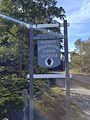
 Old Colony Nature Pathway sign, Provincetown MA.jpg 4,032 × 3,024; 5.28 MB
-
 Province Lands Bike Trail.jpg 3,000 × 2,250; 3.54 MB
-
 Provincetown bike trail - panoramio.jpg 2,048 × 1,536; 1.84 MB
-
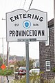 Provincetown Massachusetts town sign.jpg 2,000 × 3,000; 1.1 MB
-
 Sandwich (Massachusetts) Town Sign.jpg 2,250 × 3,000; 2.09 MB
-
 Truro Massachusetts town sign.jpg 3,000 × 3,000; 1.87 MB
-
 US Route 6 eastbound entering Truro MA.jpg 3,260 × 2,175; 1.31 MB
-
 Wellfleet Massachusetts town sign.jpg 3,000 × 3,000; 2.36 MB
-
 Yarmouth town sign (Massachusetts).jpg 2,000 × 3,000; 2.19 MB


.jpg)


_Town_Sign.jpg)


.jpg)