Category:Signs in Birkenhead
Subcategories
This category has the following 7 subcategories, out of 7 total.
Media in category "Signs in Birkenhead"
The following 58 files are in this category, out of 58 total.
-
 Beechwood, Birkenhead - DSC03608.JPG 3,648 × 2,736; 3.71 MB
-
 Bidston Hill - DSC04319.JPG 3,648 × 2,736; 3.57 MB
-
 Bidston Hill - DSC04321.JPG 2,736 × 3,648; 3.58 MB
-
 Bidston Moss local nature reserve sign.jpg 3,240 × 4,320; 4.21 MB
-
 Bidston, Birkenhead - DSC03566.JPG 2,736 × 3,648; 3.53 MB
-
 Birkenhead North railway station (3).jpg 800 × 600; 239 KB
-
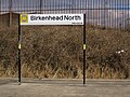
 Birkenhead North railway station sign - DSC04578.JPG 2,736 × 3,648; 3.54 MB
-
 Birkenhead Priory notices.JPG 3,648 × 2,736; 3.51 MB
-
 Birkenhead Priory sign 1.JPG 2,736 × 3,648; 3.51 MB
-
 Birkenhead Priory sign 2.JPG 2,736 × 3,648; 3.63 MB
-
 Birkenhead road sign.jpg 1,280 × 960; 251 KB
-
 Birkenhead Tramways banner at Woodside Ferry Terminal.JPG 4,608 × 3,456; 3.57 MB
-
 Case of signs etc at Woodside Ferry Terminal.jpg 4,638 × 2,898; 16.95 MB
-
 Cliff's shed, Wirral Transport Museum 1.JPG 2,736 × 3,648; 3.6 MB
-
 Entrance to Birkenhead High School GDST - geograph.org.uk - 531827.jpg 640 × 426; 134 KB
-
 Fingerposts, Birkenhead - DSC09550.PNG 3,648 × 2,736; 9.1 MB
-
 Flaybrick Memorial Gardens, Birkenhead (1).JPG 4,000 × 3,000; 2.91 MB
-
 Gwynt y Môr Offshore Wind Farm - Base Harbour Port Facility, Birkenhead.JPG 4,320 × 3,240; 3.08 MB
-
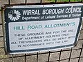 Hill Road Allotments sign, Birkenhead - IMG 0572.JPG 4,320 × 3,240; 4.07 MB
-
 Information sign at Upton railway station - geograph.org.uk - 531579.jpg 640 × 426; 119 KB
-
 Location sign at Bidston station.jpg 2,911 × 2,823; 3.71 MB
-
 Mapleholme, Birkenhead (3).jpg 4,608 × 3,456; 3.45 MB
-
 Monks Ferry fingerpost 2.JPG 2,736 × 3,648; 3.55 MB
-
 Monks Ferry Walkway sign.JPG 2,736 × 3,648; 3.7 MB
-
 National Grid sign, Hind Street, Birkenhead - IMG 0317.JPG 4,320 × 3,240; 2.7 MB
-
 NCN 56 at School Lane, Bidston.jpg 3,204 × 4,926; 11.36 MB
-
 NCN 56 sign, Ackers Road.jpg 4,438 × 3,363; 9.39 MB
-
 Noctorum, Birkenhead - DSC03645.JPG 3,648 × 2,736; 3.73 MB
-
 Noctorum, Birkenhead - DSC03649.JPG 3,648 × 2,736; 3.52 MB
-
 Old Woodside Ferry sign.jpg 4,746 × 3,138; 7.75 MB
-
 Oxton Conservation Area sign, Arno Road.jpg 3,315 × 5,043; 10.47 MB
-
 Oxton Fields sign - IMG 0956.JPG 4,320 × 3,240; 3 MB
-
 Oxton Fields sign - IMG 0957.JPG 3,240 × 4,320; 4.18 MB
-
 Palm Court sign, Birkenhead - IMG 0584.JPG 4,320 × 3,240; 4.25 MB
-
 ParkingSign-NrWirralTramway-CIMG2729 (34692966016).jpg 2,304 × 1,712; 1.76 MB
-
 Prenton Reservoir sign - IMG 0294.JPG 4,320 × 3,240; 3.62 MB
-
 Road sign, Claughton Road, Birkenhead - DSCF0143.JPG 4,000 × 3,000; 2.79 MB
-
 Rock Park estate, Rock Ferry, Wirral - DSC03001.JPG 3,648 × 2,736; 3.58 MB
-
 Rock Park estate, Rock Ferry, Wirral - DSC03016.JPG 3,648 × 2,736; 3.56 MB
-
 Sign at the commemorative tree, The Arno, Oxton.jpg 4,320 × 3,240; 3.83 MB
-
 Sign, Hamilton Square railway station.JPG 2,736 × 3,648; 3.49 MB
-
 Sign, The Rock Ferry Centre.JPG 3,648 × 2,736; 3.51 MB
-
 South Bank, Oxton - IMG 0971.JPG 4,320 × 3,240; 5.07 MB
-
 Springhill Borehole, Balls Road, Birkenhead - IMG 0590.JPG 4,320 × 3,240; 4.8 MB
-
 TA Centre sign, Whitford Road, Tranmere.JPG 3,240 × 4,320; 3.81 MB
-
 The Arno sign, Oxton - IMG 0895.JPG 3,240 × 4,320; 4.3 MB
-
 The Oldest Off License in Birkenhead (2).JPG 4,320 × 3,240; 3.56 MB
-
 Townfield Health Centre construction site sign, Noctorum - DSC09350.JPG 2,736 × 3,648; 3.46 MB
-
 Tranmere Methodist Church sign - DSC08203.JPG 3,648 × 2,736; 3.46 MB
-
 Tranmere, housing development sign.JPG 2,736 × 3,648; 3.56 MB
-
 Upton sign at M53 bridge.jpg 5,020 × 2,872; 7.18 MB
-
 Victoria Park Health Centre sign.JPG 3,648 × 2,736; 3.62 MB
-
 Walker Park sign, Prenton - IMG 0292.JPG 3,240 × 4,320; 2.15 MB
-
 Welcome sign, Tesco Bidston Moss.jpg 4,113 × 3,474; 6.68 MB
-
 Wirral magistrates court.jpg 2,048 × 1,536; 883 KB
-
 Woodchurch, Birkenhead - DSC04017.JPG 2,736 × 3,648; 3.65 MB
-
 Woodchurch, Birkenhead - DSC04028.JPG 3,648 × 2,736; 3.49 MB
-
 Woodlands play area sign.jpg 5,184 × 3,456; 5.53 MB


.jpg)


.JPG)


.jpg)


.jpg)


.JPG)


