Category:Signs in Joshua Tree National Park
United States national parks: Acadia · Arches · Badlands · Big Bend · Black Canyon of the Gunnison · Bryce Canyon · Canyonlands · Capitol Reef · Congaree · Crater Lake · Death Valley · Denali · Everglades · Glacier · Glacier Bay · Grand Teton · Great Basin · Great Smoky Mountains · Guadalupe Mountains · Hawaii Volcanoes · Joshua Tree · Lassen Volcanic · Mesa Verde · Mount Rainier · Olympic · Petrified Forest · Pinnacles · Rocky Mountain · Sequoia · Shenandoah · White Sands · Yellowstone · Yosemite · Zion
Subcategories
This category has only the following subcategory.
Media in category "Signs in Joshua Tree National Park"
The following 83 files are in this category, out of 83 total.
-
 A sign marks a restoration area (37987611454).jpg 5,760 × 3,840; 3.25 MB
-
 Bigfoot Trail (46681777284).jpg 5,174 × 3,528; 6.72 MB
-
 Black Rock Canyon Trailhead and Backcountry Board (24252250574).jpg 7,360 × 4,912; 26.95 MB
-
 Boy Scout Trail (30685552550).jpg 4,052 × 2,704; 6.09 MB
-
 Boy Scout Trail (30898913041).jpg 5,794 × 3,867; 12.92 MB
-

-
 Campground Sign (24762367142).jpg 7,360 × 4,912; 18.24 MB
-
 Checking the Roadrunner Shuttle Schedule at Jumbo Rocks (40053614462).jpg 7,360 × 4,912; 18.16 MB
-
 Cholla Cactus Garden at night (29644063711).jpg 7,097 × 4,737; 13.96 MB
-
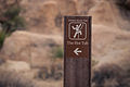
 Climbing Access Sign (17388030669).jpg 5,053 × 3,369; 8.46 MB
-
 Climbing trail from Ryan Campground (25367429912).jpg 7,360 × 4,912; 9.11 MB
-
 Exit-Desert.jpg 2,816 × 2,112; 788 KB
-
 Hidden Valley (15830501289).jpg 4,730 × 3,173; 8.99 MB
-
 Joshua Tree National Park (15077239718).jpg 2,048 × 1,368; 257 KB
-
 JOSHUA TREE NATIONAL PARK (15112604349).jpg 1,368 × 2,048; 475 KB
-
 Joshua Tree National Park - Pine City trailhead.JPG 2,458 × 1,454; 1.57 MB
-
 Joshua Tree National Park Sign - Route 66 (28276060424).jpg 5,760 × 3,840; 21 MB
-
 Joshua Tree National Park West Entrance Sign at Sunset (46105870025).jpg 7,288 × 4,816; 5.93 MB
-
 Joshua Tree National Park West Entrance Sign at Sunset (46967728522).jpg 7,360 × 4,912; 7.13 MB
-
 Joshua Tree Wayside circa early 2000s - Apostle of the Cacti (33731894688).jpg 3,072 × 2,304; 1.08 MB
-
 Joshua Tree Wayside circa early 2000s - Barker Dam (46693472435).jpg 3,072 × 2,304; 1.1 MB
-
 Joshua Tree Wayside circa early 2000s - Barren or Bountiful (47609214761).jpg 3,072 × 2,304; 1.18 MB
-
 Joshua Tree Wayside circa early 2000s - Bighorn's Domain (47609209371).jpg 3,072 × 2,304; 1.03 MB
-
 Joshua Tree Wayside circa early 2000s - Classic Lines (47609214321).jpg 3,072 × 2,304; 801 KB
-
 Joshua Tree Wayside circa early 2000s - Desert Queen Ranch (47609213941).jpg 3,072 × 2,304; 1,021 KB
-
 Joshua Tree Wayside circa early 2000s - Echo Rock (47609213561).jpg 3,072 × 2,304; 1,011 KB
-
 Joshua Tree Wayside circa early 2000s - Geology Tour Road (33731892708).jpg 3,072 × 2,304; 1.29 MB
-
 Joshua Tree Wayside circa early 2000s - Hidden Life (47609213091).jpg 3,072 × 2,304; 1.32 MB
-
 Joshua Tree Wayside circa early 2000s - Hidden Valley (33731892108).jpg 3,072 × 2,304; 897 KB
-
 Joshua Tree Wayside circa early 2000s - Intersection Rock (47609212551).jpg 3,072 × 2,304; 928 KB
-
 Joshua Tree Wayside circa early 2000s - Learning the Ropes (47609212141).jpg 3,072 × 2,304; 866 KB
-
 Joshua Tree Wayside circa early 2000s - Lost Horse Mine (33731891508).jpg 3,072 × 2,304; 963 KB
-
 Joshua Tree Wayside circa early 2000s - Memorial Fire (47609211791).jpg 3,072 × 2,304; 1.08 MB
-
 Joshua Tree Wayside circa early 2000s - Mojave Desert (33731891248).jpg 3,072 × 2,304; 1.17 MB
-
 Joshua Tree Wayside circa early 2000s - Mojave Symbols (47609211191).jpg 3,072 × 2,304; 887 KB
-
 Joshua Tree Wayside circa early 2000s - North Entrance (33731890958).jpg 3,072 × 2,304; 1.05 MB
-
 Joshua Tree Wayside circa early 2000s - Rapid Fire (47609210771).jpg 3,072 × 2,304; 797 KB
-
 Joshua Tree Wayside circa early 2000s - Rattlesnake Canyon (33731890648).jpg 3,072 × 2,304; 801 KB
-
 Joshua Tree Wayside circa early 2000s - Rock Piles (47609210351).jpg 3,072 × 2,304; 818 KB
-
 Joshua Tree Wayside circa early 2000s - Rockpiles (33731890458).jpg 3,072 × 2,304; 1.07 MB
-
 Joshua Tree Wayside circa early 2000s - Ryan Mountain (47609210081).jpg 3,072 × 2,304; 1.41 MB
-
 Joshua Tree Wayside circa early 2000s - Ryan Ranch (33731890138).jpg 3,072 × 2,304; 1.02 MB
-
 Joshua Tree Wayside circa early 2000s - Saddle Rock (47609209621).jpg 3,072 × 2,304; 1.13 MB
-
 Joshua Tree Wayside circa early 2000s - The Coachella Valley (47609209101).jpg 3,072 × 2,304; 853 KB
-
 Joshua Tree Wayside circa early 2000s - Tip the Odds (47609208621).jpg 3,072 × 2,304; 1.03 MB
-
 Joshua Tree Wayside circa early 2000s - Tree of Life (47609208261).jpg 3,072 × 2,304; 867 KB
-
 Joshua Tree Wayside circa early 2000s - Wall Street Mill (46884884394).jpg 3,072 × 2,304; 1.05 MB
-
 Joshua Tree Wayside circa early 2000s - We Have Contact (32666692577).jpg 3,072 × 2,304; 1.14 MB
-
 Joshua Tree Wayside circa early 2000s - Woodland Bounty (46884883814).jpg 3,072 × 2,304; 1 MB
-
 Joshua Tree Wayside circa early 2000s -Distinguishing Yuccas (33731893018).jpg 3,072 × 2,304; 989 KB
-
 Joshua Tree Wayside circa early 2000s -The Desert Beseiged (47609208901).jpg 3,072 × 2,304; 946 KB
-
 Keep Wildlife Wild Sign (24252315584).jpg 7,360 × 4,912; 17.73 MB
-
 Message Board in Hidden Valley Campground (24715135488).jpg 7,360 × 4,912; 18.22 MB
-
 Message Board in Hidden Valley Campground (24715146848).jpg 7,360 × 4,912; 15.64 MB
-
 Mine Warning Sign (30457453004).jpg 5,184 × 3,456; 4.34 MB
-
 Mojave National Preserve (27231962049).jpg 4,502 × 2,976; 5.47 MB
-
 No Camping Sign (24253399203).jpg 3,927 × 5,969; 10.22 MB
-
 No shooting or hunting is allowed in Joshua Tree National Park (21300984385).jpg 4,422 × 2,697; 6.42 MB
-
 Park Boulevard (15857238759).jpg 5,599 × 3,658; 13.42 MB
-
 Picnic Sign at Black Rock Campground (24762419022).jpg 7,360 × 4,912; 14.45 MB
-
 Ranger Lacy Ditto Updates Campground Bulletin Boards (15303931498).jpg 4,548 × 3,400; 8.16 MB
-
 Rattlesnake Canyon Trailhead; Twentynine Palms, CA (12660752995).jpg 5,184 × 3,456; 5.69 MB
-
 Restoration Sign (25281549564).jpg 7,360 × 4,912; 19.1 MB
-
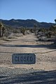 Road Closure Sign (24252204044).jpg 4,912 × 7,360; 18.77 MB
-
 Road Closure Sign (24787000331).jpg 7,360 × 4,912; 20.98 MB
-
 Road Closure Sign (24854104406).jpg 7,360 × 4,912; 19.74 MB
-
 Road closure signs (50020678157).jpg 8,256 × 5,504; 41.84 MB
-
 Roadrunner Shuttle (40053492592).jpg 3,680 × 2,456; 5.56 MB
-
 Roadrunner Shuttle (40053498742).jpg 2,456 × 3,680; 4.71 MB
-
 Roadrunner Shuttle Ryan Mountain (28305674399).jpg 3,680 × 2,456; 5.72 MB
-
 Roadrunner Shuttle Ryan Mountain (40053479892).jpg 3,680 × 2,456; 5.19 MB
-
 Sign along Split Rock Trail (49902563407).jpg 6,893 × 4,600; 13.26 MB
-
 Sign at Oasis Visitor Center, Twentynine Palms, California (14816318568).jpg 5,570 × 3,133; 14.59 MB
-
 Signage (16437419743).jpg 7,360 × 4,912; 23.6 MB
-
 South Entrance Park Sign (17574901265).jpg 5,184 × 3,264; 11.75 MB
-
 Staff and volunteers work in a restoration area (24832633288).jpg 5,760 × 3,840; 885 KB
-
 Staff and volunteers work in a restoration area (38673130522).jpg 5,760 × 3,840; 1.92 MB
-
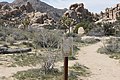
 Trail to Ryan Ranch (25576055546).jpg 7,360 × 4,912; 11.35 MB
-
 Vegetation Sign (24854149026).jpg 7,360 × 4,912; 18.64 MB
-
 Vegetation Sign (24854161226).jpg 7,360 × 4,912; 18.02 MB
-
 Wayside near Ryan Campground (25459855966).jpg 7,360 × 4,912; 12.08 MB
-
 West Entrance Park Sign (17570400632).jpg 5,184 × 3,456; 10.23 MB
-
 White Tank Campground "Full" sign (16489743289).jpg 5,097 × 3,326; 9.18 MB
.jpg)
.jpg)
.jpg)
.jpg)
.jpg)
.jpg)
.jpg)
.jpg)
.jpg)
.jpg)
.jpg)

.jpg)
.jpg)
.jpg)

.jpg)
.jpg)
.jpg)
.jpg)
.jpg)
.jpg)
.jpg)
.jpg)
.jpg)
.jpg)
.jpg)
.jpg)
.jpg)
.jpg)
.jpg)
.jpg)
.jpg)
.jpg)
.jpg)
.jpg)
.jpg)
.jpg)
.jpg)
.jpg)
.jpg)
.jpg)
.jpg)
.jpg)
.jpg)
.jpg)
.jpg)
.jpg)
.jpg)
.jpg)
.jpg)
.jpg)
.jpg)
.jpg)
.jpg)
.jpg)
.jpg)
.jpg)
.jpg)
.jpg)
.jpg)
.jpg)
.jpg)
.jpg)
.jpg)
.jpg)
.jpg)
.jpg)
.jpg)
.jpg)
.jpg)
.jpg)
.jpg)
.jpg)
.jpg)
.jpg)
.jpg)
.jpg)
.jpg)
.jpg)
.jpg)
.jpg)
.jpg)