Category:Signs in Llandudno
Subcategories
This category has the following 4 subcategories, out of 4 total.
Media in category "Signs in Llandudno"
The following 79 files are in this category, out of 79 total.
-
 1893 datestone - geograph.org.uk - 4819514.jpg 1,000 × 1,000; 543 KB
-
 A boundary stone on St. David's Place, Llandudno - geograph.org.uk - 2283924.jpg 3,000 × 4,000; 1.4 MB
-
 A man with a large organ on show - geograph.org.uk - 4941092.jpg 1,000 × 750; 629 KB
-
 A welcome to Llandudno - geograph.org.uk - 84394.jpg 640 × 480; 54 KB
-
 AA four star sign at Imperial Hotel, Llandudno - geograph.org.uk - 6175880.jpg 1,024 × 683; 135 KB
-
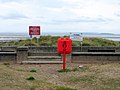 Access to the Prom and beach - geograph.org.uk - 864328.jpg 640 × 480; 170 KB
-
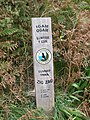
 Alice in Wonderland trail sign - geograph.org.uk - 6264934.jpg 1,024 × 683; 308 KB
-
 An oops on the signage^ - geograph.org.uk - 4619470.jpg 640 × 480; 85 KB
-
 Army Reserve Centre - geograph.org.uk - 4072077.jpg 1,000 × 816; 263 KB
-
 Arvon Avenue - geograph.org.uk - 339473.jpg 640 × 480; 144 KB
-
 Beach with warning - geograph.org.uk - 2249269.jpg 640 × 480; 98 KB
-
 Benchmark on Plas Road, Llandudno - geograph.org.uk - 2110536.jpg 4,000 × 3,000; 5.67 MB
-
 Benkid77 B5115 5 220709.JPG 2,240 × 1,680; 831 KB
-
 Benkid77 B5115 6 220709.JPG 2,240 × 1,680; 897 KB
-
 Benkid77 Falling rocks warning sign, Llandudno 220709.JPG 1,680 × 2,240; 883 KB
-
 Benkid77 Llandudno fingerpost 220709.JPG 2,240 × 1,680; 810 KB
-
 Benkid77 Llandudno welcome sign 220709.JPG 2,240 × 1,680; 928 KB
-
 Bryn Rosa Guest House signage (1) - geograph.org.uk - 6259275.jpg 1,024 × 683; 173 KB
-
 Bryn Rosa Guest House signage (2) - geograph.org.uk - 6259277.jpg 1,024 × 683; 139 KB
-
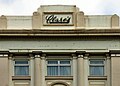 Clare's with an apostrophe - geograph.org.uk - 4647376.jpg 1,000 × 713; 499 KB
-
 Clwyd and Gwynedd Army Cadet Force - geograph.org.uk - 4071912.jpg 1,000 × 824; 217 KB
-

-

-
 Date Stone on Tedder House - geograph.org.uk - 4681935.jpg 1,000 × 810; 548 KB
-
 Ffynnon Gogarth Wici (1).jpg 2,592 × 1,944; 3 MB
-
 Ffynnon llygad wici.jpg 3,000 × 4,000; 2.44 MB
-
 Ffynnon Powell (Powell's Well) - geograph.org.uk - 2606930.jpg 3,888 × 2,592; 2.89 MB
-
 Ffynon Gogarth, Great Orme - geograph.org.uk - 2234337.jpg 800 × 600; 115 KB
-

-

-
-
 Footpath signs, Marine Drive, Great Orme - geograph.org.uk - 3838031.jpg 1,200 × 798; 240 KB
-
 Footpath to Ffynnon Sadwrn Lane - geograph.org.uk - 5489348.jpg 1,280 × 851; 590 KB
-
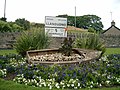
 Gardd Greigiau'r Copa - Summit Rock Garden - geograph.org.uk - 4891910.jpg 1,000 × 695; 655 KB
-
 Gorchymyn Gwahardd Cwn-The Dogs Exclusion Order - geograph.org.uk - 4649658.jpg 1,963 × 1,863; 2 MB
-
 HiPoints information QR code on sea wall, Penrhyn Bay - geograph.org.uk - 2984830.jpg 3,240 × 4,320; 5.79 MB
-

-
 Incomplete sign - geograph.org.uk - 6258386.jpg 1,024 × 683; 140 KB
-
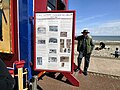
 Information sign in Llandudno - geograph.org.uk - 3675346.jpg 1,024 × 757; 163 KB
-
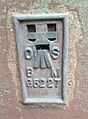
 L.M.S. signage - geograph.org.uk - 4434533.jpg 480 × 640; 77 KB
-
 Llandudno beach.jpg 500 × 500; 79 KB
-
 Llandudno promenade - geograph.org.uk - 3676343.jpg 1,024 × 683; 107 KB
-
 Llandudno road sign. - geograph.org.uk - 349211.jpg 640 × 480; 129 KB
-
 Llandudno seafront - geograph.org.uk - 163394.jpg 640 × 479; 64 KB
-
 Llandudno Welcomes You - geograph.org.uk - 4179502.jpg 1,600 × 1,064; 451 KB
-
 Llandudno welcomes you - geograph.org.uk - 5489322.jpg 1,280 × 851; 416 KB
-
 Llandudno welcomes you in lights - geograph.org.uk - 4796581.jpg 1,024 × 768; 120 KB
-
 Llandudno Welcomes You^ - geograph.org.uk - 2803573.jpg 640 × 471; 49 KB
-
 Llandudno-Station-Wyrdlight-814235.jpg 844 × 1,500; 1.3 MB
-
 Lloyd Street - geograph.org.uk - 871727.jpg 640 × 478; 116 KB
-
 Llwybr IGAM OGAM i'r copa, Llandudno - geograph.org.uk - 2643614.jpg 3,000 × 4,000; 5.27 MB
-
 London Midland & Scottish emblem cast in to the gates of Llandudno railway station.jpg 2,861 × 4,753; 1.12 MB
-
 Looking to the cable car - geograph.org.uk - 5218891.jpg 640 × 480; 54 KB
-
 North Wales Path, Happy Valley Road, Llandudno - geograph.org.uk - 3831771.jpg 1,200 × 798; 277 KB
-
 Old Road Sign - geograph.org.uk - 340080.jpg 640 × 480; 211 KB
-
 Ordnance Survey block - Creigiau Cochion, Llandudno - geograph.org.uk - 2440826.jpg 4,000 × 3,000; 1.41 MB
-
 Ordnance Survey block - Maes-y-facrell, Llandudno - geograph.org.uk - 2394408.jpg 4,000 × 3,000; 1.49 MB
-

-

-

-
-
 Ordnance Survey surface block - Bod-Ruffydd, Bryn Pydew - geograph.org.uk - 2452119.jpg 4,000 × 3,000; 1.4 MB
-
 Ordnance Survey Tide Gauge - geograph.org.uk - 5567508.jpg 450 × 640; 90 KB
-
 Parish boundary stone, Llandudno - geograph.org.uk - 6060559.jpg 1,200 × 1,600; 567 KB
-
 Parking charges on The Parade - geograph.org.uk - 4647833.jpg 1,000 × 1,000; 791 KB
-
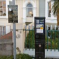 Parking Ticket Machine on The Parade - geograph.org.uk - 4647810.jpg 1,000 × 1,000; 788 KB
-
 Provision of New Concrete Slipway - geograph.org.uk - 4081771.jpg 2,000 × 1,434; 791 KB
-
 Rhos on Sea Golf Club - geograph.org.uk - 4179322.jpg 1,600 × 1,064; 523 KB
-
 Rhos on Sea Golf Club Hotel - geograph.org.uk - 4179325.jpg 1,457 × 1,460; 635 KB
-

-
 Rocky Pines Adventure Golf - geograph.org.uk - 2233334.jpg 800 × 600; 122 KB
-
-
 Screaming Gull on the Coast Path sign - geograph.org.uk - 4804586.jpg 1,000 × 1,299; 1,017 KB
-
 Show me a sign^ - geograph.org.uk - 677385.jpg 480 × 640; 89 KB
-
 Sign Rocky Children.jpg 1,024 × 768; 237 KB
-
 Site of new Lifeboat station - geograph.org.uk - 4822638.jpg 640 × 427; 62 KB
-
 The Tailor of Taste - geograph.org.uk - 2508559.jpg 1,000 × 419; 123 KB
-
 West Shore Goats - geograph.org.uk - 842218.jpg 640 × 480; 122 KB
-
 Ysgol John Bright - geograph.org.uk - 581753.jpg 640 × 480; 122 KB


_-_geograph.org.uk_-_6259275.jpg)
_-_geograph.org.uk_-_6259277.jpg)


.jpg)

_-_geograph.org.uk_-_2606930.jpg)


_-_geograph.org.uk_-_5567421.jpg)

_-_geograph.org.uk_-_5567593.jpg)


,_Llandudno_-_geograph.org.uk_-_2452062.jpg)


