Category:Signs in North Carolina
States of the United States: Alabama · Alaska · Arizona · Arkansas · California · Colorado · Connecticut · Delaware · Florida · Georgia · Hawaii · Idaho · Illinois · Indiana · Iowa · Kansas · Kentucky · Louisiana · Maine · Maryland · Massachusetts · Michigan · Minnesota · Mississippi · Missouri · Montana · Nebraska · Nevada · New Hampshire · New Jersey · New Mexico · New York · North Carolina · North Dakota · Ohio · Oklahoma · Oregon · Pennsylvania · Rhode Island · South Carolina · South Dakota · Tennessee · Texas · Utah · Vermont · Virginia · Washington · West Virginia · Wisconsin · Wyoming – District of Columbia: Washington, D.C.
American Samoa · Guam · Northern Mariana Islands · Puerto Rico · United States Virgin Islands – Midway Atoll
American Samoa · Guam · Northern Mariana Islands · Puerto Rico · United States Virgin Islands – Midway Atoll
Subcategories
This category has the following 35 subcategories, out of 35 total.
B
- Banners in North Carolina (4 F)
- Billboards in North Carolina (20 F)
C
- Church signs in North Carolina (22 F)
- City signs in North Carolina (11 F)
E
F
G
H
M
N
- Neon signs in North Carolina (8 F)
P
R
S
- School signs in North Carolina (16 F)
T
W
Media in category "Signs in North Carolina"
The following 200 files are in this category, out of 299 total.
(previous page) (next page)-
 "Durham's Station" Sign.jpg 6,000 × 4,000; 13.1 MB
-
 "Looking Back At Stepp's Gap" Sign.jpg 6,000 × 4,000; 11.55 MB
-
 "Now Hiring" Sign.jpg 6,000 × 4,000; 6.91 MB
-
 2008-07-18 Gas station ran out of fours.jpg 2,592 × 3,888; 3.58 MB
-
 2008-07-24 100 percent tobacco free.jpg 3,888 × 2,592; 2.3 MB
-
 2008-07-30 DHS Threat Level Orange at RDU.jpg 2,592 × 3,888; 3.59 MB
-
 2008-08-01 No Tresspassing sign at RDU.jpg 3,888 × 2,592; 3.98 MB
-
 2008-08-02 Durham Property & Facilities Management Center sign.jpg 3,888 × 2,592; 3.97 MB
-
 2008-10-04 Tommyknocker Brewery at Beer Fest.jpg 3,888 × 2,592; 3.75 MB
-
 2009-02-26 Circuit City going out of business.jpg 3,888 × 2,592; 4 MB
-
 2009-02-26 Progress Energy sign - No Trespassing - No Traspasar.jpg 3,888 × 2,592; 3.32 MB
-
 2009-04-13 PineGate entrance sign.jpg 3,756 × 2,336; 3.69 MB
-
 2009-04-13 The Atrium entrance sign.jpg 3,888 × 2,592; 5.1 MB
-
 2009-04-18 Bull City Market sign.jpg 2,592 × 3,888; 3.89 MB
-
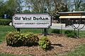 2009-04-18 Old West Durham sign.jpg 3,888 × 2,592; 5.78 MB
-
 2009-07-05 Ample Storage Center with businesses.jpg 3,888 × 2,592; 2.89 MB
-
 2010-04-03 Tarantino for school board.jpg 3,888 × 2,592; 2.79 MB
-
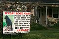 2010-05-28 Reward for lost black cat.jpg 3,888 × 2,592; 3.05 MB
-
 2010-08-03 Taxation without rectification.jpg 2,592 × 3,888; 4.59 MB
-
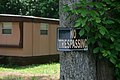
 2011-02-11 No tresspassing trailer.jpg 2,408 × 3,612; 3.3 MB
-
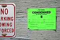 2011-05-22 Liberty Warehouse condemned notice in Durham.jpg 3,888 × 2,592; 3.98 MB
-
 2011-05-23 No Tresspassing.jpg 3,834 × 2,556; 2.97 MB
-
 2011-10-23 Parking lot war in Durham.jpg 3,888 × 2,592; 4.61 MB
-
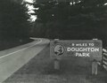 9 Miles to Doughton Park sign (cd0a81b3b6464d12831ac1476239dff1) (cropped).tif 1,353 × 1,061; 4.11 MB
-
 9 Miles to Doughton Park sign (cd0a81b3b6464d12831ac1476239dff1).tif 2,412 × 1,513; 10.44 MB
-
 Accomodations Bulletin Board (bc6b57d880ad43a5be28d45f48cc42b1) (cropped).tif 1,350 × 1,057; 4.08 MB
-
 Accomodations Bulletin Board (bc6b57d880ad43a5be28d45f48cc42b1).tif 2,474 × 1,571; 11.13 MB
-
 Ackland Art Museum.jpg 460 × 300; 33 KB
-
 Anson County Historical Society Inc ncecho 139033.jpg 1,536 × 2,048; 450 KB
-
 Appalachian Trail crossing sign (8358828273964b6bb3661913da80bcec) (photo).tif 1,348 × 971; 3.75 MB
-
 Appalachian Trail crossing sign (8358828273964b6bb3661913da80bcec).tif 2,474 × 1,571; 11.13 MB
-
 Appalachian Trail interpretive sign (0a77751c94d14543a0f9e0c458ca6042) (cropped).tif 1,354 × 999; 3.87 MB
-
 Appalachian Trail interpretive sign (0a77751c94d14543a0f9e0c458ca6042).tif 2,474 × 1,571; 11.13 MB
-
 Appalachian Trail sign IMG 4933.JPG 4,608 × 3,456; 4.55 MB
-
 Asheville District, Blue Ridge Parkway (9971bb0bfb964f409d949854ec83fc20).tif 2,409 × 1,509; 10.4 MB
-
 Autryville, North Carolina.JPG 2,560 × 1,920; 1.21 MB
-
 Beach access sign in Wrightsville Beach.jpg 6,000 × 4,000; 7.29 MB
-
 Beacon Heights Parking Area sign (c59a25213b9d4f7789de0f376c7ce3c6).tif 2,409 × 1,510; 10.41 MB
-
 BKR Sign.jpg 4,128 × 3,096; 3.97 MB
-
 Block House Historic Site.jpg 4,032 × 2,268; 1.82 MB
-
-
-
 Boone's Trace Overlook and historical marker (4af4205c593c48e084211462fd296df2).tif 2,409 × 1,508; 10.39 MB
-
 Boone's Trace Overlook and historical marker (69cef798298d436ba85b6abb8fe90bb9).tif 2,425 × 1,504; 10.44 MB
-

-
 Bridge Sign in Wrightsville Beach.jpg 3,264 × 2,448; 3.66 MB
-
 Brightleaf Square - panoramio (1).jpg 3,236 × 2,410; 2.19 MB
-
 Brightleaf Square - panoramio.jpg 3,257 × 1,215; 850 KB
-
 Brinegar Cabin Gunboard Sign (2ef93b0e-da5e-07bd-0253-8aaf88c09f6e).jpg 800 × 600; 258 KB
-
 Cape Fear Academy Road Sign 2.jpg 3,264 × 2,448; 2.94 MB
-
 Cape Fear Academy Road Sign.jpg 6,000 × 4,000; 7.4 MB
-
 Cape Hatteras Lighthouse Cape Hatteras 63.jpg 4,608 × 3,456; 5.5 MB
-
 CapeHatterasNationalSeashore.JPG 800 × 641; 274 KB
-
 Carrboro Town Hall sign.jpg 792 × 473; 115 KB
-
 Catawba River Greenway (44d8f2e8-4912-416f-8d9a-af8866ece5da).jpg 1,000 × 666; 229 KB
-
 Chatham County Government Complex Sign.jpg 6,000 × 4,000; 10.72 MB
-
 CherryNeighborhood.jpg 828 × 1,093; 916 KB
-
 Clark and Sorrell Garage.jpg 3,648 × 2,736; 2.4 MB
-
 COLLEGE PARK - panoramio.jpg 1,536 × 2,048; 1.37 MB
-
 ConcordNC Barber-ScotiaCollege 0579.jpg 3,724 × 2,483; 7 MB
-
 Cool Springs Baptist Church (0b766f373483421dbb8c8d3a0bf1e292).tif 2,425 × 1,504; 10.44 MB
-
 Core Banks - Bird signs - 1.JPG 2,400 × 2,000; 1.98 MB
-
 Core Banks - Bird signs - 2.JPG 2,284 × 2,592; 1.99 MB
-
 Crystal Coast Welcome.jpg 3,456 × 2,592; 2.99 MB
-
 Cubbies-Freedom Fries.jpg 800 × 534; 114 KB
-
 Deep Gap, Milepost 276.4, Blue Ridge Parkway (001941e180a1434da43697ff27bb0404).tif 2,409 × 1,511; 10.41 MB
-
 Deep Gap, Milepost 276.4, Blue Ridge Parkway (2351099daf6f45238ea403a93f51675e).tif 2,409 × 1,510; 10.41 MB
-
 Deep Gap, Milepost 276.4, Blue Ridge Parkway (392bde184a2843fa91b5e5580fe740e2).tif 2,409 × 1,508; 10.39 MB
-
 Deep Gap, Milepost 276.4, Blue Ridge Parkway (4fe20649fd6d43b9b68c070bde17ed50).tif 2,409 × 1,504; 10.37 MB
-
 Deep Gap, Milepost 276.4, Blue Ridge Parkway (b3cc9ccd609340a49c739f62e4d98a4f).tif 2,409 × 1,503; 10.36 MB
-
 Deep Gap, Milepost 276.4, Blue Ridge Parkway (b8a649f1a18141858a0343689ca5d439).tif 2,409 × 1,506; 10.38 MB
-
 Defense of Habitation citation.JPG 1,024 × 768; 533 KB
-
 DeGraffenried Park Historic District.JPG 4,320 × 2,880; 4.98 MB
-
 Devils Backbone Parking Overlook sign (60adecb35485488a90a44048c195bcbb) (cropped).tif 1,352 × 1,005; 3.89 MB
-
 Devils Backbone Parking Overlook sign (60adecb35485488a90a44048c195bcbb).tif 2,470 × 1,567; 11.08 MB
-
 Do Not Block Driveway (30943818983).jpg 4,896 × 3,264; 1.91 MB
-
 Do Not Climb Sign (ab0a0866a4d8409cbff5301406e0680e) (cropped).tif 1,350 × 895; 3.46 MB
-
 Do Not Climb Sign (ab0a0866a4d8409cbff5301406e0680e).tif 2,448 × 1,557; 10.91 MB
-
 Dodge Power Wagon @ Kenly 95-7.jpg 3,648 × 2,736; 2.07 MB
-
 Durham School for the Arts - panoramio.jpg 3,262 × 2,446; 1.88 MB
-
 Easel "The Shagbark Hickory" (854147c6408f410ab7ced6b3c702373a) (cropped).tif 1,346 × 1,005; 3.87 MB
-
 Easel "The Shagbark Hickory" (854147c6408f410ab7ced6b3c702373a).tif 2,448 × 1,557; 10.91 MB
-
 Easel "Virginia Profile" (cf145783ab7f45fa875a31c716c856f4) (cropped).tif 1,351 × 1,003; 3.88 MB
-
 Easel "Virginia Profile" (cf145783ab7f45fa875a31c716c856f4).tif 2,448 × 1,567; 10.98 MB
-
 Easel "Virginia Profile" (f620bbb6ce6444d2b9d49f3c39c60af0) (cropped).tif 1,351 × 1,005; 3.89 MB
-
 Easel "Virginia Profile" (f620bbb6ce6444d2b9d49f3c39c60af0).tif 2,448 × 1,567; 10.98 MB
-
 Easel at Headforemost Parking Area on Tulip Poplar Tree (af7ccd654dfc4d0783b46910cfcde44c).tif 2,448 × 1,567; 10.98 MB
-
 Easel at Headforemost Parking Area on Tulip Poplar Tree (f6f0c76847724bc8b5b9b771f3153459).tif 2,448 × 1,567; 10.98 MB
-

-
 East Chapel Hill High School with sign.jpg 2,592 × 1,944; 1.14 MB
-
 Eastover Community Center.jpg 1,024 × 768; 630 KB
-
 Entrance sign to E.B. Jeffress Park (508898a0e9024101a9946ff9afb4e345).tif 2,409 × 1,508; 10.39 MB
-
 Entrance sign, Rockfish Gap (55b1ee35960b4175ae0404a0974feba1).tif 2,448 × 1,567; 10.98 MB
-
 Entrance sign, Rockfish Gap (9958e1c1b3eb437799ecf84850176f2d).tif 2,448 × 1,567; 10.98 MB
-
 Entrance sign, Rockfish Gap (a1c2f4a5d9594ee9b006e27d430a9bb4).tif 2,448 × 1,567; 10.98 MB
-
 Entrance sign, Rockfish Gap (c0aa4c6cc1af4ef4bf4e9af7be94b52c).tif 2,448 × 1,567; 10.98 MB
-
 Entrance to the Blue Ridge Parkway Sign.jpg 5,038 × 1,978; 1.66 MB
-
 Environmental Message label near bench (b45a2354ebdb457ca328d5033c90de81).tif 2,448 × 1,557; 10.91 MB
-
 Environmental Message label sign (34b285ba7efd43bbb310df6d415f9fd8).tif 2,448 × 1,557; 10.91 MB
-
 Exterior of Great Wolf Lodge Charlotte-Concord (May-June 2023) 04.jpg 6,000 × 4,000; 12.88 MB
-
 Exterior of Great Wolf Lodge Charlotte-Concord (May-June 2023) 05.jpg 6,000 × 4,000; 10.93 MB
-
 Exterior of Great Wolf Lodge Charlotte-Concord (May-June 2023) 16.jpg 6,000 × 4,000; 4.81 MB
-

-
 Facilities and signs in Rocky Knob Campground (a21e49036d514df598d43c5808a5597c).tif 2,448 × 1,557; 10.91 MB
-
 Forest Preservation Warning Sign in NC.jpg 4,000 × 3,000; 3.93 MB
-
 Fountain and sign at Stillhouse Hollow Parking Overlook (1555be3de4034d44a60718ab84cc84df).tif 2,448 × 1,557; 10.91 MB
-
 Grade crossing at Milepost 4.4 (2a9489a81c3e4a2782019cf37e1efc60).tif 2,448 × 1,567; 10.98 MB
-
 Greenstone Parking Overlook sign (010ebd7d952b4c7a929349c0790c0cf3).tif 2,448 × 1,567; 10.98 MB
-
 Greenstone Parking Overlook, Milepost 10.4 (204db1eae7fe45fa87312b1e829ea4f4).tif 2,448 × 1,567; 10.98 MB
-
 Greenstone Trail Interpretive Sign (a71e7494a16b4f0ca1a6fc8f4b6c6ddf).tif 2,448 × 1,557; 10.91 MB
-
 Guilford Courthouse National Military Park entrance.jpg 5,347 × 3,514; 7.64 MB
-
 Hamby Creek-02.jpg 7,360 × 4,912; 9.28 MB
-
 HarwoodGarden.jpg 2,832 × 2,128; 2.5 MB
-
 Humpback Rocks area sign (01a36b7c717b4ab7bb68135ecf803ba3).tif 2,448 × 1,567; 10.98 MB
-
 HurricaneFloodLevelSign-Cats15-10FtElevation (26270568908).jpg 1,600 × 2,400; 2.09 MB
-
 Hyman Heights.jpg 1,836 × 3,264; 2.2 MB
-
 Informational sign in front of Haughton-McIver House.jpg 4,032 × 3,024; 2.97 MB
-
 Interpretive easel showing "Drainage Divide" (f47d4c727e354bd7a9f8aae70aa2c625).tif 2,470 × 1,567; 11.08 MB
-
 Interpretive sign "Rakes Mill Pond" (eacb36fb0abe450386d1843e47fea787).tif 2,448 × 1,557; 10.91 MB
-
 Interpretive Sign - "The Saddle" (ad2160a7a07f4e8f9900900c235544e4).tif 2,448 × 1,557; 10.91 MB
-
 Interpretive Sign - "The Saddle" (d63cbe6e949b46f4be213087c80cc82b).tif 2,448 × 1,557; 10.91 MB
-
 Interpretive sign at Porter Mountain (642628f6d37c496fa3ecc656f15471b6).tif 2,474 × 1,571; 11.13 MB
-
 Interpretive sign at Purgatory Mountain (e551420c539e4b07b0cc68fa55fb6523).tif 2,474 × 1,571; 11.13 MB
-
 Interpretive sign with program schedule (ece3ee66c0244ba2bba24fab651d93e4).tif 2,474 × 1,571; 11.13 MB
-
 Intersection Parkway and US 221, Adney Gap (0895566c89ca445796366332f6c34e7f).tif 2,470 × 1,567; 11.08 MB
-
 JimCrowInDurhamNC.jpg 1,878 × 1,260; 612 KB
-
 Johnson Farm interpretive sign (18731420d72e4823a024ef27d6575571).tif 2,448 × 1,567; 10.98 MB
-
 Johnson Farm interpretive sign (3327b26da9e44df6837cae2002ef7e91).tif 2,448 × 1,567; 10.98 MB
-
 Johnson Farm interpretive sign (971a97b5dcef4f2c9ae8a418b95ec83f).tif 2,448 × 1,567; 10.98 MB
-
 Johnson Farm interpretive sign (f1cb7129c6d44a46822170ba28824fd5).tif 2,448 × 1,567; 10.98 MB
-
 Johnson Farm with interpretive sign in foreground (6bdffb89d8a04ca288ebcfdc508ed026).tif 2,448 × 1,567; 10.98 MB
-
 Kings Mountain (326e2cab-5011-40ab-bf46-244152b6f380).jpg 1,000 × 666; 164 KB
-
 Landfill Hill - panoramio.jpg 3,264 × 2,235; 1.25 MB
-
 Leaning sign at The Loops Overlook (10704d2d63e9464fb43d9fa470ce45ba).tif 2,393 × 1,504; 10.3 MB
-
 Leaning sign at The Loops Overlook (30452e182b3245558927eae9a37bdebe).tif 2,425 × 1,500; 10.41 MB
-
 Live Oak Bank 2.jpg 4,032 × 3,024; 6.3 MB
-
 Mall Twin Theatres.jpg 4,032 × 3,024; 3.17 MB
-
 MariaParamHospital 9876.jpg 3,655 × 2,514; 9.93 MB
-
 Marshville Welcome Sign on U.S. Route 74.jpg 6,000 × 2,082; 2.08 MB
-
 Medgar Evers Historic District (2).jpg 3,264 × 2,448; 2.31 MB
-
 Miscellaneous signs near Peaks of Otter (26208d4bb8f147f99c560dac0a08609e).tif 2,474 × 1,571; 11.13 MB
-
 Miscellaneous signs near Peaks of Otter (e73819201cc94a46b8bef33f12dc5384).tif 2,474 × 1,571; 11.13 MB
-
 Miscellaneous signs near Peaks of Otter (f1cbd0f96247431dbd9d691134c4adcd).tif 2,474 × 1,571; 11.13 MB
-
 Miscellaneous signs near Peaks of Otter (fdb260900115454d8842cb0d3dbac0b5).tif 2,474 × 1,571; 11.13 MB
-

-

-
 Mount Mitchell State Park sign (0290715ae70644d59274a1b93474c92f).tif 2,409 × 1,508; 10.39 MB
-
 Mount Mitchell State Park sign (8f180b087d6c41709ff661f8b6dfd927).tif 2,409 × 1,508; 10.39 MB
-
 Mountain Pines easel at Whites Gap (379dfa6b56b543e090ff620320dd1eda).tif 2,448 × 1,557; 10.91 MB
-
 Mountain Pines easel at Whites Gap (65dc2a0b5cdb40a7ae19b9b094173cd1).tif 2,448 × 1,557; 10.91 MB
-
 Mountain Pines easel at Whites Gap (8843f9821afc48ad959cbad5307e3e7b).tif 2,448 × 1,557; 10.91 MB
-
 NCDOT HQ Building Sign in Raleigh.jpg 4,000 × 3,000; 3.45 MB
-
 Neal Somers Alexander Homestead Sign.jpg 3,910 × 2,613; 6.5 MB
-
 Non-conforming "No Parking" sign (2a18d158cd0b40e0a12ec05d4efb26cb).tif 2,474 × 1,571; 11.13 MB
-
 North Carolina Department of Agriculture Building Sign in Raleigh.jpg 4,000 × 3,000; 1.86 MB
-
 North Carolina State Highway 143 (Cherohala Skyway) - 14717994086.jpg 3,072 × 2,304; 824 KB
-
 North Carolina State Highway 143 (Cherohala Skyway) - 14737814351.jpg 3,072 × 2,304; 680 KB
-
 North Carolina State Highway 143 (Cherohala Skyway) - 14738565664.jpg 3,072 × 2,304; 1.46 MB
-
 Occoneechee outhouse.jpg 2,816 × 2,112; 4 MB
-
 Occoneechee tickets.jpg 2,816 × 2,112; 4.2 MB
-
 Oconaluftee Terminus area (8adb7b2ef6c9408e93500c8d5e877ff8) (cropped).tif 1,355 × 1,052; 4.08 MB
-
 Oconaluftee Terminus area (8adb7b2ef6c9408e93500c8d5e877ff8).tif 2,414 × 1,504; 10.39 MB
-
 Oconaluftee Terminus before river (16989a77dca149489e3e6e08fafb540e).tif 2,409 × 1,504; 10.37 MB
-
 Oconaluftee Terminus before river (842c56d59eb449cb91b1276441967753) (cropped).tif 1,354 × 1,053; 4.08 MB
-
 Oconaluftee Terminus before river (842c56d59eb449cb91b1276441967753).tif 2,409 × 1,502; 10.35 MB
-
 Old Bonclarken Sign.jpg 960 × 720; 74 KB
-
 Old Bull Sign (Illuminated), Durham (April 2023) 10.jpg 6,000 × 4,000; 6.66 MB
-
 Old Bull Sign (Illuminated), Durham (April 2023) 11.jpg 6,000 × 4,000; 6.49 MB
-
 Old Bull Sign (Illuminated), Durham (April 2023) 12.jpg 6,000 × 4,000; 5.71 MB
-
 Old Bull Sign (Illuminated), Durham (April 2023) 13.jpg 6,000 × 4,000; 4.87 MB
-
 Old Bull Sign (Illuminated), Durham (April 2023) 14.jpg 6,000 × 4,000; 6.53 MB
-
 Old Bull Sign (Illuminated), Durham (April 2023) 15.jpg 6,000 × 4,000; 6.29 MB
-
 Old Bull Sign (Illuminated), Durham (April 2023) 16.jpg 6,000 × 4,000; 6.24 MB
-
 Old Bull Sign (Illuminated), Durham (April 2023) 17.jpg 6,000 × 4,000; 6.05 MB
-
 Old Bull Sign (Illuminated), Durham (April 2023) 18.jpg 6,000 × 4,000; 6.29 MB
-
 Old Bull Sign (Illuminated), Durham (April 2023) 2.jpg 6,000 × 4,000; 6.72 MB
-
 Old Bull Sign (Illuminated), Durham (April 2023) 3.jpg 6,000 × 4,000; 7.11 MB
-
 Old Bull Sign (Illuminated), Durham (April 2023) 4.jpg 6,000 × 4,000; 6.68 MB
-
 Old Bull Sign (Illuminated), Durham (April 2023) 5.jpg 6,000 × 4,000; 5.85 MB
-
 Old Bull Sign (Illuminated), Durham (April 2023) 6.jpg 6,000 × 4,000; 6.4 MB
-
 Old Bull Sign (Illuminated), Durham (April 2023) 7.jpg 6,000 × 4,000; 6.1 MB
-
 Old Bull Sign (Illuminated), Durham (April 2023) 8.jpg 6,000 × 4,000; 5.9 MB
-
 Old Bull Sign (Illuminated), Durham (April 2023) 9.jpg 6,000 × 4,000; 5.41 MB
-
 Old Bull Sign (Illuminated), Durham (April 2023).jpg 6,000 × 4,000; 6.09 MB
-
 Old Bull Sign (Illuminated), Durham (September 2022).jpg 4,000 × 3,000; 2.32 MB
-
 Parkway near Puckett Cabin (58d3ab96976e45cbb0176bc60daa3580).tif 2,448 × 1,557; 10.91 MB
-
 Parkway sign before Doughton Park sign (85482c2cc18442ef976041b6b0636fde).tif 2,409 × 1,506; 10.38 MB
-
 Parkway Sign by State (fcd3be921fad461c96aba18e1882626d).tif 2,448 × 1,567; 10.98 MB
-
 Parkway sign near Milepost 90 (4b4f59c4329e45728242fbe184526f96).tif 2,474 × 1,571; 11.13 MB
-
 Peaks of Otter Campground (3a255ba93f9940909bf72e4f77380235).tif 2,470 × 1,545; 10.93 MB
-
 Peaks of Otter Picnic Area (4df94d40096c4e7dbe0330fb21d11a9a).tif 2,470 × 1,545; 10.93 MB
-
 Peaks of Otter sign (3c3c87b591384c338fbfc89246401d6f).tif 2,474 × 1,571; 11.13 MB
-
 Peaks of Otter sign at VA Route 43 intersection (ad4c3ba5fc804726810a15665cbb3151).tif 2,474 × 1,571; 11.13 MB
-
 Peaks of Otter Subdistrict, Milepost 105 (8434c62c7b2e4575b7a709bcc9c9aa80).tif 2,474 × 1,571; 11.13 MB
-
 Peaks of Otter Subdistrict, Milepost 105 (ae731c0bddb64422b4640aba9f45bf8a).tif 2,474 × 1,571; 11.13 MB
-
 Pelliter House Jacksonville NC June 2014 - panoramio (2).jpg 2,592 × 1,936; 2.16 MB
-
 Progress-Energy-Center-for-the-Performing-Arts-20080321.jpeg 3,008 × 2,000; 2.88 MB
-
 Public Water Access Sign in Emerald Isle.jpg 4,000 × 6,000; 12.8 MB
-
 Qualla Indian Reservation (NC).jpg 466 × 466; 23 KB
-
 Queens 1900 sign.jpg 5,184 × 3,456; 8.41 MB


.jpg)

.jpg)
.jpg)


.jpg)


.jpg)


_04.jpg)
_05.jpg)
_16.jpg)


.jpg)


.jpg)


.jpg)
.jpg)
.jpg)


_-_14717994086.jpg)
_-_14737814351.jpg)
_-_14738565664.jpg)


,_Durham_(April_2023)_10.jpg)
,_Durham_(April_2023)_11.jpg)
,_Durham_(April_2023)_12.jpg)
,_Durham_(April_2023)_13.jpg)
,_Durham_(April_2023)_14.jpg)
,_Durham_(April_2023)_15.jpg)
,_Durham_(April_2023)_16.jpg)
,_Durham_(April_2023)_17.jpg)
,_Durham_(April_2023)_18.jpg)
,_Durham_(April_2023)_2.jpg)
,_Durham_(April_2023)_3.jpg)
,_Durham_(April_2023)_4.jpg)
,_Durham_(April_2023)_5.jpg)
,_Durham_(April_2023)_6.jpg)
,_Durham_(April_2023)_7.jpg)
,_Durham_(April_2023)_8.jpg)
,_Durham_(April_2023)_9.jpg)
,_Durham_(April_2023).jpg)
,_Durham_(September_2022).jpg)
.jpg)


.jpg)
