Category:Signs in Scotland

Constituent countries of the United Kingdom: England · Northern Ireland · Scotland · Wales – British Crown dependencies: Bailiwick of Guernsey · Isle of Man · Jersey
British overseas territories: Anguilla · Bermuda · British Virgin Islands · Cayman Islands · Falkland Islands · Gibraltar · Turks and Caicos Islands
British overseas territories: Anguilla · Bermuda · British Virgin Islands · Cayman Islands · Falkland Islands · Gibraltar · Turks and Caicos Islands
Subcategories
This category has the following 32 subcategories, out of 32 total.
A
B
- Banners in Scotland (12 F)
- Billboards in Scotland (7 F)
C
- Cairngorms National Park signs (13 F)
- Castle signs in Scotland (18 F)
- Church signs in Scotland (43 F)
E
- Entrance signs in Scotland (2 F)
F
H
- Hunting signs in Scotland (5 F)
I
M
P
R
S
- ScotWays signs (28 F)
- Shop signs in Scotland (16 F)
T
W
Media in category "Signs in Scotland"
The following 200 files are in this category, out of 200 total.
-
 "Jesus Saves" - geograph.org.uk - 362305.jpg 640 × 480; 90 KB
-
 "Piccadilly", Rothiemurchus - geograph.org.uk - 185704.jpg 640 × 427; 128 KB
-

-
 ... from Hell - geograph.org.uk - 2941127.jpg 640 × 480; 255 KB
-
 2011 Perthshire Ben Lawers parkeerplaats 6-06-2011 17-02-53.jpg 4,288 × 2,848; 2.15 MB
-
 2011 Schotland Ben Lawers parkeerplaats 6-06-2011 17-02-53.png 4,288 × 2,848; 18.26 MB
-
 A gate on the way to Fast Castle - geograph.org.uk - 3526337.jpg 640 × 478; 214 KB
-
 A nostalgic level crossing sign - geograph.org.uk - 5456289.jpg 480 × 640; 395 KB
-
 A tree-mounted 'Farms sign' - geograph.org.uk - 3169744.jpg 3,648 × 2,736; 2.74 MB
-
 Auchlean, Glen Feshie. - geograph.org.uk - 420783.jpg 640 × 427; 156 KB
-
 Bell Tower signpost - geograph.org.uk - 260090.jpg 640 × 480; 86 KB
-
 Borders Region.jpg 1,178 × 796; 115 KB
-
 Brainport Heritage Trail - geograph.org.uk - 460971.jpg 430 × 640; 97 KB
-
 Bruichladdich-Islay.jpg 3,570 × 1,614; 956 KB
-

-
 Bynack Stable. - geograph.org.uk - 420611.jpg 640 × 427; 168 KB
-
 CalMac Ferry Terminal sign - geograph.org.uk - 741335.jpg 640 × 480; 70 KB
-

-
 Coire Cas - geograph.org.uk - 419612.jpg 469 × 640; 142 KB
-
 Comes to the point^ - geograph.org.uk - 543222.jpg 640 × 480; 78 KB
-
 Crossgates - geograph.org.uk - 43053.jpg 640 × 480; 83 KB
-
 Danger Ahead^ - geograph.org.uk - 1255155.jpg 480 × 640; 157 KB
-
-
 Doune Castle - geograph.org.uk - 245270.jpg 480 × 640; 95 KB
-
 Druimuachdar Pass railway sign - geograph.org.uk - 385960.jpg 640 × 480; 103 KB
-
 Dunna Chuck Bruck - close up - geograph.org.uk - 458570.jpg 362 × 480; 133 KB
-
 Elgol harbour boat trips schedules.jpg 690 × 870; 212 KB
-
 ElmwoodCollegeLogo.JPG 3,040 × 2,016; 1.17 MB
-
 England Sign on Coldstream Bridge - geograph.org.uk - 84923.jpg 1,176 × 1,760; 885 KB
-
 Entering Rosehearty. - geograph.org.uk - 317900.jpg 640 × 426; 98 KB
-
 Fire Mark for Caledonian Insurance Company in Edinburgh, Scotland.jpg 1,946 × 1,702; 830 KB
-
 Fire mark for Caledonian Insurance Company in Edinburgh, Scotland.jpg 1,917 × 1,721; 785 KB
-
 Foot and Mouth sign. - geograph.org.uk - 249537.jpg 480 × 640; 70 KB
-
 Forest Lodge Sawmill - geograph.org.uk - 402912.jpg 640 × 480; 136 KB
-

-
 Forse House sign - geograph.org.uk - 481237.jpg 640 × 481; 94 KB
-
 Geographical signpost - geograph.org.uk - 53805.jpg 527 × 640; 113 KB
-
 Gift shop, Gairloch - geograph.org.uk - 281528.jpg 640 × 480; 92 KB
-
 2018 at Glasgow Central station - corner of Gordon Street.JPG 1,024 × 1,366; 628 KB
-
 Glenkinchie Distillery2.jpg 1,200 × 1,600; 252 KB
-
 Graveyard of the signs - geograph.org.uk - 890886.jpg 359 × 640; 86 KB
-
 Guidance on Stronsay harbour. - geograph.org.uk - 531477.jpg 640 × 426; 47 KB
-
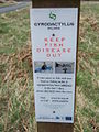 Gyrodactylus salaris warning.jpg 480 × 640; 82 KB
-
 Helpful Road Sign - geograph.org.uk - 225036.jpg 640 × 398; 276 KB
-
 Hilton of Forthar, road end. - geograph.org.uk - 122098.jpg 640 × 509; 99 KB
-
 Horse in snowy field at Balquhidder - geograph.org.uk - 677815.jpg 640 × 480; 81 KB
-
 Information boards at Old Kirkland - geograph.org.uk - 1516436.jpg 640 × 427; 138 KB
-
 Inverdruie 1.jpg 2,493 × 1,648; 2.02 MB
-
 Inverie, school access only - geograph.org.uk - 3288697.jpg 640 × 480; 100 KB
-
 K boot sign, Esplanade, Lerwick - geograph.org.uk - 1804905.jpg 640 × 480; 81 KB
-
 Kielder - Water and Forest Park - geograph.org.uk - 770190.jpg 640 × 423; 100 KB
-
 2019 at Kilmarnock station - platform 1.JPG 1,366 × 910; 462 KB
-
 Kintyre Way sign post Tarbert Castle. - geograph.org.uk - 558955.jpg 640 × 480; 63 KB
-
 Leverburgh Ferry Terminal Entrance.jpg 4,032 × 3,024; 2.73 MB
-

-
 Loch Arthur Creamery Sign - Scotland.jpg 3,264 × 2,176; 2.88 MB
-
 Loch Luichart Dam - geograph.org.uk - 693496.jpg 640 × 360; 90 KB
-
 Locked gate on cycle route - geograph.org.uk - 263390.jpg 640 × 480; 95 KB
-
 Lyth crossroads - geograph.org.uk - 479411.jpg 640 × 480; 118 KB
-
 Milton - geograph.org.uk - 544672.jpg 640 × 480; 88 KB
-

-
 Nardini’s, Largs - view of sign above corner entrance.jpg 5,472 × 3,648; 9.36 MB
-
 National Cycle Network route marker - geograph.org.uk - 1167131.jpg 640 × 480; 68 KB
-
 Nimby sign, Craik. - geograph.org.uk - 105738.jpg 640 × 480; 93 KB
-
 No Climbing - geograph.org.uk - 231806.jpg 640 × 480; 79 KB
-
 No skiing^ - geograph.org.uk - 72777.jpg 640 × 480; 55 KB
-
 Notice in the Crown Hotel, Peebles (geograph 6426268).jpg 1,600 × 1,066; 198 KB
-
 NTS sign.jpg 768 × 1,024; 359 KB
-
 On Nairn Beach - geograph.org.uk - 610954.jpg 640 × 480; 49 KB
-
 Park Signage - geograph.org.uk - 3052554.jpg 2,304 × 1,728; 993 KB
-
 Pirates Cove and Treasure Island sign Yellowcraigs.jpg 500 × 270; 154 KB
-
 Red light and escort services - geograph.org.uk - 635316.jpg 640 × 425; 110 KB
-
 Road to Knapperfield - geograph.org.uk - 543558.jpg 640 × 480; 80 KB
-
 Ryvoan Pass. - geograph.org.uk - 420588.jpg 427 × 640; 158 KB
-
 Sailings timetable - geograph.org.uk - 479790.jpg 640 × 480; 110 KB
-
 Sign at Aultmore Distillery - geograph.org.uk - 1107975.jpg 385 × 640; 192 KB
-
 Sign care - geograph.org.uk - 70607.jpg 640 × 523; 39 KB
-

-
 Sign for National Bank of Scotland, National Museum of Scotland.jpg 2,056 × 3,088; 2.85 MB
-
 Signpost for The Witches Trail - geograph.org.uk - 342328.jpg 627 × 479; 78 KB
-
 Signposts in Forrest Estate. - geograph.org.uk - 514915.jpg 640 × 480; 100 KB
-
 Signs hg.JPG 4,928 × 3,280; 9.54 MB
-
 Signs in Friarton, Perth.jpg 3,104 × 1,746; 1.84 MB
-
 Signs, Ayr High Street - geograph.org.uk - 4400864.jpg 600 × 800; 100 KB
-
 Spier's Care Home.jpg 2,288 × 1,712; 1.18 MB
-
 The Butt of the Joke..... - geograph.org.uk - 603382.jpg 640 × 480; 70 KB
-
 The New Bridge at Musselburgh - geograph.org.uk - 1195848.jpg 640 × 480; 112 KB
-
 The Old And The New - geograph.org.uk - 615330.jpg 369 × 600; 54 KB
-
 The road to Blackburn Farm - geograph.org.uk - 522009.jpg 640 × 480; 111 KB
-
 This way to the internet - geograph.org.uk - 244950.jpg 640 × 480; 85 KB
-

-
 Tuiteam sign.jpg 366 × 275; 65 KB
-
 Unexpected notice - geograph.org.uk - 369788.jpg 640 × 480; 104 KB
-
 Upper Lenie 1.jpg 4,096 × 3,072; 5.95 MB
-
 Welcometomoodiesburn.jpg 2,240 × 1,240; 917 KB
-
 Wemyss Estate sign at Gosford - geograph.org.uk - 920923.jpg 640 × 480; 61 KB
-
 West Saltoun - geograph.org.uk - 76125.jpg 640 × 480; 186 KB
-
-
 A notice - geograph.org.uk - 481710.jpg 640 × 427; 62 KB
-
 A signal signpost - geograph.org.uk - 154733.jpg 427 × 640; 106 KB
-
 A Sign^ - geograph.org.uk - 255129.jpg 640 × 480; 102 KB
-
 Access Only - geograph.org.uk - 1458583.jpg 640 × 427; 45 KB
-
 Allt Ruigh Chaorachain Water Supply - geograph.org.uk - 727728.jpg 640 × 480; 111 KB
-
 Back Walk, Stirling - geograph.org.uk - 57900.jpg 640 × 427; 112 KB
-
 Beware of the squirrels - geograph.org.uk - 714962.jpg 640 × 480; 75 KB
-
 Bridge this way - geograph.org.uk - 549598.jpg 640 × 480; 192 KB
-

-
 Corgyle sign post. - geograph.org.uk - 246921.jpg 640 × 480; 130 KB
-
 Corran Ferry fares - geograph.org.uk - 728308.jpg 480 × 640; 70 KB
-
 Cunninghamhead Mill Sign - geograph.org.uk - 283967.jpg 640 × 480; 131 KB
-

-
 Direction marker - geograph.org.uk - 544343.jpg 640 × 480; 161 KB
-
 Direction sign - geograph.org.uk - 485075.jpg 640 × 480; 62 KB
-
 Direction sign at Ben Alder Lodge - geograph.org.uk - 263948.jpg 480 × 640; 121 KB
-
 Dirty signs at road junction. - geograph.org.uk - 133804.jpg 640 × 427; 91 KB
-
 Drumguish tackles its boy racer problem - geograph.org.uk - 714952.jpg 640 × 480; 104 KB
-
 Dunvegan Road, Portree - geograph.org.uk - 358438.jpg 640 × 482; 170 KB
-
 Entering Altnaharra - geograph.org.uk - 547298.jpg 640 × 491; 125 KB
-
 Entering Golspie - geograph.org.uk - 776346.jpg 640 × 480; 81 KB
-
 Entering Seilebost from the west - geograph.org.uk - 659278.jpg 640 × 417; 55 KB
-
 Fannyfield - geograph.org.uk - 65368.jpg 640 × 480; 138 KB
-
 Finstown - geograph.org.uk - 56222.jpg 312 × 640; 132 KB
-
 Follow me^ - geograph.org.uk - 4626.jpg 640 × 528; 54 KB
-
 Footpath sign, near Coraldie - geograph.org.uk - 579461.jpg 480 × 640; 55 KB
-
 For Richard - geograph.org.uk - 102799.jpg 640 × 480; 111 KB
-
 Forest Signs - geograph.org.uk - 752362.jpg 640 × 411; 141 KB
-
 Forestry sign at Leithope Forest - geograph.org.uk - 543411.jpg 618 × 468; 104 KB
-
 Froth Raod Bridge Petorl Statoin - geograph.org.uk - 141423.jpg 640 × 480; 53 KB
-
 Good luck to Little Dounepark^^ - geograph.org.uk - 239350.jpg 640 × 426; 156 KB
-
 Hackney Coach Sign in Colinton - geograph.org.uk - 232673.jpg 480 × 640; 362 KB
-
 Haster - geograph.org.uk - 544661.jpg 640 × 480; 101 KB
-
 Helensburgh, Footpath Signpost - geograph.org.uk - 92012.jpg 640 × 480; 135 KB
-
 Helpful sign - geograph.org.uk - 308475.jpg 480 × 640; 102 KB
-
 Hill this way - geograph.org.uk - 637578.jpg 640 × 480; 99 KB
-
 House Sign for Brybeg. - geograph.org.uk - 182790.jpg 640 × 480; 84 KB
-
 Hydroelectric map - geograph.org.uk - 672702.jpg 640 × 480; 53 KB
-

-

-

-
 Junction - geograph.org.uk - 165097.jpg 640 × 480; 102 KB
-
 Kirkwall - geograph.org.uk - 13764.jpg 480 × 640; 84 KB
-
 Loch Awe fishing permit notice by loch. - geograph.org.uk - 195306.jpg 640 × 480; 172 KB
-
 Lost - geograph.org.uk - 122440.jpg 640 × 433; 103 KB
-
 Meaningless - geograph.org.uk - 693850.jpg 640 × 480; 116 KB
-
 Memorial plaque, Loch Teàrnait - geograph.org.uk - 449430.jpg 640 × 480; 129 KB
-
 Modified sign - geograph.org.uk - 157449.jpg 640 × 480; 73 KB
-
 Monymusk - geograph.org.uk - 5380.jpg 480 × 640; 143 KB
-
 Mounteagle - geograph.org.uk - 506635.jpg 426 × 640; 110 KB
-
 Mounth Roads. - geograph.org.uk - 118137.jpg 480 × 640; 107 KB
-
 Nae Sheep - geograph.org.uk - 279244.jpg 640 × 480; 223 KB
-
 Nice try - geograph.org.uk - 210759.jpg 640 × 480; 87 KB
-
 No Vehicular Access - geograph.org.uk - 231799.jpg 480 × 640; 85 KB
-
 Note to contractors - geograph.org.uk - 230577.jpg 640 × 480; 93 KB
-
 Old Mills, Elgin. - geograph.org.uk - 121231.jpg 640 × 480; 146 KB
-
 Old sign, Dirleton. - geograph.org.uk - 115740.jpg 640 × 480; 70 KB
-
 Overzealous traffic prohibition. - geograph.org.uk - 222598.jpg 640 × 480; 99 KB
-
 Pettinain City Limits - geograph.org.uk - 162196.jpg 640 × 480; 95 KB
-
 Polite Sign - geograph.org.uk - 134335.jpg 640 × 480; 118 KB
-
 Polkelly - geograph.org.uk - 157283.jpg 640 × 480; 91 KB
-
 Private Road^ - geograph.org.uk - 232239.jpg 640 × 427; 120 KB
-
 Public footpath to Kilchrenan - geograph.org.uk - 105349.jpg 640 × 480; 198 KB
-
 Public footpath to Kilchrenan - geograph.org.uk - 105352.jpg 640 × 480; 209 KB
-
 Quatre Bras - geograph.org.uk - 480821.jpg 480 × 640; 91 KB
-
 Road side sign to carpark. - geograph.org.uk - 136809.jpg 640 × 480; 120 KB
-
 Road sign and Loandhu - geograph.org.uk - 506630.jpg 640 × 426; 76 KB
-
 Scarcerig - geograph.org.uk - 131023.jpg 640 × 445; 61 KB
-
 Sign - geograph.org.uk - 147675.jpg 640 × 480; 124 KB
-
 Sign and track to Rhian - geograph.org.uk - 546761.jpg 640 × 480; 80 KB
-
 Sign at entrance gate to lodges. - geograph.org.uk - 195284.jpg 640 × 480; 89 KB
-
 Sign at junction to Midtown - geograph.org.uk - 505153.jpg 640 × 426; 105 KB
-
 Sign at Mid Thundergay. - geograph.org.uk - 553860.jpg 640 × 426; 249 KB
-
 Sign for Glen Dessarry Forest - geograph.org.uk - 703825.jpg 640 × 427; 79 KB
-

-
 Sign on grouse moor - geograph.org.uk - 157448.jpg 640 × 480; 132 KB
-

-
 Sign to the Beinn a' Ghlinne Bhig Trig - geograph.org.uk - 145722.jpg 640 × 480; 123 KB
-
 Signs to cycle trails at Whitehills - geograph.org.uk - 9217.jpg 640 × 477; 70 KB
-
 Slow pheasants^ - geograph.org.uk - 81668.jpg 640 × 480; 138 KB
-
 So are ewe^ - geograph.org.uk - 81035.jpg 640 × 480; 153 KB
-
 Southern approach to Newcastleton - geograph.org.uk - 208994.jpg 640 × 480; 88 KB
-
 Southern Upland Way marker - geograph.org.uk - 206533.jpg 640 × 480; 105 KB
-
 Stalking warning sign - geograph.org.uk - 505114.jpg 640 × 480; 115 KB
-
 Strathnaver Trail - geograph.org.uk - 501134.jpg 640 × 480; 89 KB
-
 This way - geograph.org.uk - 353177.jpg 640 × 480; 104 KB
-
 Threats - geograph.org.uk - 235947.jpg 640 × 480; 80 KB
-
 Timber operations in progress - geograph.org.uk - 246048.jpg 640 × 480; 126 KB
-
 Toward signpost - geograph.org.uk - 40168.jpg 640 × 480; 96 KB
-
 Track to hotel - geograph.org.uk - 543026.jpg 640 × 417; 51 KB
-
 Trail Sign - geograph.org.uk - 706179.jpg 640 × 479; 89 KB
-
 Trail Sign - geograph.org.uk - 707754.jpg 640 × 479; 60 KB
-
 Trail sign at the Auchairne crossroads - geograph.org.uk - 353165.jpg 640 × 480; 127 KB
-
 Unfriendly Welcome - geograph.org.uk - 125826.jpg 640 × 480; 108 KB
-
 Walk this way - geograph.org.uk - 534345.jpg 438 × 640; 80 KB
-
 Walkers' signpost - geograph.org.uk - 55773.jpg 640 × 427; 127 KB
-
 Warning sign - geograph.org.uk - 176228.jpg 640 × 480; 299 KB
-
 Warning Sign at Fiveway Cottage - geograph.org.uk - 421179.jpg 640 × 480; 79 KB
-
 Warning Sign at Gilkercleuch - geograph.org.uk - 342342.jpg 640 × 480; 172 KB
-
 Warning sign for walkers at Corran - geograph.org.uk - 408685.jpg 640 × 427; 116 KB
-
 Welcome to Drummore - geograph.org.uk - 215724.jpg 640 × 480; 80 KB
-
 Woodland Sign at Upper Ardoch - geograph.org.uk - 50626.jpg 640 × 480; 101 KB


.jpg)


