Category:Silverbridge, County Armagh
English: Silverbridge (originally known in Irish as Beal Atha an Airgid) is a small village in County Armagh, Northern Ireland. In the 2001 Census it had a population of 165 people. It lies within the Newry and Mourne District Council area.
village in County Armagh, Northern Ireland  | |||||
| Upload media | |||||
| Instance of | |||||
|---|---|---|---|---|---|
| Location | Northern Ireland | ||||
 | |||||
Media in category "Silverbridge, County Armagh"
The following 81 files are in this category, out of 81 total.
-

-

-

-

-
 B30 north-west of Silverbridge - geograph.org.uk - 4153161.jpg 1,024 × 768; 315 KB
-
 Bonds Bridge over the Cully Water - geograph.org.uk - 4149520.jpg 1,024 × 768; 308 KB
-
 Bridge over the Cully Water River at Silverbridge - geograph.org.uk - 6254923.jpg 2,474 × 1,439; 2.09 MB
-
 Bungalow at the northern end of the Silverbridge - geograph.org.uk - 6271552.jpg 3,683 × 2,002; 4.02 MB
-
 Bungalow on the Silverbridge Road - geograph.org.uk - 3771388.jpg 1,024 × 733; 124 KB
-
 Carrigans Lough - geograph.org.uk - 263542.jpg 640 × 480; 94 KB
-

-
 Cashel Lough Upper from the Cashel Road - geograph.org.uk - 4315837.jpg 1,600 × 1,200; 479 KB
-
 Cashel Road at its junction with Ballinasack Road - geograph.org.uk - 4315081.jpg 1,600 × 1,200; 329 KB
-
 Cattle grazing on the edge of the Ummeracam Hall Plantation. - geograph.org.uk - 6286553.jpg 3,977 × 2,014; 3.09 MB
-
 Cully Water above Bonds Bridge - geograph.org.uk - 4154470.jpg 768 × 1,024; 320 KB
-
 Cully Water above the B30 bridge at Silverbridge - geograph.org.uk - 4296164.jpg 1,600 × 1,200; 335 KB
-

-

-
 Drumalt Road at the turn off for Bonds Bridge - geograph.org.uk - 4154437.jpg 1,024 × 768; 324 KB
-

-

-

-
 Farm access lane off the Cashel Road - geograph.org.uk - 4315025.jpg 1,600 × 1,200; 439 KB
-
 Farm buildings at Silverbridge House - geograph.org.uk - 4153674.jpg 1,024 × 768; 254 KB
-
 Farm buildings on the west side of Cashel Road - geograph.org.uk - 4314978.jpg 1,600 × 1,200; 488 KB
-
 Farmhouse on the B30 south of Aughanduff - geograph.org.uk - 6255557.jpg 3,488 × 1,895; 4.46 MB
-
 Field barn on the ridge west of Cashel Road - geograph.org.uk - 4315003.jpg 1,600 × 1,200; 540 KB
-

-
 Finnegans Nursery at Silverbridge - geograph.org.uk - 6285748.jpg 2,572 × 1,864; 2.84 MB
-
-
 Grazing land above Ballinasack Road - geograph.org.uk - 4315089.jpg 1,600 × 1,200; 536 KB
-
 Grazing land and copses west of the Silverbridge Road - geograph.org.uk - 4296133.jpg 1,600 × 1,200; 305 KB
-
 House drive at its junction with the B30 - geograph.org.uk - 4295893.jpg 1,600 × 1,156; 210 KB
-
 Keeley Park GAA ground, Silverbridge - geograph.org.uk - 4297033.jpg 1,600 × 822; 280 KB
-
 Newly built houses on the outskirts of Silverbridge - geograph.org.uk - 4296151.jpg 1,600 × 1,200; 219 KB
-

-
 Parkland at Silverbridge House - geograph.org.uk - 4296144.jpg 1,600 × 1,200; 285 KB
-
 Powerlines running alongside Cashel Road - geograph.org.uk - 4315064.jpg 1,600 × 1,200; 426 KB
-
 Recently built detached house West of the B30 - geograph.org.uk - 6286474.jpg 2,621 × 1,938; 2.37 MB
-
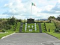 Republican Memorial - geograph.org.uk - 507797.jpg 640 × 487; 130 KB
-
 Rising land to the west of the Cully Water - geograph.org.uk - 3439679.jpg 1,024 × 737; 162 KB
-
 Roadside gardens on Cashel Road - geograph.org.uk - 4314987.jpg 1,600 × 1,200; 428 KB
-
 Rough grazing on the east side of Cashel Road - geograph.org.uk - 4315019.jpg 1,600 × 1,200; 487 KB
-
 Sheep pastures and rock outcrops - geograph.org.uk - 6282256.jpg 3,572 × 2,278; 3.32 MB
-
 Silverbridge Co.Armagh. - geograph.org.uk - 507765.jpg 640 × 426; 190 KB
-

-

-
 The B30 at its junction with Carrive Road - geograph.org.uk - 3460329.jpg 1,024 × 768; 205 KB
-

-
 The B30 climbing towards the Lough Road junction - geograph.org.uk - 6282174.jpg 2,669 × 1,998; 2.24 MB
-
 The Ballinasack Road junction on Cashel Road - geograph.org.uk - 4158376.jpg 1,024 × 768; 192 KB
-
 The bridge over Cully Water at Silverbridge - geograph.org.uk - 3460340.jpg 1,024 × 768; 217 KB
-
 The Cully Water above Silverbridge - geograph.org.uk - 6285744.jpg 3,944 × 2,926; 5.73 MB
-
 The Cully Water at Silverbridge - geograph.org.uk - 3439659.jpg 818 × 1,024; 374 KB
-
 The Cully Water at Silverbridge - geograph.org.uk - 6280906.jpg 4,000 × 3,000; 2.69 MB
-
 The Cully Water below Bonds Bridge - geograph.org.uk - 4154469.jpg 1,024 × 768; 405 KB
-
 The Cully Water immediately above Silverbridge - geograph.org.uk - 4296168.jpg 1,600 × 1,200; 267 KB
-
 The Cully Water valley from the Carrive Road - geograph.org.uk - 3460347.jpg 1,024 × 768; 254 KB
-
 The descending Ballinasack Road - geograph.org.uk - 4315582.jpg 1,600 × 1,200; 504 KB
-

-
 The Drumalt Road junction on the B30 north of Silverbridge - geograph.org.uk - 6271562.jpg 3,186 × 1,907; 3.67 MB
-
 The Drumalt Road junction on the Silverbridge Road - geograph.org.uk - 6255228.jpg 3,102 × 1,986; 4.88 MB
-

-
 The floodplain of the Cully Water above Silverbridge - geograph.org.uk - 4296175.jpg 1,600 × 1,200; 243 KB
-
 The Lough Road junction on the B30 (Silverbridge Road) - geograph.org.uk - 6255497.jpg 3,415 × 1,647; 2.86 MB
-
 The Silverbridge carrying the B30 over the Cully Water - geograph.org.uk - 6271544.jpg 2,160 × 1,338; 1.78 MB
-

-
 The Ummeracam Road junction on the B30 - geograph.org.uk - 3772550.jpg 1,024 × 768; 150 KB
-

-
 Ummeracam Hall Plantation from the B30 - geograph.org.uk - 6286549.jpg 3,969 × 1,998; 3.58 MB
-
 Ummericam Road from its junction with the B30 - geograph.org.uk - 6285532.jpg 4,000 × 3,000; 4.64 MB
-

-
 View due north along the B30 at Ummeracam - geograph.org.uk - 3772561.jpg 1,024 × 718; 102 KB
-
 View NNW along Cashel Road - geograph.org.uk - 4315058.jpg 1,600 × 1,200; 509 KB
-
 View north along Drumalt Road - geograph.org.uk - 4153670.jpg 1,024 × 768; 304 KB
-
-

-
 Wall at a bend on the B30 south of Lough Road - geograph.org.uk - 6279685.jpg 3,312 × 1,912; 2.5 MB
-

-
 'Bungalow Blight', South Armagh - geograph.org.uk - 563955.jpg 640 × 480; 85 KB
-


_-_geograph.org.uk_-_6282277.jpg)


_at_the_junction_with_Drumalt_Road_-_geograph.org.uk_-_3771380.jpg)
_ascending_towards_the_Lough_Road_junction_-_geograph.org.uk_-_6255535.jpg)


_north_of_Silverbridge_-_geograph.org.uk_-_4153234.jpg)


_-_geograph.org.uk_-_6255497.jpg)


