Category:Simplified Chinese maps of South Korea
Media in category "Simplified Chinese maps of South Korea"
The following 16 files are in this category, out of 16 total.
-
 2016 20대 총선 지역구 zh-hans.svg 1,477 × 1,443; 583 KB
-
 Battle of Kyongju (zh-hans).jpg 1,020 × 916; 299 KB
-
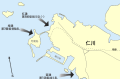
 Battle of Osan Map (zh-hans).jpg 503 × 769; 112 KB
-
 Inchon landing map (zh-hans).svg 702 × 462; 126 KB
-
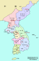 Korea-8provinces (zh-hans).svg 800 × 1,245; 274 KB
-
 Korea-8provinces.jpg 800 × 1,245; 333 KB
-
 KTX linemap zh-hans.svg 1,324 × 1,591; 563 KB
-
 Naktong Defense (zh-hans).jpg 587 × 945; 281 KB
-
 P'ohang-dong Map 1 (zh-hans).jpg 600 × 772; 148 KB
-
 Pusan Perimeter (zh-hans).jpg 350 × 572; 72 KB
-

-

-

-

-
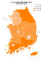 South Korea Nationwide Local Elections 2010 HMCP rate (Zh-hans).svg 1,233 × 1,750; 277 KB
-
 South Korea Nationwide Local Elections 2010 HMCP(Zh-hans).svg 1,233 × 1,750; 223 KB

.jpg)
.jpg)
.svg)
.svg)


.jpg)
.jpg)
.jpg)
_zh-hans.png)
_zh-hans.png)
_zh-hans.png)
_zh-hans.png)
.svg)
.svg)