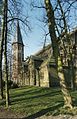
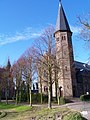
Category:Sint-Jacobuskerk (Kethel)
| Object location | | View all coordinates using: OpenStreetMap |
|---|
church building in Schiedam, Netherlands  | |||||
| Upload media | |||||
| Instance of | |||||
|---|---|---|---|---|---|
| Part of | |||||
| Location | Kethel, Schiedam, South Holland, Netherlands | ||||
| Street address |
| ||||
| Located on street |
| ||||
| Architect | |||||
| Heritage designation |
| ||||
| Inception |
| ||||
 | |||||
|
This is a category about rijksmonument number 525389
|
| Address |
|
Media in category "Sint-Jacobuskerk (Kethel)"
The following 48 files are in this category, out of 48 total.
-

-
 Een stenen verbindingsgang tussen pastorie en kerk - Kethel - 20328968 - RCE.jpg 3,064 × 3,090; 4.87 MB
-
 Exterieur - Kethel - 20125051 - RCE.jpg 2,224 × 3,310; 3.01 MB
-
 Heilig Hartbeeld (Kethel).jpg 420 × 674; 156 KB
-
 Hek Kerkplein - Kethel - 20125090 - RCE.jpg 1,200 × 804; 295 KB
-
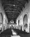
 Interieur - Kethel - 20125052 - RCE.jpg 810 × 1,200; 162 KB
-
 Interieur - Kethel - 20125053 - RCE.jpg 955 × 1,200; 222 KB
-
 Interieur - Kethel - 20125054 - RCE.jpg 991 × 1,200; 236 KB
-
 Interieur koor, glas in loodramen - Kethel - 20328978 - RCE.jpg 1,200 × 1,200; 169 KB
-
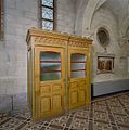
 Interieur sacristie, overzicht kastenwand - Kethel - 20328979 - RCE.jpg 1,198 × 1,200; 194 KB
-
 Interieur, aanzicht orgel, orgelnummer 780 - Kethel - 20417191 - RCE.jpg 957 × 1,200; 258 KB
-
 Interieur, biechtstoel - Kethel - 20328975 - RCE.jpg 1,193 × 1,200; 256 KB
-
 Interieur, doopvont - Kethel - 20328974 - RCE.jpg 1,193 × 1,200; 225 KB
-
 Interieur, kleurrijk beschilderd plafond - Schiedam - 20378096 - RCE.jpg 1,200 × 1,200; 411 KB
-
 Interieur, kroonluchter - Kethel - 20328976 - RCE.jpg 1,200 × 1,199; 214 KB
-
 Interieur, mozaïk tableau achter in de kerk - Kethel - 20328977 - RCE.jpg 1,200 × 1,191; 313 KB
-

-

-

-
 Interieur, overzicht naar het oosten gezien - Kethel - 20381883 - RCE.jpg 1,200 × 1,199; 198 KB
-
 Interieur, zijaltaar - Kethel - 20328973 - RCE.jpg 1,198 × 1,200; 243 KB
-
 Jacobuskerk Kethel-1.JPG 1,536 × 2,048; 1.42 MB
-
 Jacobuskerk Kethel-2.JPG 2,048 × 1,536; 1.44 MB
-
 Jacobuskerk Kethel-3.JPG 2,048 × 1,536; 1.32 MB
-
 Jacobuskerk, Kethel, Schiedam (Panoramio, 2009).jpg 3,872 × 2,592; 4.34 MB
-
 Kethel Hervormde Kerk.jpg 2,616 × 3,488; 1.87 MB
-

-
 Oude beschildering onder het orgel - Schiedam - 20378099 - RCE.jpg 3,060 × 3,060; 2.46 MB
-

-
 Overzicht kerk en pastorie - Kethel - 20328960 - RCE.jpg 3,078 × 3,073; 2.76 MB
-
 Overzicht noordgevel - Kethel - 20328970 - RCE.jpg 3,078 × 3,090; 2.62 MB
-
 Overzicht oostgevel - Kethel - 20328971 - RCE.jpg 3,075 × 3,076; 2.74 MB
-
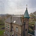
 Overzicht pastorie en gedeelte kerk - Kethel - 20328961 - RCE.jpg 3,076 × 3,086; 2.34 MB
-
 Overzicht pastorie vanaf de steiger - Kethel - 20328963 - RCE.jpg 3,070 × 3,089; 2.28 MB
-
 Overzicht pastorie vanaf de tuin - Kethel - 20328964 - RCE.jpg 3,053 × 3,089; 2.72 MB
-
 Overzicht pastorie, linker zijgevel en achtergevel - Kethel - 20328967 - RCE.jpg 3,072 × 3,090; 2.78 MB
-
 Overzicht pastorie, voorgevel en linker zijgevel - Kethel - 20328966 - RCE.jpg 3,081 × 3,085; 2.77 MB
-
 Overzicht tuin voor pastorie vanaf de steiger - Kethel - 20328962 - RCE.jpg 3,083 × 3,090; 2.4 MB
-
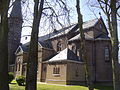
 Overzicht van de kerk gezien vanuit het park - Schiedam - 20420121 - RCE.jpg 775 × 1,200; 345 KB
-

-
 Overzicht van de zuidoostgevel van de kerk - Schiedam - 20420118 - RCE.jpg 1,200 × 793; 321 KB
-
 Overzicht van de zuidwestgevel met kerktoren - Kethel - 20381882 - RCE.jpg 1,200 × 1,197; 392 KB
-
 Overzicht voorgevel pastorie - Kethel - 20328965 - RCE.jpg 1,194 × 1,200; 476 KB
-
 Overzicht zuidgevel - Kethel - 20328972 - RCE.jpg 1,190 × 1,200; 464 KB
-
 Overzicht zuidwestgevel - Kethel - 20328969 - RCE.jpg 1,191 × 1,200; 397 KB
-

-
 Schiedam - Jacobus de Meerderekerk (R.K.) - 2008 - panoramio.jpg 1,728 × 2,304; 1.35 MB
-
 Sint Jacobuskerk, Kethel.jpg 6,111 × 1,905; 4.13 MB


.jpg)


.jpg)


_-_2008_-_panoramio.jpg)