Category:Sint-Victorkerk (Neerloon)
| Object location | | View all coordinates using: OpenStreetMap |
|---|
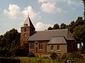
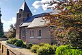
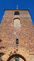
church building in Oss, Netherlands  | |||||
| Upload media | |||||
| Instance of | |||||
|---|---|---|---|---|---|
| Location | Neerloon, Oss, North Brabant, Netherlands | ||||
| Street address |
| ||||
| Located on street |
| ||||
| Heritage designation |
| ||||
| Religion or worldview | |||||
 | |||||
Nederlands: Sint-Victorkerk - anno 1821
Kerk
|
This is a category about rijksmonument number 32400
|
| Address |
|
Subcategories
This category has only the following subcategory.
Media in category "Sint-Victorkerk (Neerloon)"
The following 27 files are in this category, out of 27 total.
-
 2006-08-23 15.39 Neerloon, kerk.JPG 2,272 × 1,704; 1.22 MB
-
 32400 Sint-Victorkerk Neerloon.jpg 4,917 × 3,738; 13.53 MB
-
 Exterieur - Neerloon - 20163368 - RCE.jpg 1,200 × 958; 185 KB
-
 Interieur, aanzicht orgel, orgelnummer 1024 - Neerloon - 20369064 - RCE.jpg 831 × 1,200; 133 KB
-
 Neerloon - Sint-Victorkerk 2.jpg 6,189 × 4,126; 16.43 MB
-
 Neerloon - Sint-Victorkerk.jpg 4,128 × 6,192; 15.45 MB
-
 Neerloon, l'église.JPG 2,048 × 1,536; 1.33 MB
-
 Neerloon, la vieille tour de l'e'glise.JPG 1,536 × 2,048; 786 KB
-
 Sint Victorkerk en begraafplaats Neerloon.jpg 4,013 × 2,747; 5.28 MB
-
 Sint Victorkerk Neerloon 2.jpg 5,184 × 3,456; 8.48 MB
-
 Sint Victorkerk Neerloon 3.jpg 5,073 × 3,372; 12.36 MB
-
 Sint Victorkerk Neerloon bijgebouw.jpg 3,526 × 2,268; 6.84 MB
-
 Sint Victorkerk Neerloon Jezus kruis.jpg 2,073 × 3,685; 6.77 MB
-
 Sint Victorkerk Neerloon koetshuisje.jpg 3,526 × 2,268; 6.43 MB
-
 Sint Victorkerk Neerloon met toren schuin links.jpg 4,072 × 3,904; 13.9 MB
-
 Sint Victorkerk Neerloon met toren zijkant vanaf dijk.jpg 5,024 × 3,920; 16.12 MB
-
 Sint Victorkerk Neerloon schuin achter vanaf Dijk.jpg 3,948 × 3,030; 10.02 MB
-
 Sint Victorkerk Neerloon schuin achterkant vanaf Loonsestraat.jpg 3,210 × 2,143; 7.01 MB
-
 Sint Victorkerk Neerloon toren en zijgebouw portrait.jpg 3,688 × 4,000; 12.68 MB
-
 Sint Victorkerk Neerloon toren en zijgebouw.jpg 3,177 × 2,163; 6.2 MB
-
 Sint Victorkerk Neerloon toren kikvorks.jpg 2,268 × 4,032; 9.29 MB
-
 Sint Victorkerk Neerloon zijkant vanaf dijk.jpg 3,874 × 2,268; 7.82 MB
-
 Sint Victorkerk Neerloon.jpg 3,456 × 5,184; 7.24 MB
-
 WLM - 23dingenvoormusea - deur in toren van H.Victorkerk in Neerloon.jpg 1,200 × 798; 662 KB
-
 WLM - 23dingenvoormusea - H.Victorkerk in Neerloon (NB).jpg 1,200 × 798; 433 KB
-
 WLM - 23dingenvoormusea - mestelwerk rond deur van H.Victorkerk in Neerloon.jpg 1,200 × 798; 647 KB
-
 WLM - 23dingenvoormusea - toren van H.Victorkerk in Neerloon.jpg 798 × 1,200; 444 KB


.jpg)

