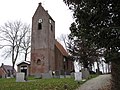
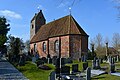
Category:Sint-Vituskerk (Wyns)
| Object location | | View all coordinates using: OpenStreetMap |
|---|
church  | |||||
| Upload media | |||||
| Instance of | |||||
|---|---|---|---|---|---|
| Dedicated to | |||||
| Location | Wyns, Tytsjerksteradiel, Friesland, Netherlands | ||||
| Street address |
| ||||
| Located on street |
| ||||
| Heritage designation |
| ||||
| Inception |
| ||||
| official website | |||||
 | |||||
|
This is a category about rijksmonument number 35690
|
| Address |
|
Media in category "Sint-Vituskerk (Wyns)"
The following 26 files are in this category, out of 26 total.
-
 De Kerk van Wyns.JPG 2,304 × 3,072; 2.14 MB
-
 De Sint Vitus kerk in Wyns Friesland.jpg 1,080 × 720; 375 KB
-
 Exterieur koor oostgevel - Wijns - 20213933 - RCE.jpg 953 × 1,200; 274 KB
-
 Exterieur noord-oostgevel - Wijns - 20213934 - RCE.jpg 1,200 × 960; 246 KB
-
 Exterieur zuid-oostgevel - Wijns - 20213930 - RCE.jpg 1,200 × 960; 306 KB
-
 Exterieur zuidgevel koor - Wijns - 20213932 - RCE.jpg 1,200 × 937; 314 KB
-
 Exterieur zuidgevel schip - Wijns - 20213931 - RCE.jpg 1,200 × 960; 323 KB
-
 Exterieur zuidwestgevel - Wijns - 20213929 - RCE.jpg 939 × 1,200; 487 KB
-
 Interieur naar het oosten - Wijns - 20213937 - RCE.jpg 960 × 1,200; 186 KB
-
 Interieur naar het oosten en naar het westen - Wijns - 20213924 - RCE.jpg 1,200 × 837; 150 KB
-
 Interieur naar het oosten en naar het westen - Wijns - 20213925 - RCE.jpg 1,200 × 837; 151 KB
-
 Interieur naar het westen - Wijns - 20213938 - RCE.jpg 1,200 × 958; 201 KB
-
 Interieur, aanzicht orgel, orgelnummer 1670 - Wyns - 20417417 - RCE.jpg 816 × 1,200; 182 KB
-
 Kerk vanuit het zuid-oosten - Wijns - 20213923 - RCE.jpg 1,200 × 836; 274 KB
-
 Kerkje Wijns.jpg 1,600 × 1,067; 423 KB
-
 Koorzijde - Wijns - 20213926 - RCE.jpg 1,200 × 807; 246 KB
-
 Noordgevel - Wijns - 20213935 - RCE.jpg 1,200 × 960; 359 KB
-
 Overzicht zuidwestgevel met kerktoren en kerkhof - Wijns - 20345882 - RCE.jpg 950 × 1,200; 265 KB
-
 Tekening bodemonderzoek - Wijns - 20213939 - RCE.jpg 946 × 1,200; 206 KB
-
 Toren - Wijns - 20213927 - RCE.jpg 805 × 1,200; 221 KB
-
 Toren noord-oost gevel - Wijns - 20213936 - RCE.jpg 960 × 1,200; 288 KB
-
 Wijns.kerk.nr1.jpg 1,600 × 1,200; 836 KB
-
 Wijns.kerk.nr2.jpg 1,200 × 1,600; 869 KB
-
 Wijns.kerk.nr3.jpg 1,600 × 1,200; 803 KB
-
 Wyns, Fitustsjerke.JPG 1,600 × 1,067; 1 MB
-
 Zijgevel - Wijns - 20213928 - RCE.jpg 1,200 × 800; 282 KB


