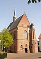
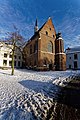
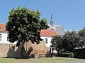
Category:Sint Catharinakerk, Harderwijk
| Object location | | View all coordinates using: OpenStreetMap |
|---|
 | |||||
| Upload media | |||||
| Instance of | |||||
|---|---|---|---|---|---|
| Location | Harderwijk, Gelderland, Netherlands | ||||
| Street address |
| ||||
| Located on street |
| ||||
| Heritage designation |
| ||||
 | |||||
|
This is a category about rijksmonument number 20204
|
| Address |
|
Media in category "Sint Catharinakerk, Harderwijk"
The following 23 files are in this category, out of 23 total.
-
 20180722 150 harderwijk.jpg 6,000 × 4,000; 12.59 MB
-
 20204-Sint-Catharinakerk.JPG 1,691 × 2,414; 3.13 MB
-
 Binnenstad, 3841 Harderwijk, Netherlands - panoramio (55).jpg 2,048 × 1,148; 308 KB
-
 Binnenstad, 3841 Harderwijk, Netherlands - panoramio (83).jpg 2,048 × 1,155; 624 KB
-

-

-
 Harderwijk - Hortuspark 01 - Ginkgo Biloba (Oldest in Europe).jpg 3,976 × 2,652; 6.1 MB
-

-
 Harderwijk - Hortuspark 05.jpg 3,976 × 2,652; 6.12 MB
-

-
 Harderwijk - Kloosterplein 01.jpg 3,976 × 2,652; 5.55 MB
-
 Harderwijk - Kloosterplein 03.jpg 3,976 × 2,652; 6.04 MB
-
 Harderwijk - Kloosterplein 04.jpg 2,652 × 3,976; 6.56 MB
-
 Harderwijk - Kloosterplein 06.jpg 3,976 × 2,652; 5.71 MB
-
 Harderwijk - panoramio (8).jpg 3,264 × 4,928; 7.75 MB
-
 Harderwijk - Smeepoortstraat - Stationslaan - Friesegracht.jpg 3,976 × 2,652; 7.22 MB
-
 Harderwijk, muurrestanten + kanon + Sint Catharinakerk RM20204 foto7 2013-07-15 12.41.jpg 4,416 × 3,312; 9.06 MB
-
 Klooster 1 - Harderwijk.jpg 3,648 × 2,736; 3.87 MB
-
 Overzicht noordwestgevel - Harderwijk - 20380776 - RCE.jpg 1,200 × 1,200; 241 KB
-
 Overzicht zuidwestgevel - Harderwijk - 20380778 - RCE.jpg 1,193 × 1,200; 257 KB
-
 Overzicht zuidwestgevel met traptoren - Harderwijk - 20359716 - RCE.jpg 945 × 1,200; 229 KB
-
 St. Catharinakerk, reproductie uit boek - Harderwijk - 20100902 - RCE.jpg 1,200 × 975; 295 KB
-
 Stadsmuur, Doelenstraat - Harderwijk - 20100694 - RCE.jpg 1,200 × 896; 312 KB


.jpg)
.jpg)


.jpg)


.jpg)


